


mobilene
-
Posts
1,247 -
Joined
-
Last visited
-
Days Won
1
Content Type
Profiles
Forums
Gallery
Blogs
Calendar
Posts posted by mobilene
-
-
I'm pretty sure the Casselman River Bridge is steel. I've driven over that one. I've not driven the one in Brownsville -- I bollixed things up on that leg of the trip and ended up staying on modern US 40. That bridge is from 1906; it could still be from the iron era, I don't know.
-
I loved following your photos as you posted them! Excellent stuff. jim
-
I wonder if this is the last iron truss NR bridge left.
-
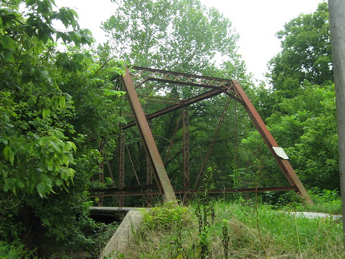
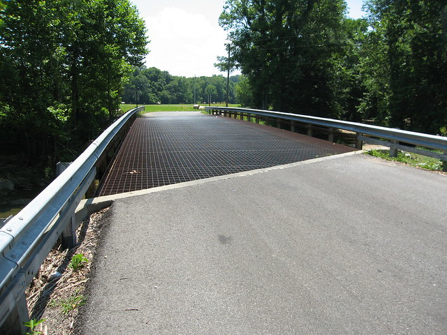
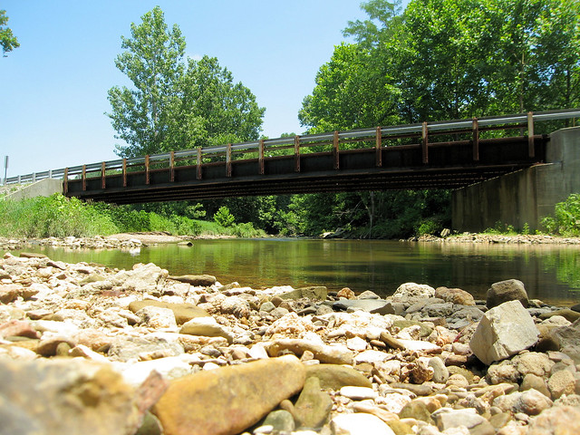
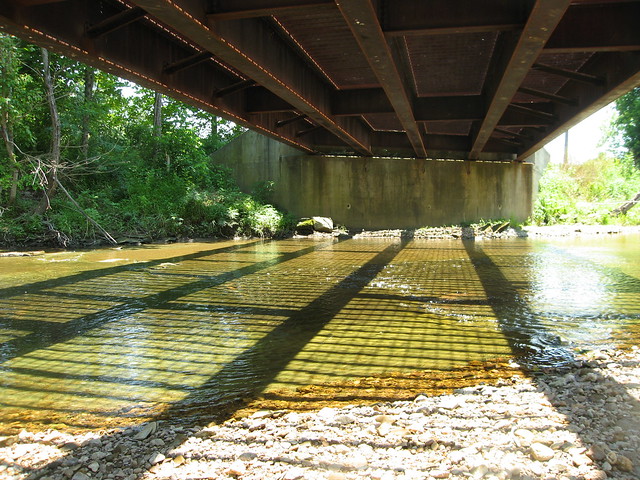
Cooper Iron Bridge by mobilene, on Flickr
This is the 1891 Cooper Iron Bridge, on a narrow gravel road in Putnam County Indiana. It used to stand 2/10 of a mile around the corner on the National Road. It served there for 38 years before the current 1925 open-spandrel concrete arch bridge was built there. That bridge is on one of the bypassed NR alignments in Putnam County.
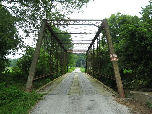
Cooper Iron Bridge by mobilene, on Flickr
This bridge has a wooden deck; it looks to be pretty new.
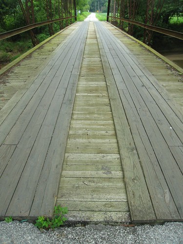
Cooper Iron Bridge by mobilene, on Flickr
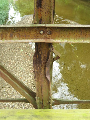
The trusses themselves are a little battered in spots, but I guess it's not so bad considering that the bridge has served for more than a century.
-
ps. Love the 1885 date on that one bridge pier.
-
I tell you what, you Iowans sure know how to obliterate enough of an old road's path so it's hard to figure out where it once lay! I never would have guessed the 1920s alignment from the modern aerial image.
We have our moments of this in Indiana, too: http://jimgrey.wordpress.com/2010/08/05/the-bedford-puzzle/
-
More great stuff, Dave. I would love to own property with an abandoned highway running through it! Reminds me of where US 50 crosses from Indiana into Illinois. There's an old brick alignment just north of it, where a previous bridge used to cross. There's a house on it, and the owner parks his cars on the brick approach to the bridge (long since removed). jim
-
Dave, yup, this is one seriously cool abandoned alignment. It looks like it could be used in a horror movie. And I've never seen a tree growing out of the roadway before. I'd love to come upon something like this! jim
-
Oh rapture. Old aerial imagery and old topos -- there are no substitutes. Indiana lacks a service like Iowa's, though Indianapolis (where I am) has one for just the city/county, which I have used extensively. I also use the USGS Earth Explorer, but it's creaky and fussy, and the aerial images are simply individual photos with roads unlabeled, so it can be hard to figure out which end is up.
It is remarkable that there is no trace today of the missing segment of old 6 west of the abandoned easement alignment. In my travels, there is usually some evidence in the aerial imagery, even if it's just a faint trace across a farmer's field.
jim
-
Oh drool. Droooooooool.
Seeing an old alignment behind a gate is very, very frustrating for me! It's like putting a big bowl of M&Ms on the table and telling me I can't eat any.
Any guess about where the old road used to lie between these two abandoned bits?
jim
-
It's too bad that the bridge is marked No Trespassing; I'd love to walk it. These photos of this old alignment photos make me happy -- the brick bits especially -- and make me want to quit my job and spend the rest of my days old-alignment hunting! I even looked up this alignment on Google Maps -- and found that it shows the road as through. I sent them a correction!
BTW, kudos for uploading some of these photos to Bridgehunter.com.
jim
-
Dave, this is crackling good stuff. I dug the old bridge and the old homes the most in your photographs. Oh, and the one abandoned alignment. I hope you'll keep sharing this excellent stuff! jim
-
Isn't that bridge cool? Hard to believe it's survived.
-
That's kind of too bad about the Prius's wheels. The car being on blocks was so Indiana I couldn't stand it.
-
Steve, what a great photo! Thanks for sharing it. jim
-
I've crossed Sideling several times and every time I try, unsuccessfully, to imagine driving the older and steeper alignment in a brake-less Model T. Since there is no mention of panic or catastrophe, I'm thinking that either the brakes only gave out near the bottom or that they were going slow enough that Granddad was able to stop the car with engine braking.
Here's a site that describes how to drive a Model T.
http://www.modelt.ca/drive-fs.html
I wonder based on what it says whether the "bands" that your grandparents had replaced were transmission bands. I guess it was very common to use the reverse pedal, or all three pedals together in a real emergency, to stop the car, and in so doing you engage the transmission.
-
US 50 (and State Road 37) appear to have been moved more than once in and around Bedford, Indiana. Without getting into all the roadsleuthing I did, here's where the two roads leave town on its southwest side today. The numbers on this map represent where these roads used to go. (Click the map to see it larger; I've placed index numbers on it which are explained below.)
1: The old road used to follow Washington St. out of town. That street dead ends now where modern 37/50 swings by. Strangely, the road seems to fork here, too. I can figure out where one fork used to go, but not the other.
2: You see, I think old 50 used to cut through what is now a field. If you zoom into the imagery at Google Maps, you can see traces of the old road.
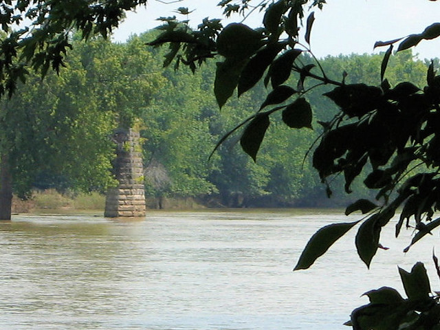
3: The road then swung around to cross the river. The bridge is long gone, but its two piers still stand. If you look on the map, you'll see a little sliver of road that heads south from about where the old bridge would have connected to the west shore. It is a dirt road, but it was signed something like "Old Turnpike." I actually shot this photo from a boat ramp right near the modern bridge -- and was eaten alive by mosquitoes and got my shoes caked in mud, so it's not like I'm not willing to sacrifice for the cause.
4: This is where Old 37 (the Dixie Highway) and Old 50 diverge. 37 goes straight; 50 veers right.
5: Yes, that's right, I said Dixie Highway! It continues on its merry way here.
-
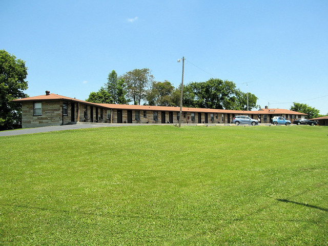
And so we toured old US 50 through the Indiana countryside.
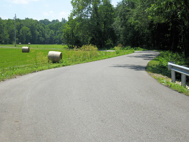
Just past where Old 50 met current 50, we encountered this old motel, nestled among the cornfields.
-
More excellent photos and stories, Dave! I love how the owners of the garage repainted the Red Trail markers on their building. And "Minimum Maintenance Road" signs (and their analogues, such as "End State Maintenance" always strike a quick chord of fear into my heart, having nearly been stranded exploring such roads before. I really ought to buy an old Jeep CJ for my road trips.
-
Here's a photo of the Medora bridge from probably the 1930s.
-
Dave, I like it when I'm fortunate and find "then" photos. I don't always manage it.
Alex, I'm not sure what the other doors on the hotel went to -- perhaps the barber shop? Hard telling. The restoration seems to be a complete gutting; there were no clues inside the building.
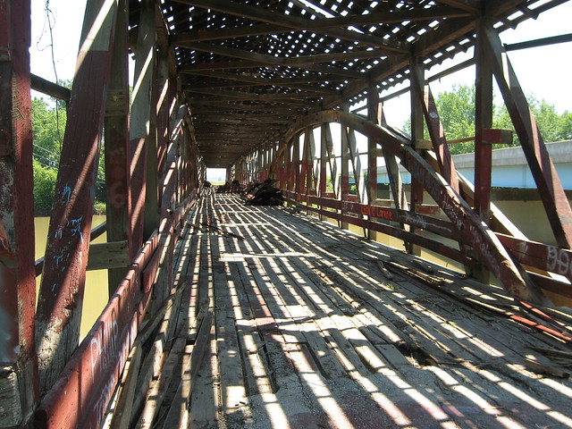
Not far past Vallonia SR 135 intersected with SR 235; old 50 followed 235 west from there, and so did we. I knew about the nation's longest covered bridge (430 feet, 5 inches on three spans) and was looking forward do seeing it -- but I did not know we'd find it in the middle of a $1 million restoration. It was a rare sighting of a covered bridge "undressed."
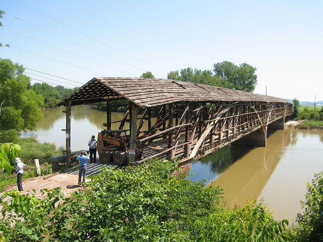
By the looks of her, she was long overdue for this work.
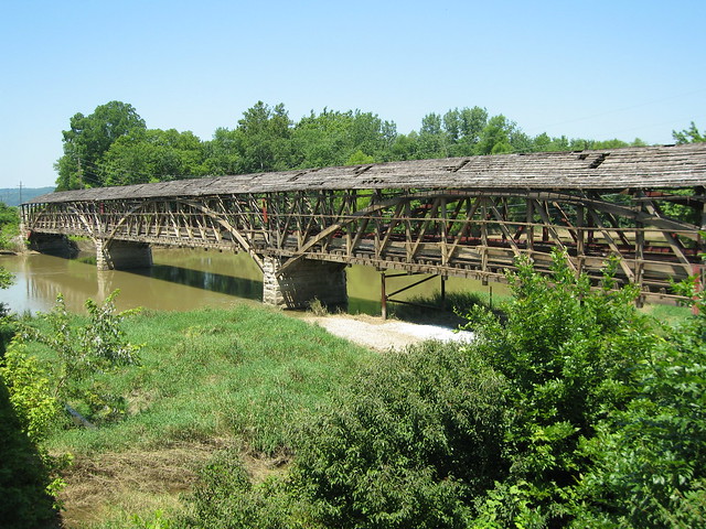
This bridge carried traffic until 1972, which I find astonishing. There were barricades and keep-off signs up all over the place, but I simply could not resist climbing onto the bridge for this shot.
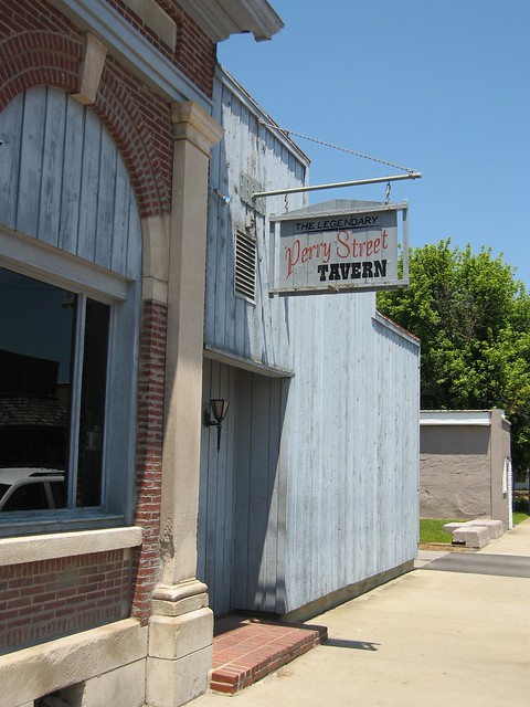
Soon we came to Medora itself. A town with a self-proclaimed legendary tavern must have guts.
At the corner of 235 and Main St. was a market with this old sign attached. I remember seeing these all the time as a kid, but they're unusual today.
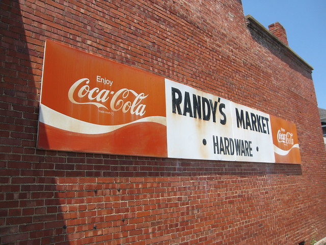
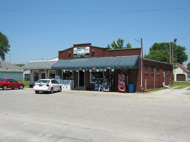
Old US 50 leaves SR 235 and heads west down Main St. This little convenience store is in the first block.
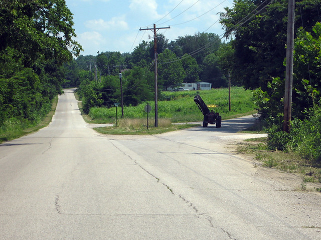
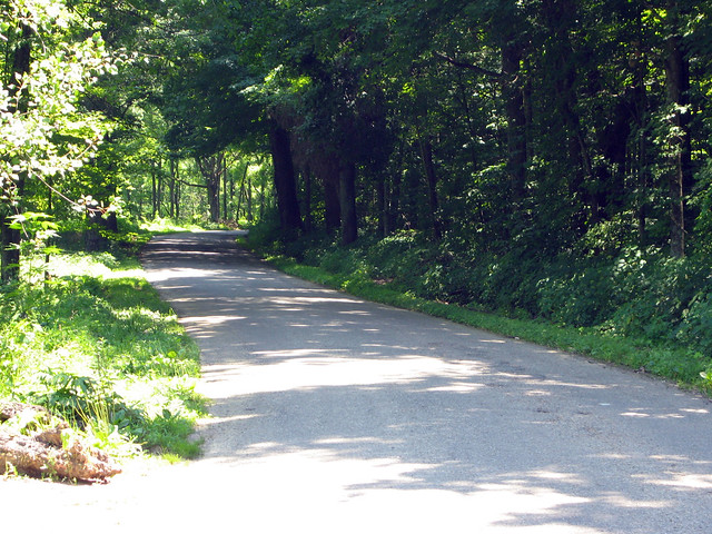
And then we headed out on the country road portion of US 50's long original alignment.
-
It sounds like you've had an excellent trip! I'm glad you've shared it with us as you've rolled along, because I've enjoyed every stop.
jim
-
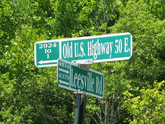
At this point, we've left current US 50 behind and are driving on State Road 135. My 1924 ABB calls this "State Highway No. 4," and the Indiana Highway Ends site says that when 50 was signed, it followed old 4 from the Ohio line to Shoals.
Vallonia was on the route, several miles down the road from Brownstown. It was settled in the late 1700s by the French, and was the site of some War of 1812 skirmishes. A fort was built there to protect residents from belligerent Indians.
135 bypasses Vallonia today. It appears to have bypassed it for a long time, as the road through Vallonia is 1920s narrow.
The town has clearly faded, and at first I thought it was going to be little more than a few rows of houses. The first interesting sight we saw was this 1906 Methodist church building.

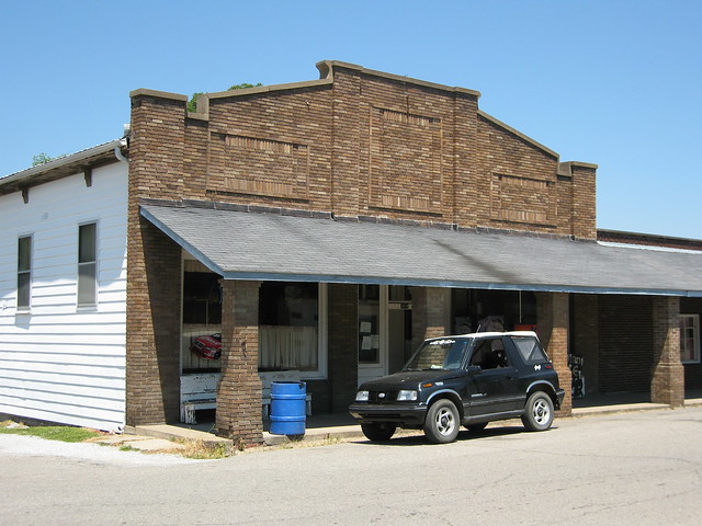
But as we rounded the curve a downtown emerged. We found about eight commercial buildings; this one is typical of them. This is the only one that appeared to have any sort of going concern in it, but it was closed this Saturday.
Click here for a look at Vallonia from about 1890. While I can't swear this is the same road we were on, and the buildings pictured don't match any of my photos, I didn't notice any commercial buildings down the side streets and so it seems reasonable to project that this is the main road.
In 1914, Joe Jackson built a hotel. I can't find much about who Joe Jackson was, but his hotel still stands and is undergoing restoration.

Here is a photo of the hotel from when it was new (and the road was made of dirt). I imagine an ABB driver staying here for the night, as it was considered the finest hotel in the county at the time. Here is a photo of the barber shop the hotel contained.
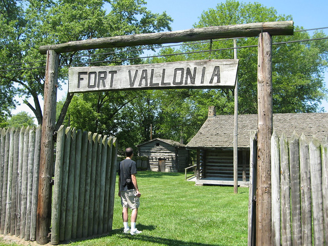
In the late 1960s local residents built a replica of the fort that once stood in town. There were no photos of it, but there were documents that described it, and so they based their work on that.
-
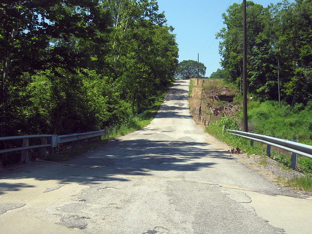
US 50 still follows its original alignment from Seymour to Brownstown. It's a nice two-lane road, but the fact that I didn't stop for a single photo between the two towns should tell you something.
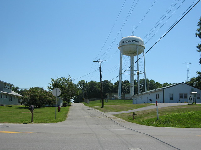
Brownstown itself is a nice, typical Indiana small town. Or is it a small city? It's smaller than Seymour, that's for sure. Yet it's the Jackson county seat.
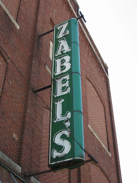
There's a bit of good neon in Brownstown.
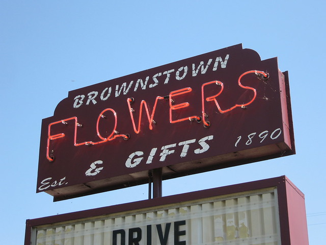

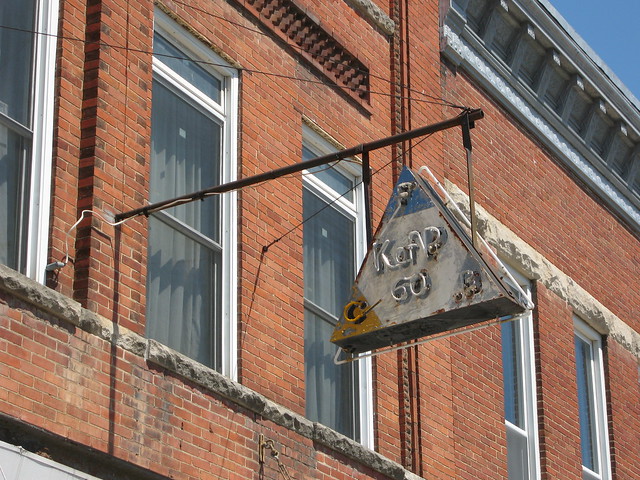
That K of P neon sign is attached, not surprisingly, to a K of P building. What is surprising is that the K of P still meets there.
Across the street, I found the Jackson County Courthouse to be especially picturesque.

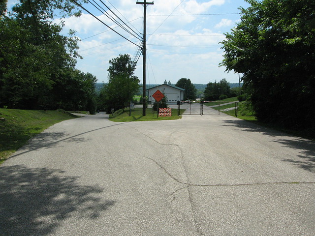
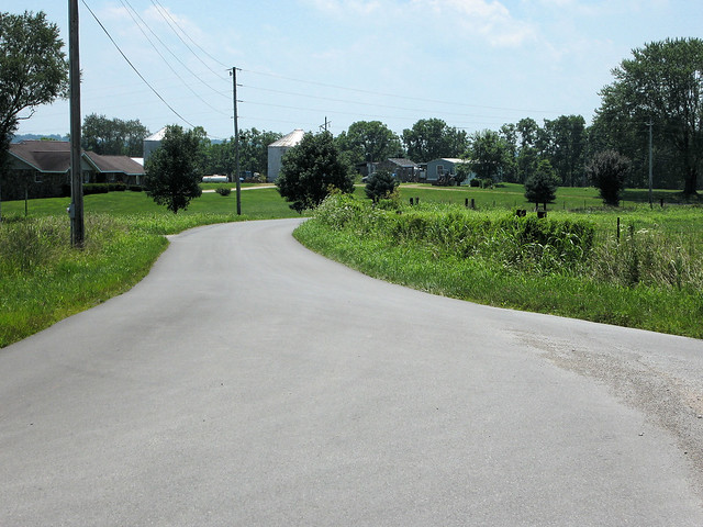
US 50's current and former alignments diverge in Brownstown. Currently, US 50 hooks a left at Commerce St., while old 50 continues down Main St., which becomes Vallonia Rd. and then runs into SR 135 in that way that roads do when they were once the same road. I knew that, even had it on my route printout (yes, printout -- one of these days I'll splurge on the high-tech gadgets you all have but for now it's paper for me). But I absentmindedly followed current 50 anyway. We found a possible older alignment marked Bloomington Road parallel to 50 just south of where it intersects with SR 135.
Our next stop would be tiny Vallonia, long since bypassed by US 50. Er, SR 135. We won't see current US 50 again for another 21 miles.

National Road Between New Market And Frederick Md.
in National Road / U.S. 40
Posted
So I'm scrolling along Google's aerial maps of the NR in MD tonight, just for fun, and I'm seeing a lot of stuff I don't recognize. First, I found a roundabout in Lisbon at MD 144 and MD 94. But the biggie appears to be between New Market and Frederick, where it looks like the road has been or is being four-laned. Has it always been that way or is this new? The Street View of the area shows two-lane highway here.
jim