


mobilene
-
Posts
1,247 -
Joined
-
Last visited
-
Days Won
1
Content Type
Profiles
Forums
Gallery
Blogs
Calendar
Posts posted by mobilene
-
-
Chris - I believe you're right, that one sign does say 46th St. 46th and Dandy was significantly reconfigured at some point. Earlier, 46th extended a bit further west, right up to where the reservoir begins today -- so behind where this sign was, is now water!
Dave - The faded signs suggest the trail had been active for some time when the photos were taken. Hard telling, really.
-
I want to draw your attention to my most recent blog post, about the Dandy Trail, which was a 1910s-1920s pleasure-drive loop around Marion County, Indiana. It was at the time a country drive, but is now entirely city, having long been absorbed by a growing Indianapolis.
http://blog.jimgrey....he-dandy-trail/
The trail was organized and signed by the Hoosier Motor Club, which created a map of the route. A 1921 copy of that map is in the collection of the Indiana State Library, and not long ago I went downtown to view and photograph it, and then to map its route onto modern roads. (An image is on the blog.) Except for a long segment of the road that was destroyed when Eagle Creek Reservoir was built in the 1960s, and a few minor reroutings, you can still drive the entire Dandy Trail today.
Not long ago, incredibly, I found on eBay a set of seven glass-plate negatives of photos from along the trail. Only two of the photos include anything that might be used to locate them, both via road signs being part of the photo. One sign is marked Sargent Road, which is on Indy's Northeastside. The other sign says "Dandy Trail" on one blade; the other blade is hard to make out, but it looks to be a numbered road, like "60th St" or something. It's too little information to go on to place it accurately.
I had the images digitized; here they are on Flickr.
http://www.flickr.com/photos/mobilene/sets/72157629790704676/
Just going about my normal business I've been on almost all the roads that made up the Dandy Trail -- at least those north of the National Road, as I have almost zero need ever to drive south of it.
-Jim
-
Great stuff. Your photos always have so much excellent detail and context.
-
Chris - I studied the map you linked and the modern imagery at Google Maps. It would help a lot to know when the various bridges were built and demolished to determine whether the Dixie ever followed what is now Wayne Court/Wayne Avenue. My 1916 ABB advises drivers to "keep right at fork" and cross the iron bridge, turning "left, running onto Market St." -- if I do a little loose interpretation there, I think this is telling drivers to follow the road that is US 136 today, but where 136 curves onto Market St., then it required a slight left turn to get onto Market. The Dixie hadn't been laid out yet in 1916. Dunno if the other bridge at Wayne Ct. still existed then or not. It's an interesting question worthy of further investigation.
Dave - It makes sense that the building next to the gas station in Mace was probably a cafe. It would have been a mighty tiny one, though.
Denny - That brick segment goes nowhere, and there's only one driveway back there in which to turn around. That driveway and its associated property is probably the only reason this road segment still exists! I actually parked my car on the shoulder of 136 and just walked the brick.
-
Well I'll be dipped, the forum converted the link to the set on Flickr to the slideshow you see. If you click it, you'll go to Flickr where I've described each photo.
-
I took a drive down the Dixie mainline from the Illinois line east to the edge of Indianapolis yesterday. Here's a gallery of all the good photos that I got from the trip.
http://www.flickr.com/photos/mobilene/sets/72157629715687524/with/7192885826/
I found a couple good old alignments, including a brief one that is still paved in brick. I stopped in a bunch of classic Indiana small towns. And as usual I enjoyed the journey as my destination.
One thing I didn't see that I wanted to was a bridge near New Ross, Indiana. Fire up Google Maps, turn on aerial imagery, and enter 39.95593, -86.69493 to see it. It appears to be on an even older alignment than the old alignment there. Without trespassing, I couldn't find a way to get a vantage point to look at it.
-Jim
-
Wow, am I ever late to this party. Denny, happy 65!
-
These are great! And made better by the sender writing about their experiences where the images were made. So often what's written on a postcard has nothing to do with the photo on the other side.
-
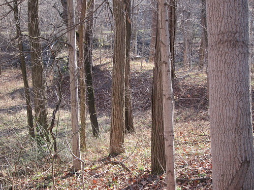
I almost forgot. Last December I found a section of the National Road in Putnam County, Indiana, that I'd been looking for. There's a 1925 bridge on an old alignment, and I've heard that the roadway and abutments of an even older bridge still stood nearby. I could never find them because of dense trees and brush, but with the trees bare there it was.
National Road path by mobilene, on Flickr
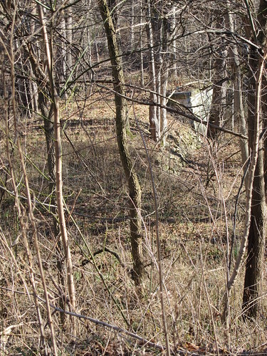
National Road path by mobilene, on Flickr
This will show up in my blog on March 15. (I write posts in advance and queue 'em up.) blog.jimgrey.net.
I also finally found the sign to the Cedar Crest Motel, thanks also to the leaves being down. It's on the only brick alignment of the National Road still extant in Indiana. The road is on private property today and is gated off. The decaying motel still stands, but there were angry dogs looking quite willing to jump the fence and nibble on my keister, so I quickly shot the sign and moved on. This is also in Putnam County.
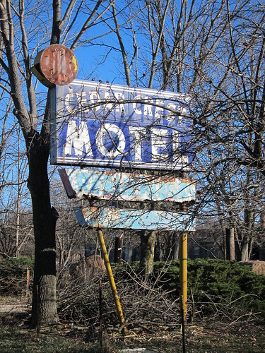
Cedar Crest Motel sign by mobilene, on Flickr
-
I haven't been participating here much since probably last Spring as my work and other personal commitments have really consumed me. I did just the one road trip last year, the National Road in Ohio, and that shot my road-trip works for the year. And of course we got the Michigan Road named a state historic byway.
I'm thinking about doing more Dixie Highway in 2012. I've traveled it from the Indiana line north of South Bend down to Indy and then to Bloomington. I'd like to do the segment from the Illinois line to Indy that mostly follows US 136. I know of an abandoned bridge that used to be on the road, and a couple old alignments. I also want to keep going south from Bloomington.
I've also had thoughts about following the abundant old alignments of SR 37 south from where the Dixie veers away. The road isn't historically significant down there other than just being old, but it has been an important corridor and therefore has been realigned over the years. You know how I loves me some old alignments.
I've also thought about revisiting the Michigan Road. It's been 4 years since my original survey. As I have made trips in support of the Byway, I've visited some southern Indiana sections again and can see how things have evolved over time. I drive the segment between Indy and South Bend all the time -- funny how I don't feel like things have changed much along that section, but I'm sure they have, just as surely as I know my children are taller than they were 4 years ago but I haven't really noticed day to day how they've grown.
All that's more road tripping than I'll have time for, but at least I have some items on my radar.
The Historic Michigan Road Association officially organized in January, and to my delight and chagrin I was elected its first president. Delight because I'm honored; chagrin because I simply am too busy to do the post justice. First order of business: incorporate and become a 501©(3). I got drafted to do the 501©(3) paperwork. Frankly I think I'd rather have half of my teeth pulled! But I'm about 2/3 of the way through it.
-Jim
-
You got some great bridge photos there. I'm really impressed with the Richardson Road bridge too -- a triple bowstring, wow! -Jim
-
Already I'm being accused of cronyism! :-)
-
I'm thinking about driving the Michigan Road again as my major road-trip effort in 2012, because a lot has probably changed since my 2008 trips that you saw in the "virtual tour."
-
Today the Historic Michigan Road Byway Committee (of which I'm co-chair) received word from the Indiana Department of Transportation that our application to name the Michigan Road a Historic Byway was approved. Lt. Governor Becky Skillman signed the order.
The Michigan Road is Indiana's first state-funded highway, built in the 1830s and stretching from Madison on the Ohio River, through Greensburg, Shelbyville, Indianapolis, Logansport, Rochester, Plymouth, and South Bend, and ending in Michigan City on Lake Michigan. It was built to provide a critical transportation link from southern Indiana to the new capital in Indianapolis, and to allow settlement of northern Indiana. It is still driveable end-to-end today, with a few minor detours that return you to the road's original path. The route is essentially US 421/old US 421 through Indianapolis, then State Road 29 to Logansport, State Road 25 to Rochester, old US 31/US 31 to South Bend, old US 20/US 20 to Michigan City, and a short bit of US 12 within Michigan City.
If you'd like to virtually tour the road yourself, go here: http://jimgrey.net/Roads/MichiganRoad/index.htm
The Byway Committee has several next steps. First, we need to become a legal entity; probably a 501©(3). Then we need to secure funds for our operations and next initiatives, which include creating marketing plans and signing the route.
-Jim
-
-
That '70 LeSabre was nice.
-
Hang in there man. I wish for an uncomplicated surgery and a fast, easy recovery. -Jim
-
These photos are beyond amazing. Seeing them makes me want to bail out of work, speed all the way to Maryland, and come see!
Do you have GPS coordinates for these locations?
-Jim
-
This sounds like a great find! I hope photos will follow... -Jim
-
Yes, the photo absolutely caused me to click the link. I might or might not have if the photo hadn't drawn me in.
As you might have noticed, my writeups here have fallen off, too, simply because the forum software is so unfriendly for the longer-form stuff. I've taken to writing up my road trips on my blog, jimgrey.wordpress.com. It's not page layout software, but it is optimized for writing and sharing photos online.
-Jim
-
Wow. I've never seen the Oregon coast before. Very nice, and what a nice writeup, Dave. -Jim
-
Nice! I saw on the ONRA's Facebook page that they had unveiled the sign; glad to know you went. -Jim
-
Steve, I'm sorry to hear about your health issues. I hope for a complete recovery and manageable treatment. -Jim
-
My last post in this area this year, thanks for coming alone.
This has been an excellent trip! I'm glad you shared it with us. -Jim
The Dandy Trail -- 88 Miles Around Indianapolis
in State Highways & Other Roads
Posted
I did! The dog belonged to a Hoosier Motor Club exec. But how did you find out? -Jim