


mobilene
-
Posts
1,247 -
Joined
-
Last visited
-
Days Won
1
Content Type
Profiles
Forums
Gallery
Blogs
Calendar
Posts posted by mobilene
-
-
Yes, one day I'll venture to Bellefontaine to see the ancient concrete!
-
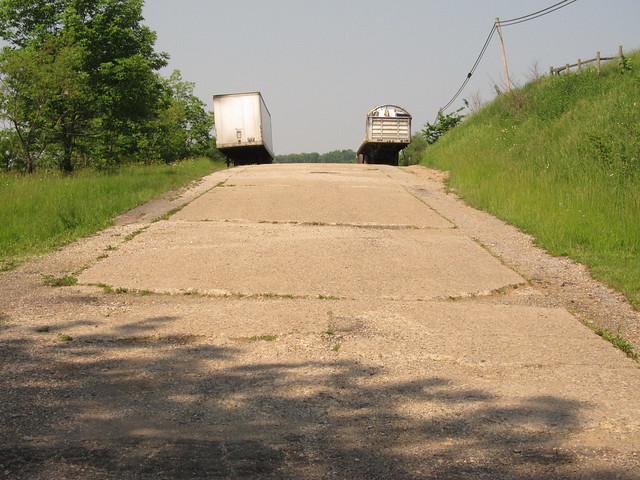
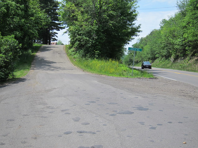
Dave, yes, it does appear that there are lateral expansion joints across the pavement. They are most apparent on the blind hill. The concrete is cracked enough elsewhere that it's hard to tell the cracks from the joints.
The only vintage photo of this concrete road I found doesn't show the strips (shoulders?) on the sides, as in the first and third photos. I wonder if those were added later? Hard telling.
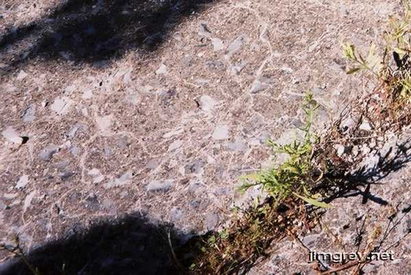
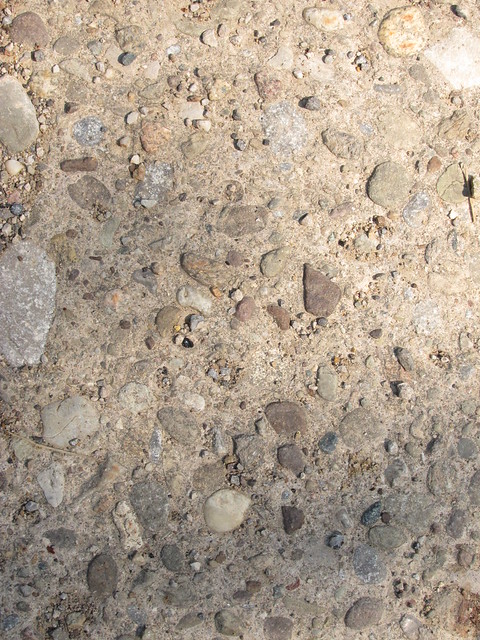
As for the aggregate, here's a shot of some concrete on Indiana's NR, which I believe to have been poured in about 1923. I find it interesting how the rocks all appear to have been broken or cut, with flat surfaces. I'm not wise in the ways of concrete but I've sure looked at a lot of it on old roads now, and this is the only time I've ever seen this.
-
I could see from Google Maps' aerial imagery that there was a sliver of old alignment in front of the Hopewell Elementary School. (Check it out at 39.95433, -82.19975). I was very pleased when I arrived there to find a strip of old concrete.
Concrete alignment by mobilene, on Flickr
That shot is westbound; this one's eastbound from the same location. It fades away into the neighborhood ahead. It looks, from the air, like a pretty long stretch of the old concrete road was torn out here when modern US 40 was built.
Concrete alignment by mobilene, on Flickr
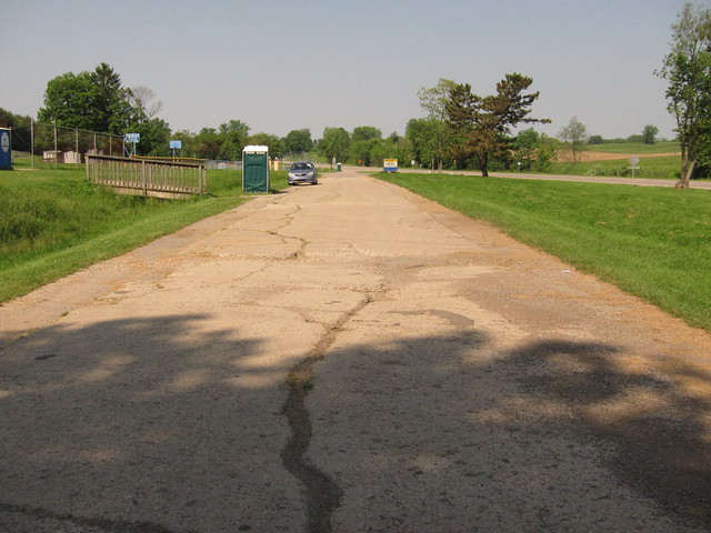
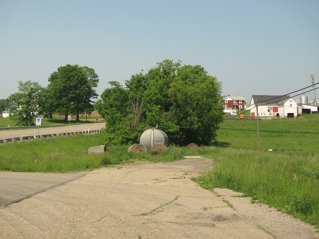
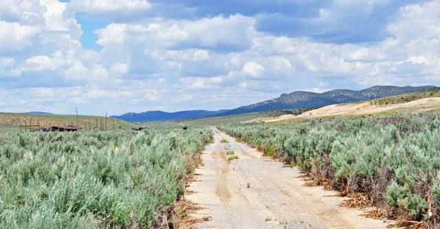
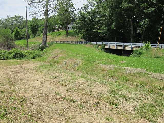
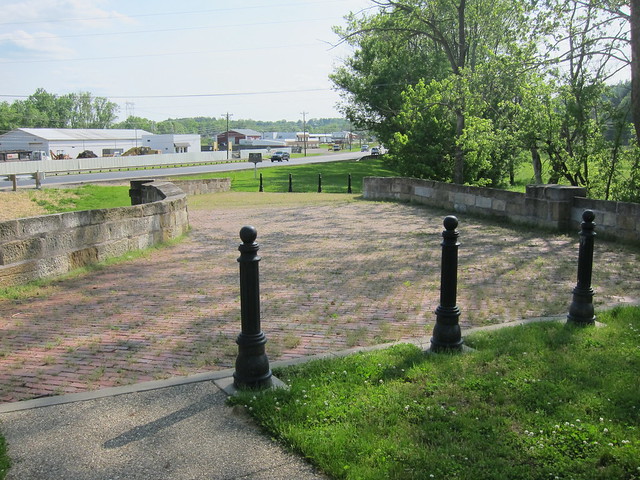
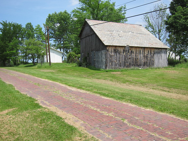
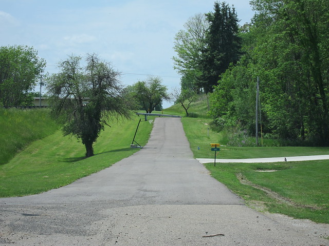
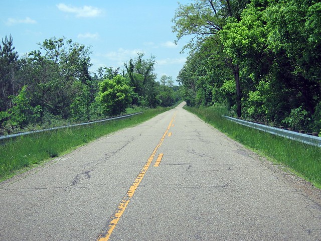
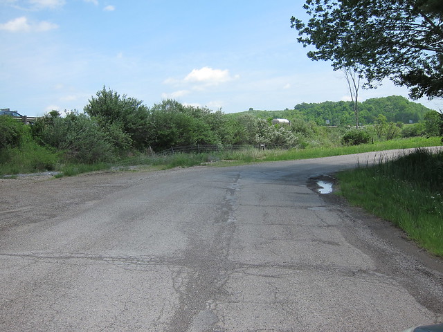
I found just a few other brief strips of concrete, all of them at ends of old alignments that were otherwise asphalted. This blind hill is just west of Gratiot. Although the main turnoff from the old alignment through Gratiot is just behind me, you can still drive this strip of concrete. 39.948112, -82.231979
Blind hill by mobilene, on Flickr
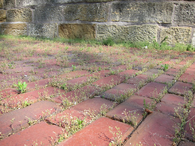
Here's a closeup of the concrete itself. It's pretty lumpy stuff, full of medium-sized pebbles, rather than the ultra smooth stuff you see today.
Concrete by mobilene, on Flickr
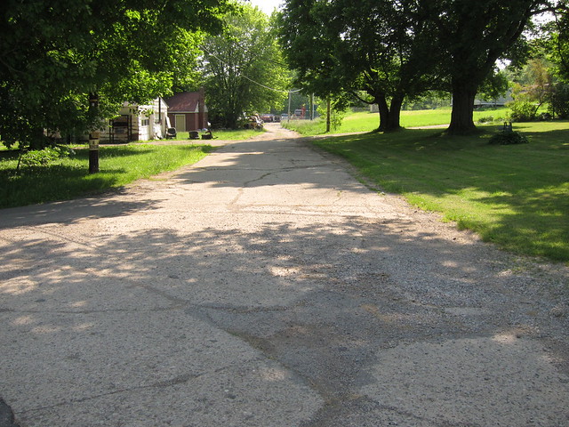
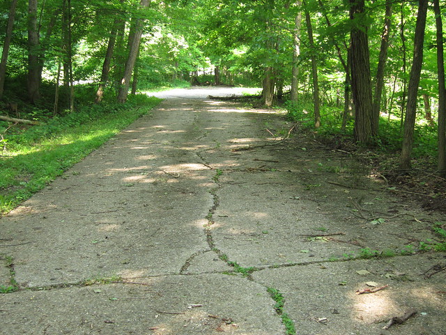
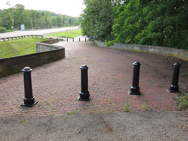
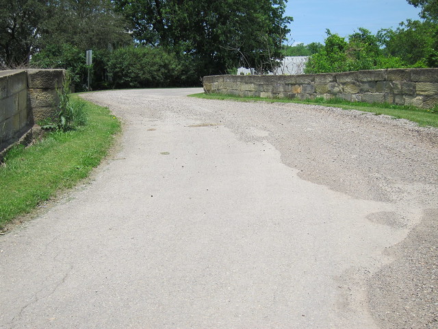
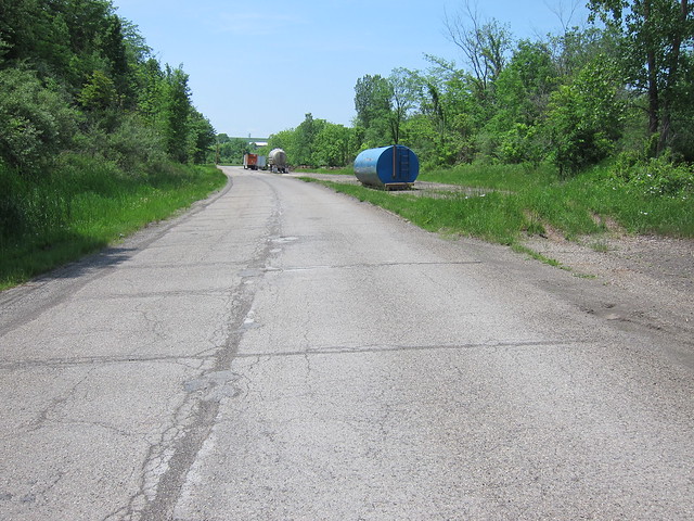
Here's where that concrete strip ends.
The end of the Gratiot alignment by mobilene, on Flickr
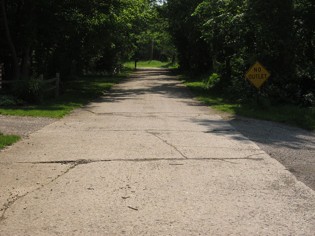
I found another short stretch of concrete at the west end of an old alignment signed Mt. Hope Road. 39.954322, -82.312145
Mt. Hope Road by mobilene, on Flickr
I found the last little bit of concrete at the end of an old alignment that was signed Panhandle Road. 39.959096, -82.369297
Panhandle Rd. by mobilene, on Flickr
Somewhere among all these little bits of concrete I found this monument. It commemorates two things -- the highest elevation along Ohio's National Road, and the concrete paving of the National Road between Zanesville and Hebron. I learned here that the concrete was poured between 1914 and 1916! This is now officially the oldest concrete I've ever knowingly driven. I just wish there had been more!
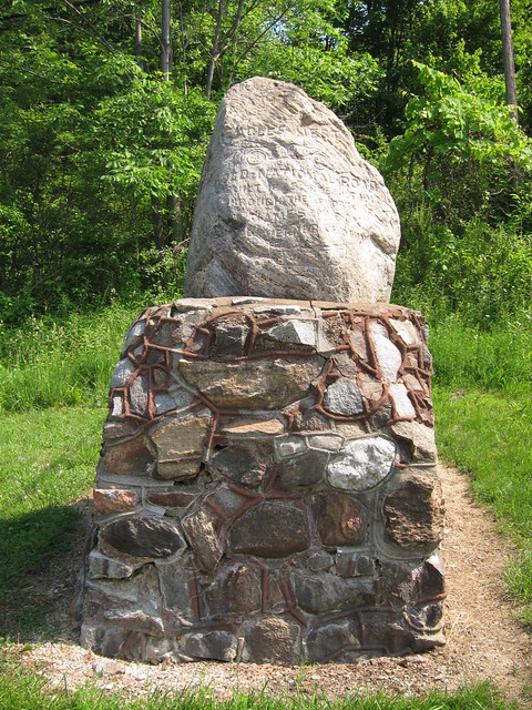
Eagle's Nest monument by mobilene, on Flickr
My understanding is that this concrete was considered a grand experiment at the time. People were so excited about the new concrete road that they held a parade along its length on the day it opened.
Here's a closeup of the stone. It's a little easier to read the inscription here.
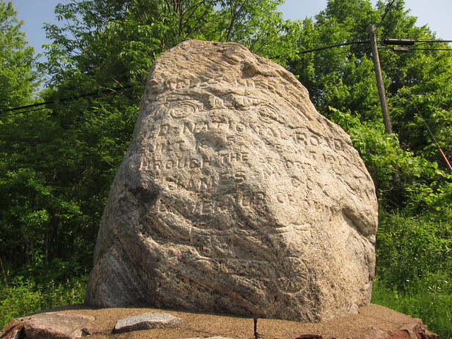
Eagle's Nest monument by mobilene, on Flickr
The east side says it's 220 miles to Cumberland; the west side says it's 39 miles to Columbus.
-
I am so drooling over this Lincoln Highway adventure! Makes me wanna buy a Jeep and go hit this dusty trail. -Jim
-
I love this photograph. It makes me want to paint this scene, and I don't paint. -Jim
-
Denny, that certainly explains them. They were certainly an oddity to come upon. -Jim
-
Denny, I wondered as I stood on the segment near Norwich if it was widened as you say the Canton segment of the LH was. -Jim
-
Thanks for these tips, Denny -- very helpful! -Jim
-
My NR trip brought me to Zanesville. Up to here, the NR was built more or less on Zane's Trace -- same Zane as in Ville. Zane's Trace curve southwest from here, leaving the NR behind.
The town is well kept.
Zanesville, OH by mobilene, on Flickr
And it has a grand courthouse.

Muskingum County Courthouse by mobilene, on Flickr
The obligatory courthouse-lawn military monuments at least take a unique twist in Zanesville.
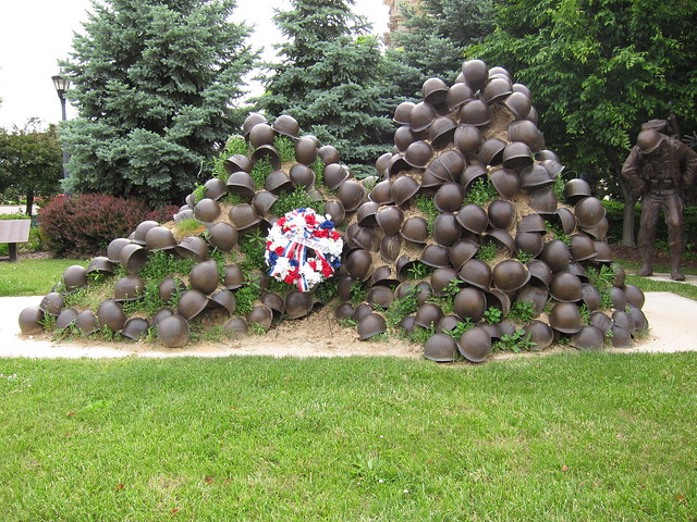
Helmets by mobilene, on Flickr
The famous Y-bridge, the fifth on this spot, is of course at the heart of town.
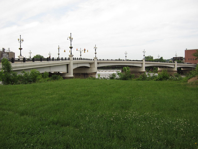
Y Bridge by mobilene, on Flickr
A railroad bridge straddles the Y bridge. This train was slowly coming in for a stop.
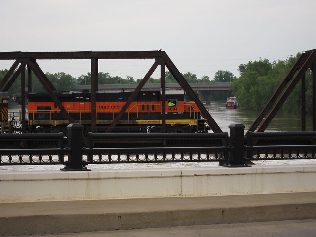
Zanesville, OH by mobilene, on Flickr
This mosaic in the sidewalk stands before a vacant lot. How much you wanna bet a Chevy dealer once stood here? A commenter on my Flickr site attributes this work to the Mosaic Tile Company of Zanesville.
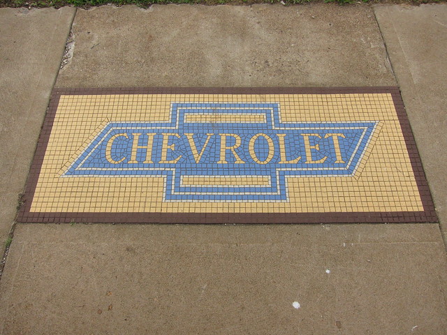
Zanesville, OH by mobilene, on Flickr
This odd display is on the lot where the Chevy dealer once stood.
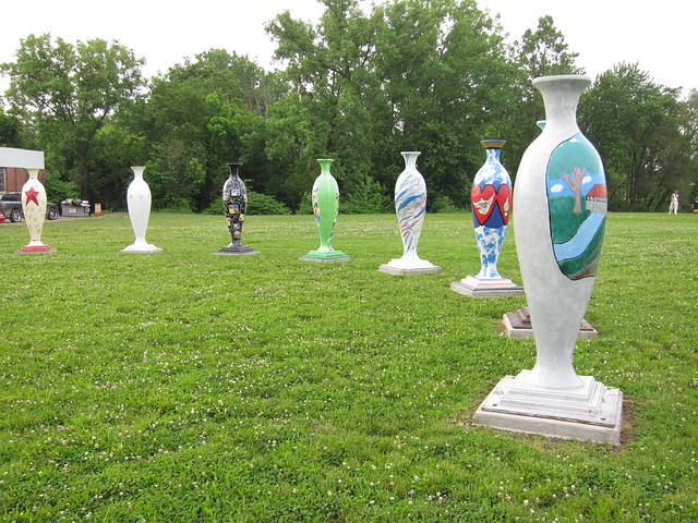
Zanesville, OH by mobilene, on Flickr
-
Great photos, Dale, regardless of the camera. Great to see the old trail. -Jim
-
I don't remember reading about S No More anywhere. Bridgehunter.com, surely the finest historic bridge Web site, knew nothing about it (though I just informed them).
You'd need a skinny motorcycle or a scooter to drive the other two S bridges!
-
S as in "S bridge." I've already shared the ones at Blaine and over Salt Fork. There are two others, and maybe even a third, but you can't drive on them anymore.
Let's deal with the "maybe" bridge first. Do you see the old roadbed here? Do you see the S shape?
Abandoned bridge by mobilene, on Flickr
There's a bridge under there. Wonder what happened to it?!
Abandoned bridge by mobilene, on Flickr
Next is the Cassell S Bridge.
Cassell S Bridge by mobilene, on Flickr
Cassell S Bridge by mobilene, on Flickr
Cassell S Bridge by mobilene, on Flickr
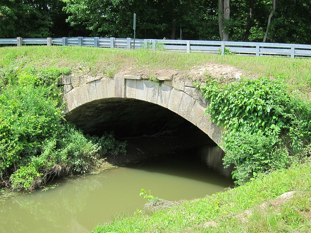
And finally the S bridge at Fox Creek.
Fox Creek S Bridge by mobilene, on Flickr
Fox Creek S Bridge by mobilene, on Flickr
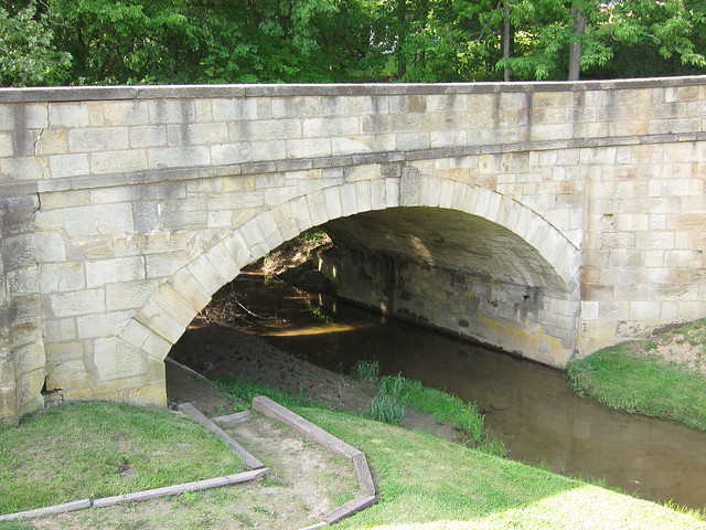
Fox Creek S Bridge by mobilene, on Flickr
Under the arch:
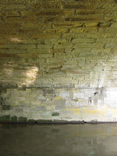
Fox Creek S Bridge by mobilene, on Flickr
The brick road leading away:
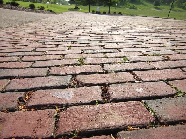
Fox Creek S Bridge by mobilene, on Flickr
-
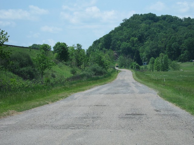
I want to repeat a comment I made about one of your earlier posts. The first shot here is another classic, that should be in a roadie's guide book. As you very well know, newer roads level the hills, fill the dips, and smooth the curves or turns. This is a perfect example of cutting the hill down. It makes the point in a way hard to forget.
Dave, honest to goodness, I was thinking of you as I stood there taking that photo! You were key in opening my eyes to some of the things I had been seeing out on the road but didn't understand; this was one of those things.
jim
-
When Ohio improved the National Road -- also known as State Route 1 at about this time -- it laid bricks east of Zanesville. A few sections of the old brick road remain. The first I encountered was the segment at Blaine, documented earlier. I expected the second to be just west of Old Washington, as it was clearly an old alignment and Google Maps labeled it Brick Road. But apparently the evil asphalters got to it before I did. But just check out the difference between the old alignment (left) and the new (right).
Brick Road isn't brick anymore by mobilene, on Flickr
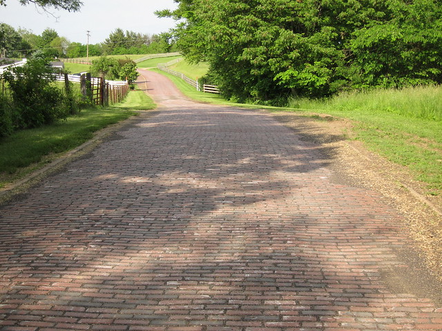
A short bit west, however, is the relatively well-known Peacock Road. It starts off as gravel, but shortly bricks emerge. (I'll bet that if you dig down in the gravel, you'll find brick, too, probably in bad shape, hence the graveling.)

Peacock Road by mobilene, on Flickr
The concrete "curbs" make me wonder if this road is built the same as the abandoned brick segments in Illinois -- concrete pad topped with bricks.

Peacock Road by mobilene, on Flickr
I had an overwhelming urge to go to a hardware store, buy an edger, a weedwhacker, and some Roundup, and come back here to clean up the overgrowth on this road.
Peacock Road by mobilene, on Flickr
Just west of Cambridge, I encountered another brief brick segment on an old alignment. It was good, rumbly brick.

Brick segment of old US 40/NR by mobilene, on Flickr
Check out how they curved the road.

Brick segment of old US 40/NR by mobilene, on Flickr
This road is still considered important, as evidenced by its striping.

Brick segment of old US 40/NR by mobilene, on Flickr
When I got to Norwich, the map called out another segment labeled Brick Rd. It was an old alignment of an old alignment. Fortunately, this one was really still brick.
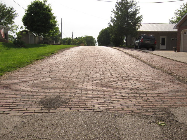
Brick Rd. by mobilene, on Flickr
It cut across a lovely country scene.
Brick Rd. by mobilene, on Flickr
These bricks are spaced unusually widely.
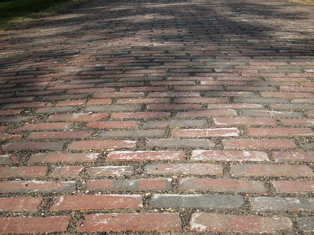
Brick Rd. by mobilene, on Flickr
This was the last brick segment I encountered on the trip. Zanesville is the next big town to the west, and the segment between there and Hebron was famously laid in concrete from 1914 to 1916. Some of that concrete remains, and I'll share it later.
-
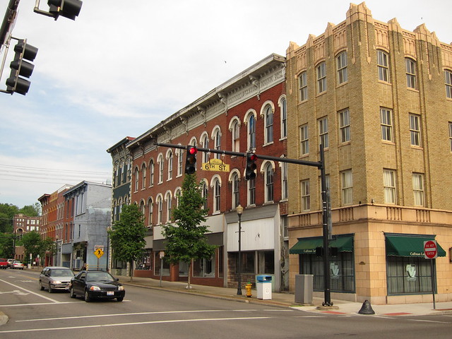
What's remarkable about Old Washington -- Chevettes notwithstanding -- is that there are so many buildings like this in at least serviceable condition. There was hardly anything but buildings like these in Old Washington!
-
Ooh! This sounds crackling good! It sounds like you have enough data to put together a very likely route map. I'm interested in the tale -- of course! -- but will have to live vicariously through you on this one!
-
I passed through a lot of little National Road towns in Ohio. Many of them were dilapidated and falling apart. Not Old Washington. It's what all those other towns wish they could be.

Old Washington, Ohio by mobilene, on Flickr
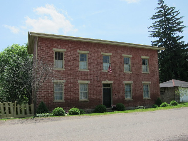
Old Washington, Ohio by mobilene, on Flickr
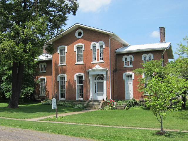
Old Washington, Ohio by mobilene, on Flickr
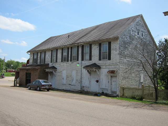
Old Washington, Ohio by mobilene, on Flickr
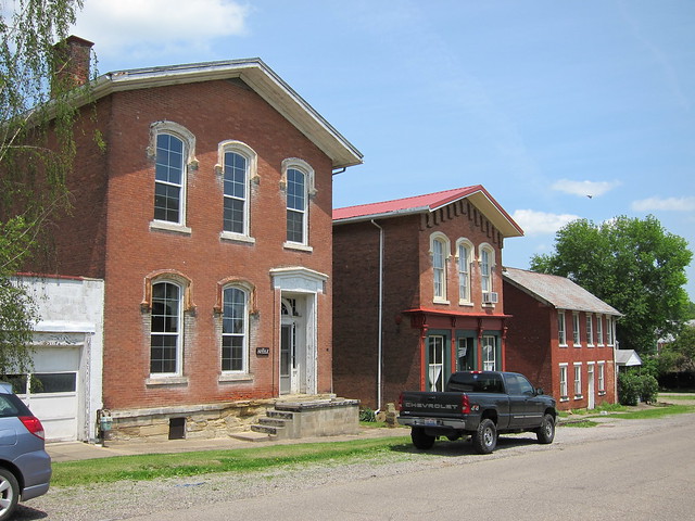
Old Washington, Ohio by mobilene, on Flickr
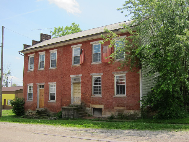
Old Washington, Ohio by mobilene, on Flickr
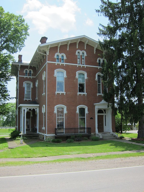
Old Washington, Ohio by mobilene, on Flickr
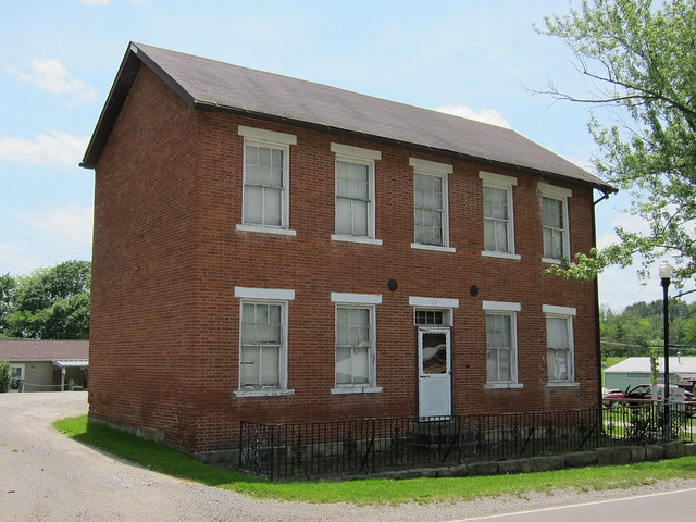
Old Washington, Ohio by mobilene, on Flickr
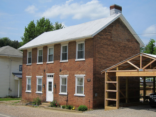
Old Washington, Ohio by mobilene, on Flickr
For this much excellence to still remain, naturally Old Washington is on an old alignment. Here's where it dead ends west of town.
Dead end of NR west of Old Washington by mobilene, on Flickr
-
Great photos! My oldest son has a red Yaris -- quarter tank of gas and 45 miles? No problem!
-
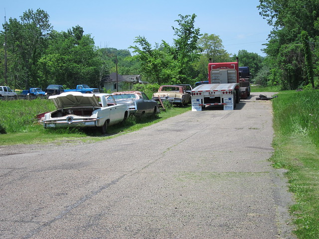
It was great to see those Imperials. I would have liked to get up close to them but out in the middle of nowhere you just never know how friendly an owner might be.
According to bridge inspectors, if that S bridge doesn't get some attention, it may become undriveable!
Here's the photo that shows up as missing above.
Wings Lane? by mobilene, on Flickr
-
Between Morristown and Old Washington, I-70 was built very close to, and sometimes on top of, US 40 and the National Road. It makes following the old road a little challenging. I had to cross over I-70 in a couple places, and in another I had to take a wide detour over some crappy gravel roads. But I'm determined -- or is that nuts? They are so often two sides of the same coin.
Hendrysburg, the first town west of Morristown, has the ignominy of having been bypassed twice, first by US 40 and then by I-70. There's not much to the town. Here's where the National Road alignment ends to its west.
Just past Hendrysburg by mobilene, on Flickr
In many places where the old road remains it is forlorn but peaceful.
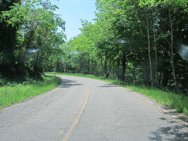
County Road 40A by mobilene, on Flickr
Waymor Rd. by mobilene, on Flickr
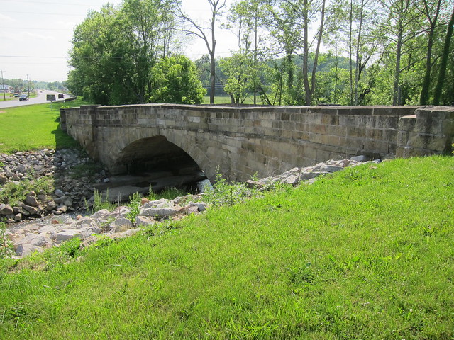
The only National Road S bridge that you can still drive is back here. It looks pretty solid to me, but engineers who make it their business to know such things say that it has deteriorated badly and will need restoration very soon.
Salt Fork S Bridge by mobilene, on Flickr
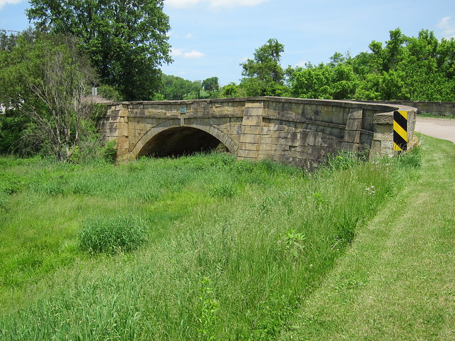
Salt Fork S Bridge by mobilene, on Flickr

Salt Fork S Bridge by mobilene, on Flickr
Just past the S bridge, the road disappears once again into the fill of I-70.

Wings Lane? by mobilene, on Flickr
-
Me too -- makes me try to imagine a time when it was still a bustling highway.
-
I shoulda read the latest ish before I traveled!
-
I-70 did a real number on about 18 miles of the National Road west of St. Clairsville, OH. Bits and pieces of the old road remain, some of them not easy to get to.
More than 20 years ago I made what remains the longest road trip of my life. I drove from Terre Haute to Mississauga, Ontario, to visit one friend, and then through Niagara Falls and upstate New York, and then down to Edison, New Jersey, where I visited two other friends. Then I headed home, mostly along I-70. I was bored of the Interstate by the time I crossed into Ohio, and when I saw an exit for US 40 at St. Clairsville, I took it. (This was just past the Blaine bridges, but I didn’t know that then.)
I regretted it almost immediately. My inner roadgeek had not yet awakened, and I was not amused by all the stoplights in St. Clairsville and by the fellow in front of me who was determined to drive 15 miles per hour less than the speed limit. I got out my big Rand McNally atlas (which seems downright quaint now) and looked for a way to get back onto I-70. It showed that US 40 merged onto I-70 ten or so miles ahead, just past Morristown. It even showed that the road widened to four lanes a few miles ahead of the merge.
The slowpoke turned off, and in relief I put my foot into the gas pedal. I reached an intersection where signs said to turn left to reach I-70, but I blew by it eager to drive the four-lane US 40 just ahead.
I had the four-lane highway to myself. A rusty guardrail divided the eastbound and westbound lanes. Then I passed a US 40 reassurance marker covered in black plastic, and then a big green sign also covered in black plastic. Was the road closed? Had I missed a detour? My concern turned to fright as I rounded a curve at 65 miles per hour and found myself staring right into a hillside. With no warning, the road ended right at its base! I slammed on the brakes and came to a stop just ten feet away from the end.
Rand McNally was wrong. US 40 didn’t merge onto I-70 here; rather, I-70 was built over US 40, at least 30 feet up.
Here's the scene today.

Dead end by mobilene, on Flickr
Here's how the road curves in from the east.
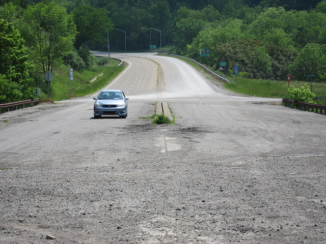
Dead end by mobilene, on Flickr
About a mile later, old US 40/NR emerges from the fill.
Mt. Olivet Rd. by mobilene, on Flickr
In this case, they abandoned the westbound lanes.
Mt. Olivet Rd. by mobilene, on Flickr
-
Good stuff so far, Denny! Loved seeing the curbed old 36 in MO.
Concrete Evidence
in National Road / U.S. 40
Posted
One thing's for sure, Dave -- it's fun to catalog these details for later use in old-road dating! -Jim