


mobilene
-
Posts
1,247 -
Joined
-
Last visited
-
Days Won
1
Content Type
Profiles
Forums
Gallery
Blogs
Calendar
Posts posted by mobilene
-
-
Dave,
I'm sitting here thinking that I should have quit my job, flown out your way, and ridden along on this trip. It just might have been worth every moment of upheaval in my life when I returned, to have seen these places and met these people.
I am hanging on your every photograph. I can't pick a favorite this time; I like them all too much.
Peace,
jim
-
Denny, that Prius on blocks is somehow both classic Indiana and just too strange for words at the same time!
Dave, the remarkable thing is that downtown Seymour still has a viable hardware store in which one can buy a 58-cent wood dowel. In many other small Indiana cities, my only option would have been to call a locksmith.
-
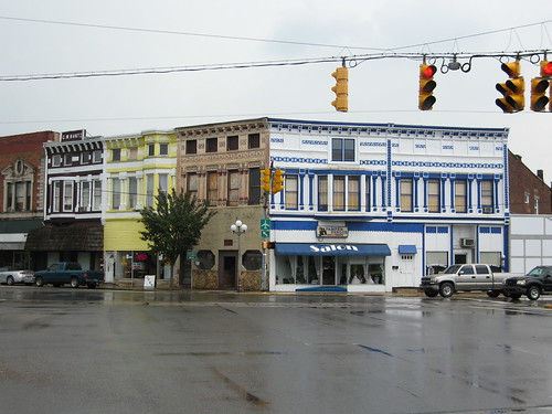
A friend of mine saw my photos from my Ohio Line to Seymour leg of my US 50 trip and asked if he could travel along on my next trip. Sure! I love having company. So on Saturday we zipped down I-65 to Seymour and spent a very hot day on the old highway.
I'm glad he came along, too. I managed to lock my keys in my car in Seymour. They fell out of my pocket as I got out of the car, and by the time I realized, I had already locked and shut the door. They lay there in the seat, taunting me. Thinking quickly, he said, "There's a hardware store down the block. Let's go buy a long wood dowel. You can stick it through the cracked window and press the lock button with it." 58 cents later we were back to the car. The lock button on the door wouldn't play ball, but I was able to flip my keyfob over and press the Unlock button on it.
The rest of the day, I locked the car with the fob after we were both out.
My 1924 ABB sends drivers into Seymour on Tipton St. (US 50), but then has them hook right on Chestnut and then out of town on 2nd St., a couple blocks north of modern US 50. The ABB claims that the route follows "State Highway No. 4," so perhaps the modern 50 alignment came later. Here's a shot of Chestnut just north of current 50.

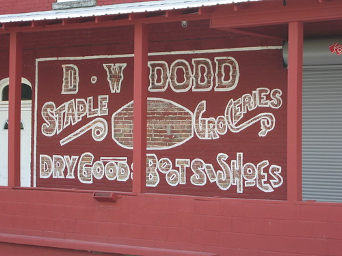
This fabulous sign is just around the corner from Chestnut St. on St. Louis Ave. Roadmaven tells me that this was part of a chain of dress shops in small Indiana towns.

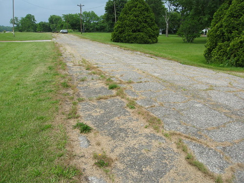
2nd St. quickly became narrow on its way out of town. Soon, a railroad track, US 50, and 2nd St. converged. 2nd turned to cross the track. The ABB sent me down a county road away from US 50's current alignment for a bit, and then down another county road to meet up with it again. But we wouldn't stay on modern 50 for long. We would soon reach Brownstown, and we would leave US 50 for a 21-mile jaunt down a series of state and county roads. The county road portion wound through some fun terrain and gave a real feel for what a trip down US 50 would have been like 80 years ago -- except, perhaps, that the roads are all paved now. I'll share photos from those roads soon.
-
I have long had a dream to own a vintage car, though my dreams go back only about 50 years, not 90. It's not in the cards financially right now, but one day...
-
I am in love with that bridge.
-
This whole post just makes me grin from ear to ear. Not only do I love how the hotel has been restored, but I love how the photo in the ABB makes the hotel look like it's moved forward to today as if it has always been vital. Awesome!
-
Well, guys, I love it when someone who owns a very old car still drives it. What's the point of owning one if it rolls only on and off a trailer? jim
-
That's very cool. I'm really in awe of that car's ability to travel.
-
This makes me want to make a similar trip if for no other reason than to stay at this hotel! What a gem.
By 1922, the hotel had stopped advertising in the Transcontinental ABB -- just checked my copy.
-
Great photos. That's some camping outfit!
-
The photos are fabulous! Boy, that is one serious-looking car. I imagine mobsters driving something like that on their way to a massacre.
Does that car run on modern fuels?
-
I love the first photo of the allegedly 1911 bridge!
-
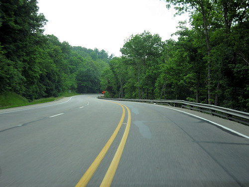
Just thinking about driving that sheer drop with no guardrail makes my innards all turn to jello. Looking forward to photos!
-
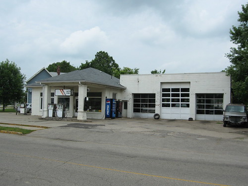
That Mobil station is fabulous! It's so complete, you expect an attendant to come out and pump some gas! jim
-
Are you going to keep us up to date as you travel? With photos, I hope?

-
These are fine photos, Dave, and the happenstance of capturing that same spot is incredible. I am thrilled to see the spot unmolested since 1949.
-
Dave, do you wonder that in the same way you wonder whether these pumps still dispense gas?

-
The last sight worth seeing on my trip the other Saturday was tiny Hayden, Indiana. It's on a county road today, but my 1916 and 1924 ABBs send drivers through it, the latter guide naming it State Road 4. Coming upon this gas station only bolsters the notion that this was once the busy highway.

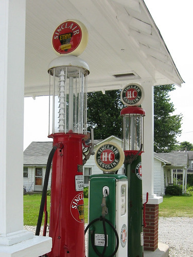
I believe I misinterpreted the ABB in following the road that passed by this building, but what the heck, it's a great building.

-
I had never heard of any of these books/stories, so thanks for sharing!
-
Denny, it's right off 50 and easy to spot. Click the photo to see it on Flickr; there, click the map link, which pinpoints its location. There are also about a dozen more photos of the bridge on Flickr.
I was quite surprised to find this little bridge. I thought all the wooden bridges went out in the 70s. And whoops, I was wrong, this wasn't built in 1908. Bridgehunter.com says more like the 1920s sometime. Maybe this is why my 1924 ABB doesn't call out this bridge -- perhaps then the road crossed the RR at grade.
A little bit more is to come from my first Indiana US 50 adventure. I'm hopeful to get back on 50 over the 4th of July weekend. I'm told there's a ghost town on an old alignment of 50 and I'm determined to see it.
Next weekend I'll be in Delphi speaking about the Michigan Road.
-
My 1924 ABB gives confusing directions on how to get to North Vernon. As best as I can decipher them, they involve a bridge that not only no longer exists, but of which there is nary a trace, as if there were never a bridge there. But it at least names the streets for one in-town intersection, and I'm able to trace westbound from there. It sends the driver out of North Vernon on a road named Hayden Pike; appropriate, for the next town is Hayden, and the mileages from that point add up perfectly.
And so I'm surprised that the ABB doesn't call out this 1908 wooden bridge that's on the old road.
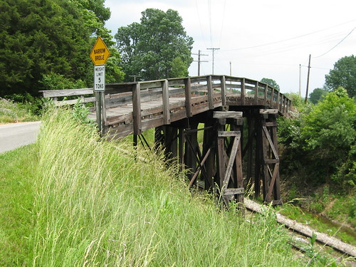
I have to admit, this thing didn't inspire confidence in me, and I considered not crossing it. But while I stood there photographing it, a half dozen farm trucks clattered (and boy, do I ever mean clattered -- the thing shivered and shook) over it. I figured that my little car had to weigh a lot less than those trucks, so I drove over it.
-
There are blogs here?
-
Some more goodness from US 50.
An old gas station in Dillsboro.
An abandoned alignment just west of Dillsboro.
The modern highway in Ripley County.
At the Michigan Road.
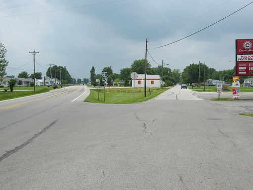
Where the old and new roads split on Holton's east side. The 1924 ABB says you follow the old road 1 mile past the center of town and then turn left and cross a RR. That left turn still exists, but it's a long driveway to somebody's house today; the RR crossing is gone.
The 1924 ABB sends the driver through what is now a reservoir. The road that leads south out of the reservoir leads to tiny Butlerville. These two old, abandoned schools stand on a cross street -- it's not clear to me whether the cross street is the old road or not.


US 50 still goes right through North Vernon -- the only town it still passed through on this trip. It's a cool little town. You may recall that the Madison State Road (from Chris Rowland's trip) passes through here, too.
-
I fixed the links. D'oh!
And on re-study, I think I was wrong again in interpreting my 1924 ABB. I think the "4 cor." is indeed at Indiana Ave., and the driver was directed left onto Indiana and along more or less the current US 50 corridor. Here's a Google Map of the route using modern 50. Indiana Ave. is 1.4 miles from the start, but Dillsboro clocks in at 9.8 miles. The ABB says 10.1 miles; could .3 miles have been gained in later straightenings of US 50?
My 1916 ABB does, however, seem to send the driver down Lower Dillsboro Road. Here's the Google Map of that route. By subtraction, my ABB says 10.2 miles; Google Maps matches exactly.
The 1916 ABB says that at 5 miles from the start (2nd & Main in Aurora), there's a sharp left then right over a bridge. The road has since been realigned there, but I can see on the map where the jog used to be, and there's still a little bridge there. It looks to be somebody's driveway today.
If that's not enough reason to revisit this segment of the old road, here's another -- something else I missed. 19 miles past Dillsboro is a little town called Holton. 2.8 miles west of Holton, US 50 crosses a creek. Just south of the modern bridge stands a stone bridge built in 1908 that carried an earlier alignment of the road -- one that even predates Indiana's original numbered highway system, which came about in 1918. Here's a link to some photos and info about that bridge.
New Federal Byway In Tennessee
in Dixie Highway
Posted
Very nice! I'm thinking of a TN vacation next year -- this might be how I do it!