


DaleS
-
Posts
140 -
Joined
-
Last visited
Content Type
Profiles
Forums
Gallery
Blogs
Calendar
Posts posted by DaleS
-
-
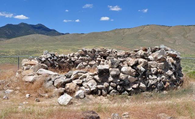
Dave,
No I didn't go inside the Stonehouse, darn it now.
I think the Pony Express went north of there?, over Rock Springs Pass.
Dale
-
I see where you missed the stop sign, you should have turned right at the blind curve, the stop sign is where
that road meets at Stonehouse.
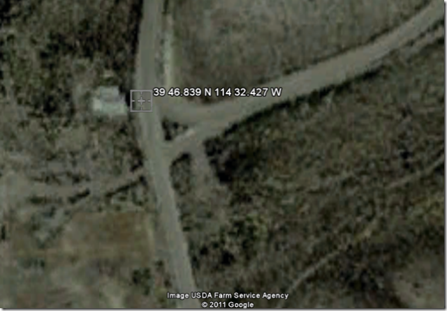
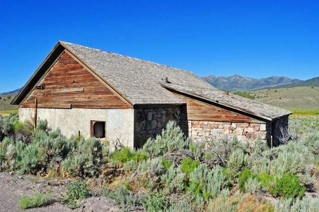
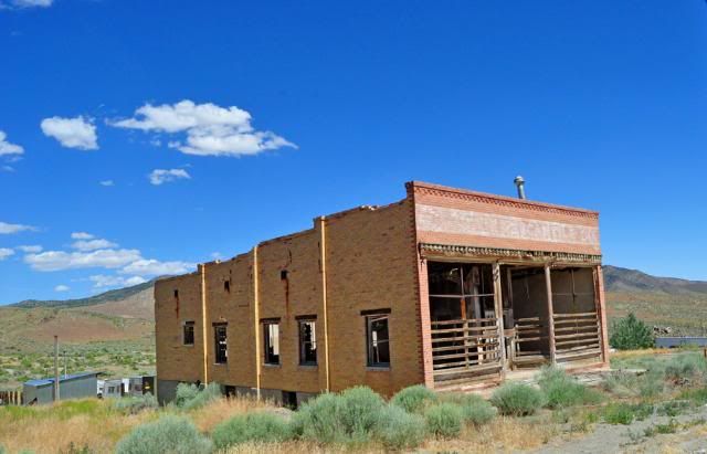
Here is a picture of Stonehouse,from Google Earth. In the little triangle the stop sign faces east in the brush.
Dale
-
Kind of know what you mean by them. They are too wide and smooth for sliding around the corners and not an old road.
Were you traveling west? Kind of sounds like it, then you would have seen the faded stop sign just before Stonehouse.
I'm not tired of the dirt roads yet, as you see I am just a "Day Tripper" here.
Dale
-
Sorry, I have one more post on the area.
There is a Stonehouse on the Lincoln Hwy at 39 46,839 N 114 32.427 that must have been a landmark.
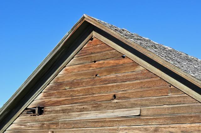
The woodpeckers liked the wood here:
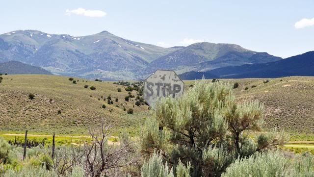
This stop sign is coming from the east just before Stonehouse and must have been here since way back then:
Did you miss it, Denny? It is in the little triangle of roads hidden by sagebrush, you only see it coming the other way.
Enjoy, Dale
-
One more thing, the west end of the Old Lincoln Hwy where it turns south on Old US 93 is at
39 48.160 N 114 43.909 W
Thank you all for the kind words.
I changed the alone to along.
Also changed Scellbourne Station to Schellbourne Bat & Cafe (Closed).
I may look for the Simpson Park Station near Austin next, moving that way.
Dale
-
Roadhound, glad you are enjoying the ride.
It had rained not long ago there. All the county roads of the Goodyear Cutoff had been just graded, guess he was too busy to go down
that 5 miles to nowhere.
Dale
-
One last post in this area.
About 2.5 miles east of Schellbourne Bar & Cafe (Closed) on US 93 up Schellbourne Road to the east is a sign for the first transcontinental telegraph.
39 47.398 N 114 41.745 W
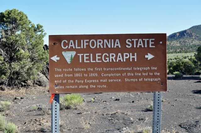
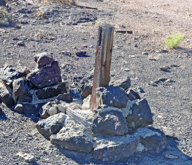
There is also a piece of an original post. The sign said there are more stumps, but I didn't see any.
Taking off from behind the sign are the tracks for the Overland Stage, then Pony Express, the first telegraph and finally the first Lincoln Hwy going west. The first .6 of a mile is driveable with high clearance. After that the road get pretty washed out through erosion in the many years. This section to old Lincoln Hwy is 2.1 miles and ends at old US 93, which is about a 1/2 mile east of modern US 93.
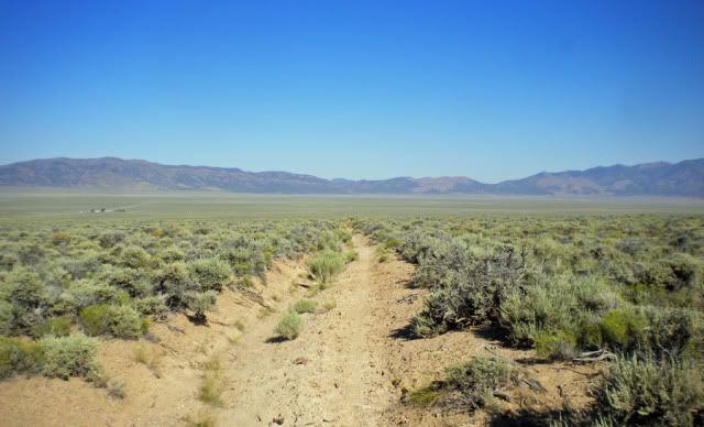
The road here is kind of a sandy ditch, glad I was on my dirt bike.
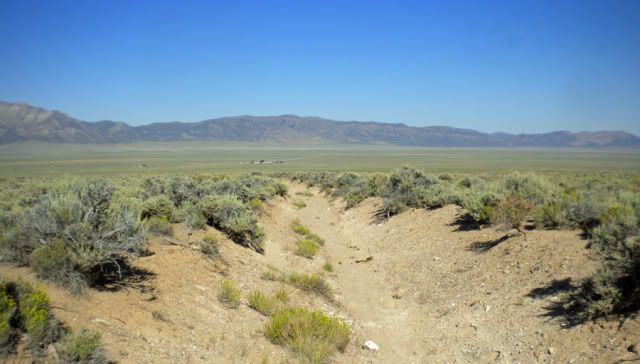
You can see where the old road washed out on the left and the newer one went to the right. In the background is Schellbourne Bar & Cafe and a couple trucks on the right
on the new highway.
My last post in this area this year, thanks for coming along.
Dale
-
Hi all! First, thanks to Denny for reminding me of this forum. The tab had somehow disappeared from my browser, and over the course of a busy two years, I'd forgotten to check it. A new tab is now there!
So many great pictures and stories! Just two questions for now.
Is there a site that easily translates GPS coordinates into map locations? I tried some of the above with Google Maps but it put me in China - although it did look like an interesting road and village!
And Dale, I think I can follow your 8-mile route on maps but I expected the last photo to have the modern road on the left as you headed south and rejoined it. Is that the case or is there indeed no trace at that juncture? Is your last view looking north?
Brian
Hi Brian,
In the last picture, the road is east and north.
Put this in Google Earth or Google Maps " 39 44.860 n 114 27.013 w " and it will show that end of the 8 miles section and will highlight the road.
The last photo was taken after I got on the main road and was looking northeast. Hope the clears it up for you.
Dale
-
I am so drooling over this Lincoln Highway adventure! Makes me wanna buy a Jeep and go hit this dusty trail. -Jim
Hey Jim, most of the Lincoln Hwy could be done in a car. The hidden 8 miles and the Pony Express would could use 4x4.
Dale
-
Wow Dave,
That is an interesting fact. There still was a little bit of water and cat tails in the reservior now.
Too bad I couldn't hang around and get some pictures of the Yellow-headed Blackbirds there.
Dale
-
Denny, I missed it driving east also. On my way back, I went up the Pony Express road saw I was on the LH and saw a couple
roads going left waited then when I saw the second LH sign. Yes, Denny 144 would put you in the Pacific Ocean.
Wanderlustjake, I don't thing you can go much faster today then back then on some parts. Not the kind of road I go fast on.
Dave, my Benchmark Atlas showed it as a small red line labeled "old Lincoln Hwy". I knew it was there. As you see in the photos
it doesn't show from the southern end. The Pony Express Trail west of Tippett is the way to find without the gps numbers.
Mga707, Blm didn't put a sign at the end. the last 1/2 mile is confusing. The is an easy way out there. I was lucky, someone had
driven over it not very long ago and had made tracks in the weeds.
-
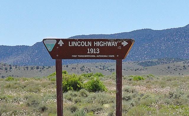
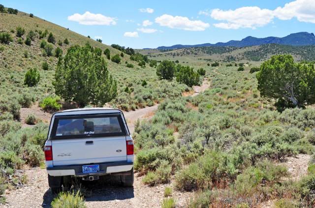
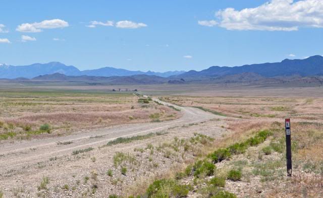
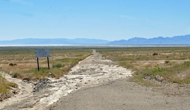
Turn off the A/C and roll down the windows in your high clearance pickup for this one. 4x4 not needed if you know how to drive offroad.
This 8 mile section is not marked at either end, there are markers at two places when the 1913 Lincoln Hwy
turns off the Pony Express Trail.
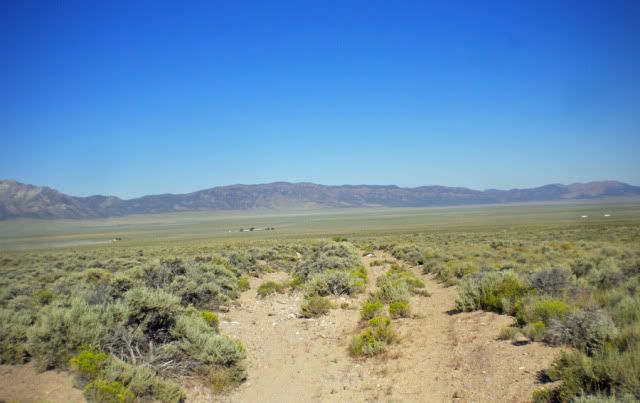
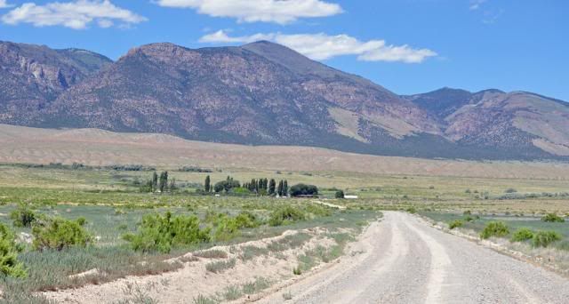
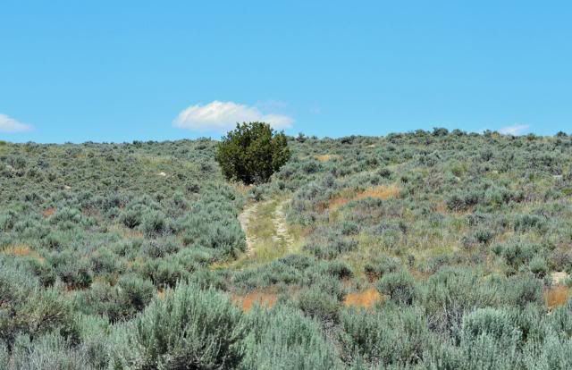
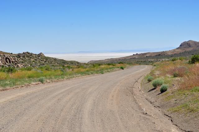
Lets start this adventure 2.3 miles west of Tippett, NV where the Pony Express Trail crosses the modern Lincoln Hwy
at 39 50.253 114 21.665. Go north a half mile and you will see this sign; 39 50.081 114 22.242
The road looks like this:
The road to the right goes about .4 of a mile and that road disappears where a creek was damned up long ago and is a bog now. The only way
I found it was the gps on my bike showed the old road. Nothing but a dirt bike could take .6 of a mile back to the modern road.
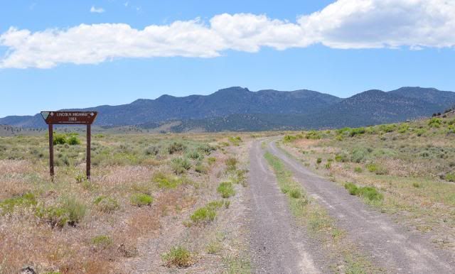
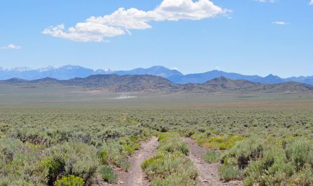
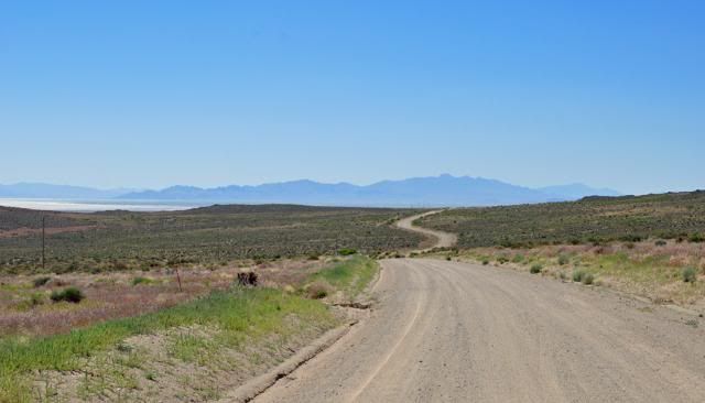
The road we want is straight ahead. At 1.6 miles there is a fork and another sign, 1913 Lincoln Hwy takes the left fork and the Pony Express goes
right and crosses the mountains Rock Spring Pass the highest point on the Pony Express Trail at 7,890'. 39 49.589 114 23.769
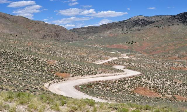
A picture along the road:
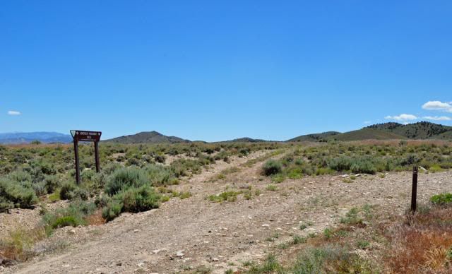
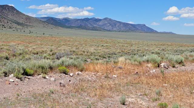
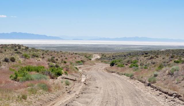
There is a fence crossing at 39 48.608 114 24.510
About .4 of a mile after the fence crossing there is a road forking to the left, go straight.
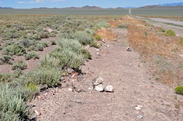
Another picture along the road, the dust straight ahead is a truck on the modern Lincoln hwy:
The road ends 39 44.860 114 27.013 This is why it is hidden:
I put some rocks to mark it,
Now you are back on the dull road, thanks for riding along with me.
Dale
-
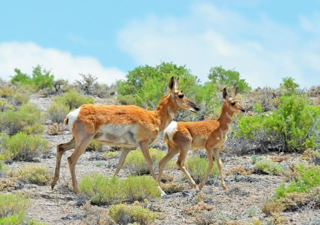
When you enter Nevada on the Lincoln Hwy there are no signs to let you know it. Not far after entering Nevada you enter the Goshute
Indian Reservation. As you leave the reservation, you enter Antelope Valley. We saw ten Antelope there: This picture was taken else
where:
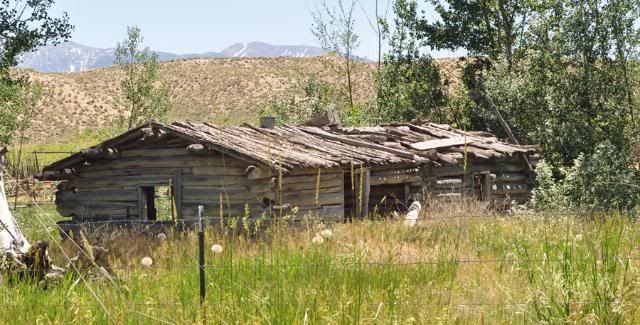
A view of Tippett. Notice Lincoln Hwy maker on the right, Tippett is in the grove of trees:
The older building at Tippett:
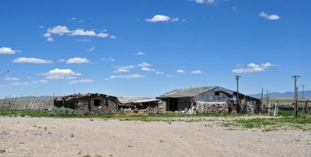
The newer store:
Some links to Tippett:
http://whitepinecountygenhelp.accessgenealogy.com/Tippett.html
http://www.robertwynn.com/Tippett.htm
That is far as we will go today.
Dale
-
Thanks for the correction, there is an airstrip there on my map that makes look like a "b" on the end.
I also titles it as the new route when it was the older one.
Dale
-
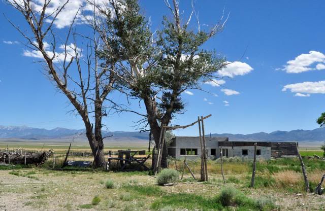
Sorry about the the Title, this is about the older route that followed the Overland Stage, Pony Express and the Telegraph.
The older Lincoln Hwy in Western is a wide dirt road now. There are some things to see along the way. Starting about five miles north
of Callao, UT. The first thing that came up was the Sixmile ranch:
At the beginning of Overland Canyon is the Pony Express Canyon Station, It replaced a wooden station that was burnt down by indians three
miles away. Notice the gun port on the far wall.
From Canyon Station looking up Overland Canyon. The Overland Stage used this route before the Pony Express.
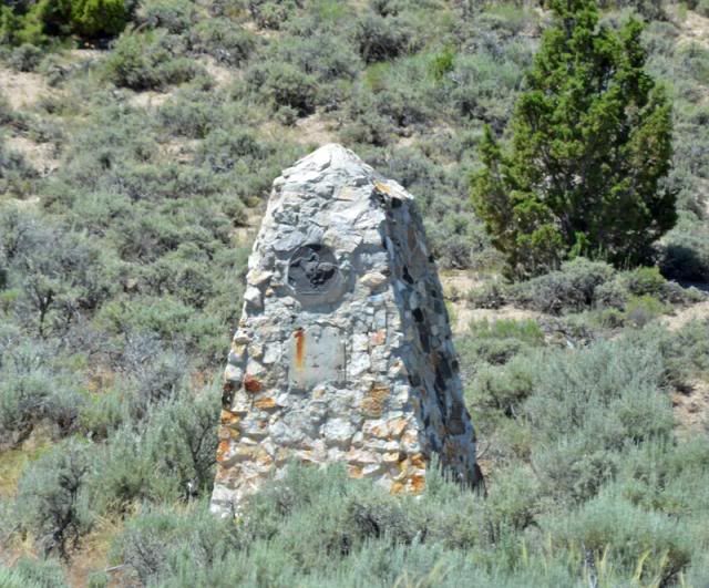
This is a monument for the Pony Express that is a couple hundreds yards off the road with a deep wash between. I used a telephoto lens
for this picture.
This may have been the old Lincoln Hwy, taken near the last picture as the road came out of Overland Canyon.
Finally an old building west of Ibapah, UT.
That is it for the Lincoln Hwy in Utah. Next Lincoln Hwy in Eastern Nevada.
Dale
-
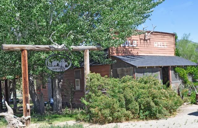
That's another place I "missed by that much" last month. I was intentionally following the original alignment west but could still have visited Gold Hill with a fairly short side trip. Perhaps if I had realized (or remembered) that there were some interesting buildings there I would have made that side trip. But your photos are the next best thing and I've promised myself that I'll never again get that close to Gold Hill without visiting.
It looks like the Cutoff might be drivable/ridable up to the Dugway gate. Did you do that?
No Denny, I didn't go to the Dugway gate. Drove drove 171 miles yesterday as it was.
I came back the way you went and have pictures of there, that I will post soon. Also, I found a hidden part of the 1913 Lincoln Hwy, signs in
there center of it, but none on either end. I found it off the Pony Express Trail, I have to go back on my dirt bike and see where the other end
comes out. When the gps numbers, I'll post it.
Dale
-
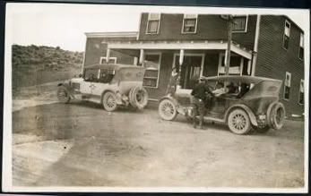
The Goodyear Cut Off went from Dugway, Utah across the Grat Salt Lake Desert and went through Gold Hill, Utah and connected to the old Lincoln Hwy in the Deep Creek Range, east of Ibapah, Utah. I think with started in 1919. I found this 1922 picture of Gold Hill on the internet.
Yesterday I took a ride on it traveling east, these pictures start at Good Hill, Utah as it is today.
Now, just east and downhill from Good Hill is the first look at the Salt Flats.
At this point the road turn south and passes over rolling hills.
Still going downhill.
This is where the Goodyear Cut Off leaves todays road and heads across the Salt Flat that is Dugway Proving Gound now with "No Public Access"
End of this story, Dale
-
In May when I drove on US 6 over Montgomery Pass in Western Nevada, there were parts of the old road I think that could driven
on.
My Benchmark Nevada Atla shows a dirt road going east from Basalt to almost SR 264 that could part of the Midland Trail.
Dale
-
Hey Jim, save the picture then. There are no copyrights on any of them.
I'll have a lot more as soon as I can get out of Ely, NV. Wife has some business to get done here this afternoon, I hope.
Dale
-
I just discovered that the Lincoln Highway Driving CD has a pointer for the remnants of the original concrete mount for the GM plaque.
39 22.8888 -115 54.5737 if you feel like taking a look someday.
Thanks for looking it up, Denny. It looks it is about 10 miles or so south of Eureka past Pinto Summit and South Gate on north side of Hwy 50.
On Map Source it showed 9.5 miles in a straight line.
Dale
-
The Pony Express Trail west of US 93 is also Overland Stage Route which is the first road in that
part of Nevada. I think everybody enjoys my photos that I try to tell the story with and take the viewers
with me.
Dale
-
Thanks Dave & Denny, for the input.
Later in the week I'll be moving north and try to start from Willow Springs Pony Express station site in Utah to follow Lincoln Hwy & Pony
Express trail to Egan Canyon, NV. My Benchmark atlas shows a couple different routes through there. Early on it looks like the Lincoln Hwy
followed the PE trail, then the LH took a different route. I can drive over one way and come back the other. Should be fun.
I guess the pony Express Trail would not be off topic as it was one of the first roads.
Dale
-
This would be the route just before the new Hwy 50. That looked like 70's satellite system, somebody could have
been living in it, as other places on the road.
I ran a story about the old Lincoln hwy west of Ruth a few years ago and about the new section around
the mining area and how I had to use 4x4 to get around it.
-
At 6:45am not much else was open.
Dale
Stonehouse East Of Scellbourne
in Lincoln Highway / U.S. 30 / U.S. 50
Posted
Dave,
I don't how correct my Benchmark book is. The currant BLM Pony Express signs show the Trail going north going east off Schellbourne Road.
Here is a scan off my Benchmark Atlas showing the Spring Valley Station near the intersection of Schellbourne Rd & Spring Valley Road. I rode my motorcycle from Spring Valley Station to Antelope Springs Station following the BLM PE signs.
Who knows, you have better info than I do. Sorry about the marks on the map book. My way of finding things.
Dale