


DaleS
-
Posts
140 -
Joined
-
Last visited
Content Type
Profiles
Forums
Gallery
Blogs
Calendar
Posts posted by DaleS
-
-
Never mind, I figured it out and have posted some pictures today
Dale S
-
Thanks to knightfan for posting a Lincoln Hwy map. I had been riding the first 4.5 miles of the old hwy on my dirt bike for the last five years and didn't know it was old Lincoln Hwy.
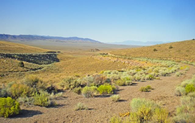
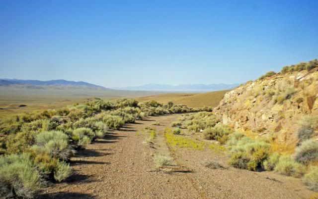
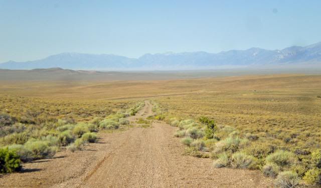
There is about a 15 miles piece of the of the 1913 Lh south of Hickison Summit starting in the west about one mile east of where the where the old Hwy 50 meets the new highway at 39 25.135 n 116 45.418 w.
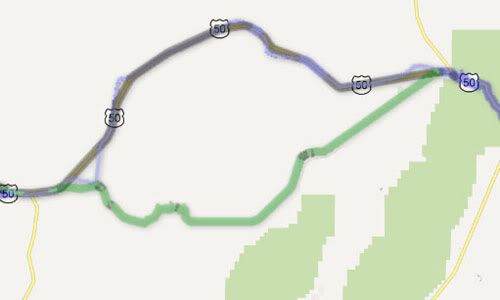
In the photo of the map below, Hickison Summit is at the farest point north and the green line is the 1913 Lincoln Hwy.
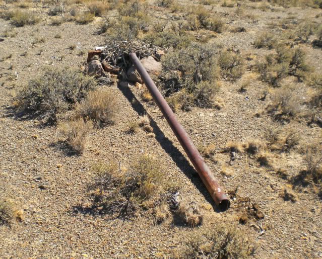
About two miles to the east is the old summit, now a two track dirt road. Looking west from the summit. At 39 24.222 n 116 43.981
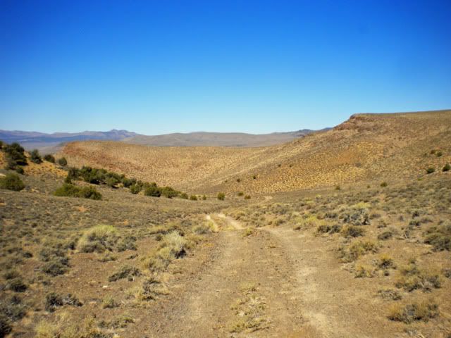
At the summit there is an old pole that had a sign at one time. Now it is laying down with a pack rats nest at the bottom of it,
On the road east of the summit the present day dirt road is next to the washed out old road.
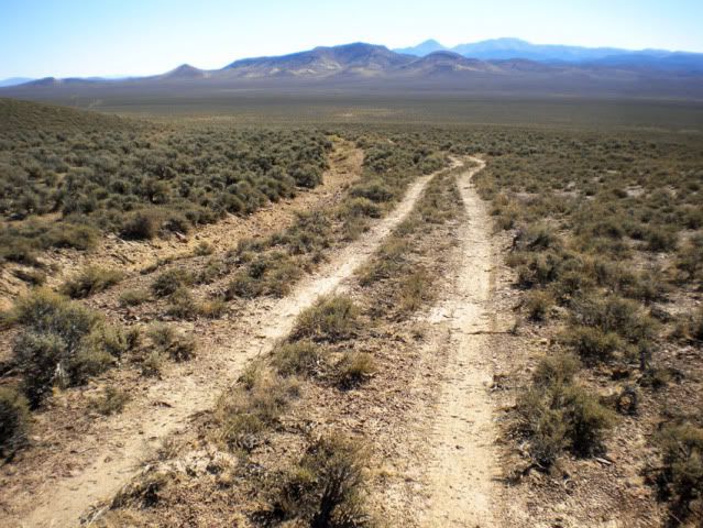
At about four and a half miles the old hwy crosses Grimes Ranch Road and continues east. At about five miles a creek has washed out the old hwy so only a jeep, quad or dirt bike can pass. I went another five miles to Grimes Flat Well. About .2 of a miles is the site of the old Grimes Ranch, I could
see nothing there and didn't go as there is on road now to it. The old hwy went about another five miles, which I didn't go.
Dale S
Oh yes Dave, the hamburgers are still good at the International Cafe,in Austin and too big to finish.
-
This way of putting in pictures doesn't seem to work now.
I am trying to post some pictures of the 1913 Lincoln Hwy south of Hickison Summit.
http://i479.photobucket.com/albums/rr153/cwit_99/LincolnHwy1913008downhill.jpg
-
Very interesting map, Roadhound. I see a section of the 1913 route east of Austin, NV that I have been on with my dirt bike and didn't it now it was part of 1913 Lincoln HWY. The section south of Hickison Petroglyth Site and present Hwy 50.
I will ride it again this summer and post pictures and gps numbers of it.
Grover might have to back his Model T up some of it.
Dale S
-
Thanks Guys, I guess having birthdays is better then not having them.
Dale
-
Thanks, Dave. Those birthdays just come in go now, not like a kid who haven't had many of them and needs new toys.
In Mid Oregon near Bend now. Taking pictures and trying to get out and ride the dirt bike, don't know of any old roads around here.
Dale S
-
Hey Denny, I had a Dodge Lancer (same as Valiant) 4 door late in it's life with a standard transmission, around the early 80's. It was geared so low that you take off from a stop light in second and only shift once to high. My great uncle owned it and it had a small engine fire near where I lived and I towed it home and got it for $60. Last car I owned, vans & pickups ever since.
Dale S
-
Very nice and interesting report, too bad you didn't get to spend more time in the area.
Dale S.
-
Happy Birthday, Denny!
Dale
-
Good report again, Grover. Can't wait for the rest of your travels.
I should be near Hwy 50 in July or Aug.
Dale
-
Nice pictures and report, Dave. Reminds of the times I took the ride up the Oregon coast on 101. The Oregon coast has to be the prettiest sea shore ride in the west.
Now my travels are different, but I should do it again.
Thanks Dale
-
Nice write up, Grover. Waiting for the desert part.
Dale
-
Grover, about the only place to stop between Fallon & Austin is Middlegate. They have gas, bar, camping and all that stuff.
The shoe tree is between there and to turn off for old hwy 50, SR 722.
Dale
-
Those numbers looks like where it is me.
It used to be a good drinking place, my friends would talk to the navy pilots there.
Dale
-
Hey Denny, I just saw the bold letters for Hot Creek Hotel and thought he stayed there. Places he may have drove by were not bold. I don't know
how many miles a day you could drive back then. My dad told me in 1922 they would have at least four flat tires a day.
There at least were four routes after you entered California on the Midland Trail. Tioga Pass doesn't open until June NOW! only a summer only route.
Now I am in Southeast Nevada near Pioche, heading south for the winter. It was getting cold (for us) along Hwy 6 as we moved east. Saw frost from sprinklers going to Ely. Nice country to visit some day.
Dale
-
I'd never even heard of Hot Creek Ranch but I sure liked the pictures. Guess I'll have to look deeper into the Midland Trail someday.
Hey Denny,
The Hot Creek Ranch Hotel is where the fellow who wrote the Midland Trail Tour Guide stayed between Currant (or Ely) and Tonopah, NV.
The Hot Creek Ranch is about 10 to 15 miles north of Hwy 6.
Not much in the Midland Tour Guide on Nevada, 4 pages going west and 2 pages going east.
Dale
-
No Dave, we didn't see charcoal kilns or much else of an old town. I drove up to Upper Hot Creek Ranch before turning around and
going back around the ranch to the east and to Hwy 6 that way. I came into Hot Creek Ranch from the Tybo road.
This was written ten years ago:
http://www.robertwynn.com/HotCreek.htm
BTW, Tybo is an active mine now and there are Keep Out signs now.
Dale
-
Went to the Hot Creek Ranch and took pictures of the Hotel that is listed in thee Midland Trail Tour Book. I didn't see any one around and didn't get a tour of
the hotel as a web page on ghost towns said a person got to do 10 years ago.
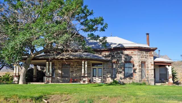
A view of the back of the hotel:
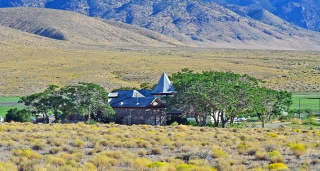
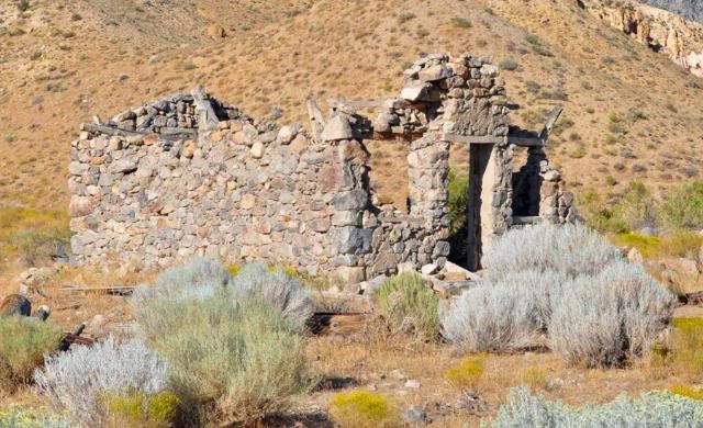
An old building close by:
About a mile before the Hot Creek Hotel I saw this Golden Eagle, it was a long ways from the road using a 400 mm lens:
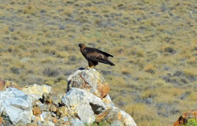
Then it flew away:
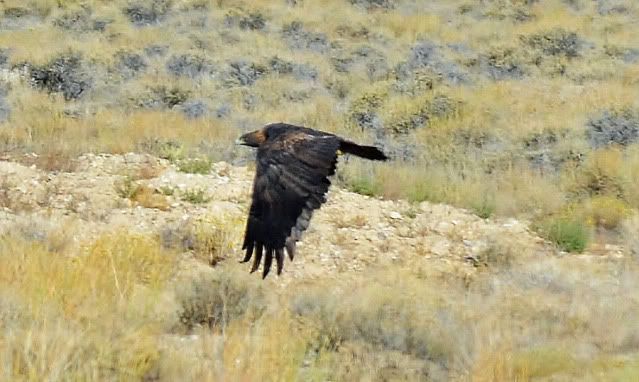
That is all for now, Dale
-

Sheila and I visited the Oregon Coast last weekend. Halfway down US 101, the little seaside village of Yachats is a favorite of ours. I didn't plan to post the trip, but I decided there may be some interest, so I prepared a PDF file using InDesign, which I may use in the future because it is a simple way to tell a story in text and pictures.
A double click on the link should bring up the story and pictures, in Acrobat Reader.
Dave, I always thought the Oregon coast was prettier tha California's. Long time since I have been there.
You kind of unlucky with the weather. I was at Bodega Bay (50 miles north of San Francisco) ocean fishing Aug 14-20 and the weather was fine. That
storm must have just hit where you were.
Dale
-
After reading the Midland Trail Tour Guide written in 1916, I camped off Hwy 6 between Stone Cabin Ranch and Hot Creek Hotel.
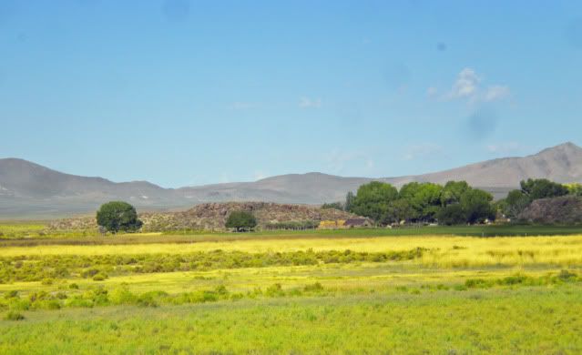
Today I took a 30+ mile, one way, motorcycle ride to Stone House Ranch. On the way I counted 49 wild horses. Stone House Ranch
is still a working ranch, that is why I didn't get closer. There could be hungry dogs.
This picture was taken at the ranch gate looking northwest. The yellow flowers at Rabbit Bush that bloom late in the year. There are
many trees around the buildings, a pretty place.

Another view of the ranch from the east:
Tomorrow I will be going to Hot Springs Hotel, hope I can get closer to it than I did today.
Dale
-
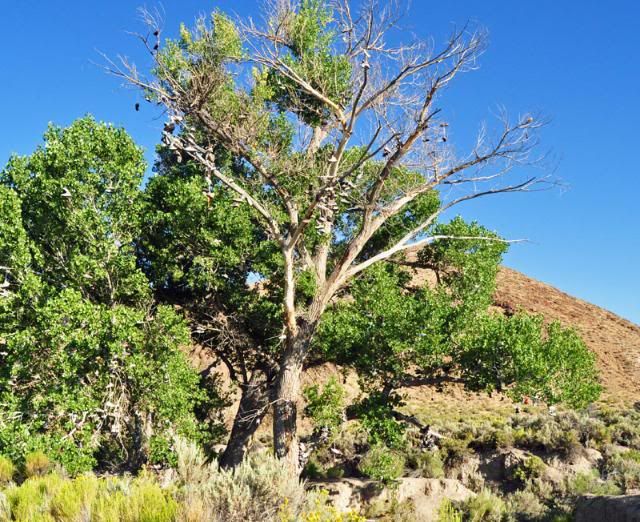
I drove by the Shoe Tree yesterday, it is down and being cut up for fire wood.
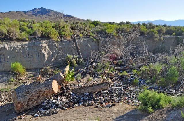
But, it will never be forgotten:
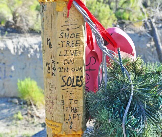
The tree next to it has replace it and there are many shoes in it now.
Dale
-
Hey Grover,
From what I saw in Google Earth that intersection is at 40 06' 41.11" N 113 44' 04.64". Sorry about that style gps numbers,
but that is what GE gave me.
There is no gas I know of in Ibapah, I didn't go down where a few houses are there. It didn't look like any business's were there.
The next gas would be in McGill, NV, you better take some. I haven't been to Dugway, some others here should know.
Dale
-
I have been driving by and camping near this stretch of abandoned highway 50 for a few years now. Finally took a ride on it with
my motorcycle yesterday, also the pickup later in the afternoon with my wife after a cheeseburger at the International Cafe in Austin.
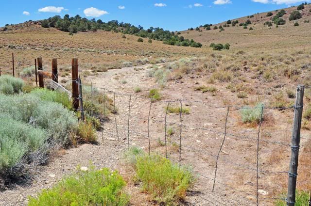
The road starts at Hickison Summit (6546') there is a little loop road (below) on the north side of the road. One end is across the road from
wide paved area with a historic marker. The other end is JUST west of the Hickison Summit. There a gate in the fence at
39 26.662 N 116 44.727 W
This picture was taken from the old hwy looking east.
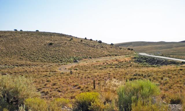
This is the only hard spot on the road, it is kind of a side hill to keep the sport cars off of it. Take the left fork just inside the fence.
Up to the old hwy 50 may be a piece of Lincoln Hwy?? Looking close, I think this old hwy 50 crossed the new highway here. You can see a cut on the other side.
This picture shows the old highway on the right and the new one on the left.
This shows a cut for the old road
Beware of piles of wild horse exhaust
This horn was shed from a deer and is still laying by the road.

The last part of the road
The west gate is at 39 24.66 N 116 46.325 W
Thanks for taking another ride with me.
I started from the east end because is the easiest for Denny to find.
Dale
-
I just discovered that the Lincoln Highway Driving CD has a pointer for the remnants of the original concrete mount for the GM plaque.
39 22.8888 -115 54.5737 if you feel like taking a look someday.
Hey Denny, I drove by the original concrete mount for th GM plaque this morning at a quarter to six and saw it.
It is easy to find, it is on the Eureka/White Pine County Line. There is a pull out to the west of it a couple hunderd yards, pulling
the hill in my motorhome, I didn't stop for a picture.
Dale
A Piece Of 1913 Lincoln Hwy East Of Austin, Nevada
in Lincoln Highway / U.S. 30 / U.S. 50
Posted
Hey Dave, I have been on the road, just not the "good ones". Only thing I can say about the post is, there are a few hole at the top
that could have held a sign. Looks like it had rocks to hold it up, packrat's nest was an added extra. I'll take a better look at it tomorrow and get more pictures of it for you.
Dale
PS, the beer was real cold too.