


mga707
-
Posts
328 -
Joined
-
Last visited
-
Days Won
4
Content Type
Profiles
Forums
Gallery
Blogs
Calendar
Posts posted by mga707
-
-
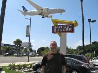
Who can spot additional classic symbols of the old time diner? (You can double click on the image to get a better squint.)
The individual serving cereal boxes! I used to love eating those as a kid right out of the box, using the perforations on the box to make it into a bowl.
-
I know this is not the site for Interstate Highway discussions, but I was wondering if anyone knows if the part of the CKC across northern Missouri, from Hannibal over to I35, that follows US36, is or will become an extension of I72 (which presently has it's western terminus at Hannibal). The Tribune article was just about the Illinois portion of the highway, and did not mention anything about the Missouri part.
-
That is a great postcard! If you squint your eyes and look very closely, it looks like there are two cars passing on another in the far background, right by the far utility pole (or poles--looks like two together) that can be seen to the right of the foreground pole. They're a little sharper, but far smaller, in the full postcard.
-
Denny,
You didn't say when your trip was but if it is in the summer months you are going to find that the the run between CA-152 and Barstow to be 1.) mostly boring and 2.) hot, hot, hot.
Might I suggest a nice scenic route through the Sierra Nevada Range instead? Make your way over to the East Bay and follow I-580 to CA 120 and let 120 take you through Yosemite, over Tioga Pass to Mono Lake before you turn south on 395 to CA-58 and Barstow. Plus, if time permits while your passing through the East Bay, we can do lunch and I can point out some local remnants of the Lincoln Highway and routes to keep you off the Interstate as much as possible.
Rick
Good advice, but I would definitely suggest one slight detour: When you get to the 120/395 junction at Mono Lake detour north a few miles and go to Bodie. The absolute best 'true' ghost town in the continental USA (there's one in Alaska north of Anchorage that rivals it). It is an amazing place and one can easily spend an entire day wandering around, being amazed that people could live for generations (until the 1940s!) in such a lonely, treeless, forbidding-looking place! It's probably a bit less forbidding-looking in the summer, but in the winter with snow on the ground (I was there on a New Year's Day) it is truly eerie.
-
Yes, it was the Consolidated (later Convair) B-24 "Liberator". While the B-17 did fly well before the first flight of the Liberator, they were usually considered as contemporaries of one another.
and yes, the B-17 did have a much "tougher" reputation than the B-24.
The B-24's ace-in-the-hole, though, was it's substantially larger fuel capacity and, thus, longer range than the 17. For long-range bomb missions in Europe, such as the Ploesti (Romania) oil refinery strikes, the 24 was the only choice.
-
Wow! Those are some great shots, and the writing's not bad either! I've done the south bank Columbia drive on US30, but not the north side. and I still haven't satisfied my Pig'N'Pancake urge, since they were so darn busy (Mt. Hood to the beach relay race) the last time I was in the Astoria/Seaside area. Have to get back there someday...
-
One last comment....you have no doubt seen this site but it was new to me.
http://members.tripod.com/airfields_freeman/CA/Airfields_CA_LA_E.htm
Dave
Keep the Show on the Road!
Actually I had not...but it's a great site with lots of info on Alhambra and other former LA area airfields. Thanks--it's been bookmarked!
-
Thank you, Dave!
Both of the maps tell me a lot. The 1939 map tells me that by that time Garvey Ave. was the 60/70/99 alignment, as I suspected, and also tells me that the Alhambra Airport had already been closed by that time, as it is not noted on the map. It's location was the open square right above the word "Wilmar" on the 1939 map, with Valley Blvd. to the north and the tracks to the south. The railroad alignment is where the San Bernardino Freeway would later be built. It's interesting that Wilmar was known as "Ramona Acres" on the 1925 map. Also note that Grand Central Airport is noted on the map, up in the northwest corner, as it was still in use. Commercial carriers had all moved to either Burbank or Mines Field--today's LAX--by that time.
The 1925 map is interesting in that Garvey Avenue had not yet been constructed, so the earlier 60/70/99 alignment could well have been Valley Blvd, which apparently was called El Monte Road west of El Monte at that time. Alhambra Airport did not yet exist (opened in early 1930) so again the site is the open square just above "Ramona Acres".
Thanks for posting the maps--they're excellent. It is always neat to see old LA maps from "B.F."--before freeways!
-
Hello everyone--I am researching the old Alhambra Airport in the town of the same name and have a question about the former alignment of US 60/70 (I believe US 99 also was on the same alignment, at least for a while).
My question is, did the pre-freeway alignment of 60/70 follow Valley Boulevard, which ran along the north edge of the airport, or did it follow Garvey Avenue to the south? The old south boundary of the airport was the former streetcar track that was where the San Bernardino Freeway (Interstate 10) now runs, to the north of Garvey.
The Alhambra Airport is a fascinating and largely forgotten place. It was constructed by Western Air Express and opened in early 1930. For it's day it was state of the art, with a concrete runway and a large hexagonal hangar in the northwest corner of the site, where a shopping center now exists. I believe, but cannot prove, that the shopping center sits on old airport tarmac. WAE moved to Alhambra from another long-gone airfield, Vail Field, which was in the City of Commerce (unincorporated in the 1920s), just west of Montebello.
Alhambra airport had a short life, as Western ran into financial difficulty later in 1930 and was forced to divest itself of many of it's routes and aircraft (the infamous "Shotgun Marriage")by the Postmaster General and merge them into Transcontinental Air Transport (TAT), creating Transcontinental and Western Air (TWA). Another of it's routes it was forced to sell to American Airways, today's American Airlines. Both TAT and AA at that time used Grand Central Airport in Glendale (which Disney now owns and is planning to renovate into it's early 30s appearance), and the small part of WAE that was left independent, The LA to Salt Lake City route, was moved to Union Air Terminal in Burbank (today's Burbank Airport), where the United Airlines/Boeing System already operated. I am not sure when exactly Alhambra ceased to operate as an airport, but it was not long after the "shotgun marriage" of 1930. Incidentally, WAE survived, became Western Airlines, and operated fairly successfully until they bought by and merged into Delta in 1987.
Anyway, just wondering if anyone is familiar with the old alignment(s) of 60/70 in the Los Angeles basin, and how it was routed through the Alhambra area.
Thanks!
-
Climbing over Teton Pass and dropping down into Jackson Hole is still quite a thrill even today, with a much wider--and paved--highway. Especially during a summer thunderstorm, as we experienced it in June of 09! It even turned into a summer thunderSNOWstorm at the top of the pass.
-
Thank you Dave and Denny--it makes sense that only I can see my 'warning points' and cannot see anyone else's, Sure don't want them on my "Permanent Record" like that stuff from back in elementary school!
-
What are they, why are they shown on my posts (even though apparently I have zero of them) and from what I can tell nobody else's posts?
-
Forget the Mustang for your trip for they do not have the heart of Henry's Fords. To me the best automobile for road exploring is a GM Suburban for it's interior space, and ride comfort.
...until you have to fill that monster up with $3 to $4/gal gas!
She wanted a Ford, so I was giving her the closest current model to an open roadster from 1928. Even closer would be the 02-05 retro two-seater Thunderbird, which laid a huge sales egg. FoMoCo was about 15 years too late for a 50s retro T-Bird, IMHO (Apropos Lois Griffin line from "Family Guy": "Kids, these 50s diners were all the rage back in the 80s")!
-
They drove a 1928 Ford Model A Roadster, and I think it would be appropriate for me to drive a Ford as well (what type, not so sure). If I could stop off somewhere during my trip to try out what they drove, that would be fun, but since I'm only retracing the steps and not recreating the trip, I'm good in something newer, lol.
Maria
I think a Mustang convertible is the closest Dearborn spiritual descendant of that 28 'A' roadster!
-
@mga707 We like the OBX area and get down there a few times a year (usually in the summer, on the bikes). Another great thing about OBX is the light houses. There are three you can get to without taking a ferry and another 2 if you don't mind the ferry.
Thanks for the reply! I haven't been to the eastern side of VA/NC in way too long. Have to get back there sometime. Just to clarify in case someone's wondering, OBX stands for Outer Banks, the long, thin barrier islands that are separated from the rest of North Carolina by Currituck/Albemarle/Pamlico sounds. Long known as the "Graveyard of the Atlantic" due to the large number of shipwrecks, the Banks were also pirate/privateer (depending on which side of British maritime law he was operating under at the time) Blackbeard's favorite haunts. Arrrrr!

-
 1
1
-
-
Northeast North Carolina has both the Wright Brothers National Memorial near Kill Devil Hills and Fort Raleigh National Historic Site close by at Manteo. As I enjoy both aviation and early American History, both are of interest to me. The latter is the site of the "Lost Colony", and is particularly eerie as it is still unknown what exactly became of this pre-Jamestown attempt to establish an English colony in North America.
-
Roadhound, you continue to bring back pleasant memories! We hiked the Capital Gorge Road during our '93 Capital Reef/other Utah NPS sites visit. Absolutely wonderful and easy hike.
Now, to your question: I have two old Utah road maps. Surprisingly, the road is signed as Utah Route 24 even on the older one, which is a mid-to-late 1930s (no date on it) Conoco map. The road is shown as an unimproved dirt road and carries the warning: "Unimproved road--carry water". It is amazing how wild and virtually roadless the entire southeast quarter of Utah was back then. There were zero miles of pavement south of US 50 and east of US 89 at that time.
Capital Reef was not yet an NPS site either. The area is simply marked as "Wayne (county) Wonderland".
The newer map is a Chevron map from the early-to-mid 1950s (again, no specific date). the road, and all of Utah 24, had by that time been slightly upgraded to an "improved" graded dirt or gravel road. Capital Reef has by this time been protected, but it is a much smaller area than today and is a National Monument rather than a National Park. If I recall, it and Arches were 'promoted' from Monument to Park status in the 1970s.
I really enjoy your posts!
-
I drove the entire Burr Trail in '04. One of the most spectacular drives, scenery-wise, that I've ever been on. And Boulder, at least at the time that I was there, was a neat little town in a beautiful setting that had not yet been discovered/ruined/"Sedonafied"!
-
Finally, an update from the AZ Dept. of Transportation (ADOT) on this multi-stage Marsh Station Road (old US80) interchange realignment: Early next year (2013) the old Southern Pacific (now Union Pacific) railroad bridge across Interstate 10 is scheduled to be demolished. This bridge is located just to the west of where the old Marsh Station Road overpass stood until it was demolished in 2011 (see above). Once the railroad bridge is gone, the short 65MPH section of I-10 in this area will be replaced with new pavement and a much wider median, so that it will have the same 75MPH speed limit as the rest of the highway. When this happens, the last vestige of this early (mid-1950s) limited access (freeway) section of US80/Interstate 10 will be history. Don't worry, the original two-lane 1930s old US 80 that parallels it is still there and drivable!
-
What was your routing?
(notice only one capital letter...
 )
) -
I have a reproduction of a 1924 Rand McNally Auto Trails map that does not show the NPH at all, so I guess it had fallen into disuse by that time, just a couple of years before the start of the Federal numbered highway system. What the map does show are three separate highway branches converging on Spokane, with the most southerly labeled as the Yellowstone Highway and the two more northerly branches being some combination of the Parks To Parks Highway, the California-Banff 'B' Line, and the Theodore Roosevelt International Highway.
Then there is another highway that enters Washington from Idaho at Lewiston/Clarkston that is labeled as the Evergreen National Highway.
The map does not show any road through Glacier, which jibes with what I learned from my most recent visit there: That until sometime in the 1920s there was no road connecting the east and west sides of the park. Going-to-the-Sun road was not completed until the 30s, and today's US 2 along the southern boundary of the park was not completed yet either, so motorists on the Parks To Parks or T. R. routes had to put their autos (and themselves} on the train that parallels what is now US 2 to get them from one side of the park to the other.
-
Thanks! I just now noticed the one on the left edge of the picture as well.
-
Jim--
Do you know what the objects are that look like two silver (Mylar) balloons on the pole in the top right corner of the 1914 shot?
I second Dave's comment above!
-
This topic prompted me to dig out an Oldsmobile history I have to find out more about the 1905 NY to Portland race. The book is titled "Setting the Pace" and was published in 1996 to commemorate the then-upcoming Olds centennial in 1997. How sad that Olds would be 'thrown under the bus' by GM less than a decade later. But I digress...
The book did not disappoint. Several pages and a lot of photos are devoted to the event.
I'm sure that Dave, world expert that he is, knows all of this, but I did not. The race was held to promote road construction in America, and was timed to coincide with the Good Roads Association meeting in Portland that year. Oldsmobile did indeed contribute financially to the race, to the tune of just slightly more than $4,000.00!
What I found interesting was that by 1905 the five-year-old Curved Dash model was something of an anachronism, although it would continue in production for another two years. Olds had already introduced some other models that were much more 1905-modern, both in looks and in features. I surmise, though, that it's light weight, high ground clearance, and relative simplicity made it a better choice for a transcontinental race over absolutely horrible roads.
Middlegate Shoe Tree Now
in Lincoln Highway / U.S. 30 / U.S. 50
Posted · Edited by mga707
This is like one of those "how many differences can you spot" pictures!
1) W. C. Fields has replaced the rearing stallion on the wall.
2) Both the stools at the counter and the table chairs have been replaced. The stools appear to be more deeply padded now.
3) The green drink mixer is either now gone or has been relocated to a spot out of the picture.
4) Not only is the pay phone gone but the bulletin board as well.
Others?