


mga707
-
Posts
328 -
Joined
-
Last visited
-
Days Won
4
Content Type
Profiles
Forums
Gallery
Blogs
Calendar
Posts posted by mga707
-
-
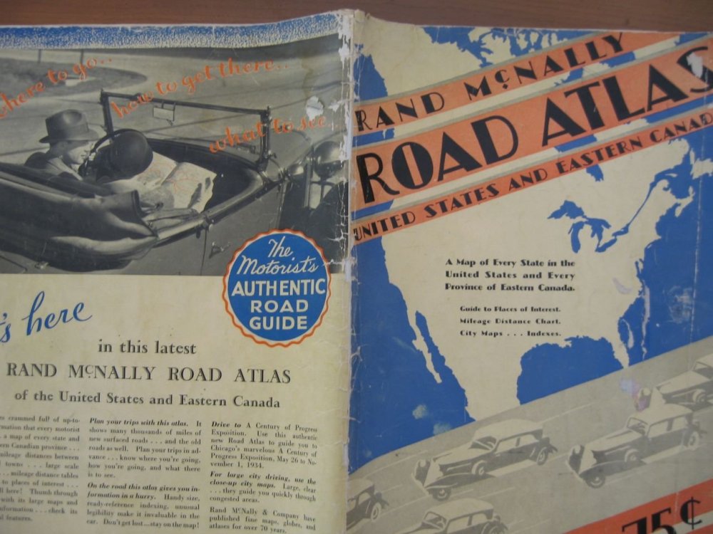
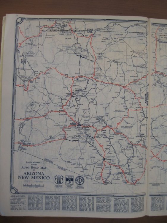
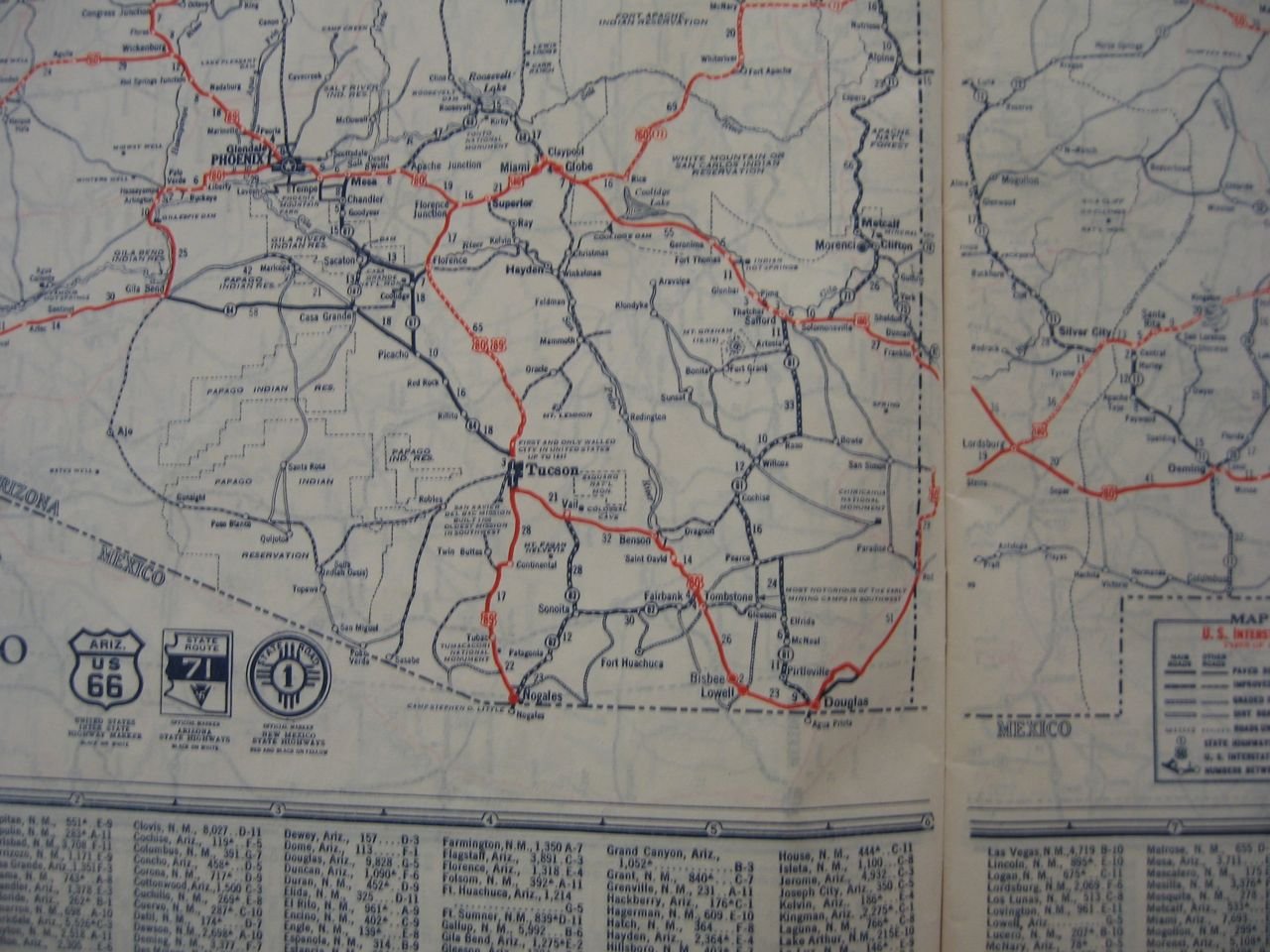
It's 1934. And the western terminus of 66 is in Los Angeles, hard to tell exactly where. The Los Angeles city map in the back is stingy with US highway shields. The farthest west 66 shield shown is in Monrovia. Also interesting is that California is one of the few states that did not by that time have a numbered state highway system. Only US routes are shown on the combined California/Nevada map, and now California state shield is shown for reference, unlike nearly all other states. The variety of state highway shields is amazing! Arizona's had a 'backwards' swastika on theirs, which was a Navajo symbol before that idiot in Germany ruined it forever. You can see ti above, inside of the arrowhead, which in turn is inside of the detailed state outline. Current AZ shield is a very simplified and 'stylized' rendering of our state's shape.
-
1934 Rand McNally road atlas, good shape, all pages, only five bucks! Hours and hours of old road enlightenment here. Below are the front and back covers, my state, and my local area:

-
 1
1
-
-
On 9/1/2018 at 11:25 PM, roadhound said:
I would like to start a thread that captures those buildings along the roadside whose days of glory are in the past and now wait for time to take it's ultimate toll.
During my road trip travels I am always on the lookout for those buildings that were once part of the road trip experience but are now likely relegated to a distant memories of road trips past. Whenever I pass through a small town, or along what was once the major thoroughfare through an area that is now bypassed by the Interstate, I always keep an eye out for that former gas station, diner, or motel. Sometimes they have been repurposed to fulfill another roll, others are in a state of suspended animation, but many times they are abandoned likely to never be a stop along the highway again.
In the 15 or so years that I have taken an active interest in the history of the American road I have had the opportunity to visit sites multiple times seperated by a few years and have witnessed the accelerated decay of some of these buildings, some are even gone completely. The "Kamp"ground office at Two Guns is an example that comes to mind. Each time I pass through that area east of Flagstaff I pull off the Interstate and take a look. Each time there is more grafitti, less of the buildings siding intact, and more of the interior exposed to the elements. I'm sure there are many more examples out there and I hope you will share some of what you've seen.
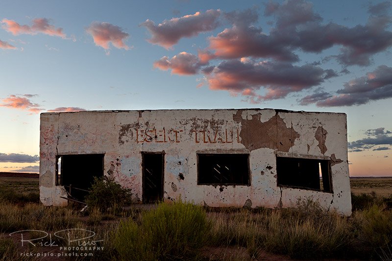
https://fineartamerica.com/featured/painted-desert-trading-post-at-sunset-rick-pisio.html
I'll start with an iconic building that I have attempted to reach 3 times, once successfully, but don't expect to see the next time I pass through Arizona. The Painted Desert Trading Post stands in the middle of nowhere, east of Painted Desert National Park, and nearly inaccessible. The section of Route 66 that this building sits on was bypassed sometime in the 50's and like many Route 66 buildings that lost traffic to the Interstate it eventually was abandoned. It has survived the 70 or so years since it last saw customers only because of its remoteness. Time and the elements have taken their toll however. When I was last there the east side of the building has started to slip, the stucco was flaking off, parts of the walls are gone, massive cracks are present in the foundation, and you can see the sky through the roof.
There may be hope for the old gal yet. As I was writing the draft for this post I was looking online for some information and came across this article. It would appear that a group has purchased the land and the building with an eye to preserving the structure. I wish them the best of luck!
http://www.route66news.com/2018/04/08/group-buys-painted-desert-trading-post/
Roadhound
Minor correction: The correct name of the national park is Petrified Forest National Park. The Painted Desert itself occupies the northern third or so of the park, and extends outside the park boundaries to east, north, and west. The entire park is a wonderful place.
-
Just saw the sad news that the historic summit Inn restaurant at the Cajon Pass summit in California has been totally destroyed by the current wildfire. If anyone has more details, or pictures, please post.
-
1
-
-
Great pictures! Only been to Butte one time (1999), and for way too short of a visit, but I loved it. Seems so 'authentic', not fancified for tourists and rich visitors.
-
1
-
-
Took the Alaska Railroad from Anchorage to Fairbanks, with a two-night stopover in Denali National Park, in the summer of 2010, and thoroughly enjoyed it. Still more of a car/plane guy than a train guy, but an overnight train trip is something I would like to experience when I have the time (come on, retirement!). I think cross-country might be a big too long, but I'd love to do the Canadian rail trip between Vancouver and Calgary, or v.v., across the Rockies.
-
Have not heard of that particular LP, but it sounds like a small label's response to "Big Sounds Of The Drags!", an LP of dragstrip audio that was released on Capitol Records in late 1963 and reached #27
on the "Billboard" album chart in early 1964.
-
Enjoyed it very much! The 'then-and-now' feature is outstanding. Thanks for posting them.
-
That piece of road is in amazingly good shape for a 101-year-old! I'd love to see it if I ever get up to the top half of Indiana--I visit frequently but always to the bottom half.
-
Deja vu. Attempted to send a page via e-mail. The 'captcha' anti-spam device would not work. After indicating that I had assembled the image correctly, it then said it was incorrect when I tried to send the email.
The most recent Lincoln Highway thread is the one i was attempting to send.
-
Great picture! I've seen the building from I-40 but have not been close-up--yet!
-
Tamales in Mississippi, who would've thought?
I'll have to try a 'Delta Tamal' (the proper singular of the plural 'tamales' is 'tamal', not 'tamale') if and when I'm back in that area to compare it with our 'Sonora-style' Southern Arizona tamales.
-
Lots of drivable remnants of old US80 on the OST routing, at least in AZ and CA. And, of course, the Old Plank Road that the BLM has preserved in the dunes west of Yuma.
As far as the heat, a well-maintained modern vehicle can handle it. Just this past Sunday I drove home from LA on I-10. The reading on my car's outside thermometer was at 110 or over all the way from the Palm Springs area to the east side of the Phoenix valley, where welcome thunderstorms and much-needed rain dropped it down to the mid-80s in a hurry. The peak temperature was reached west of Blythe at 115. Right around the Chuckwalla Road remnant of old US60/70, which I was sorely tempted to drive, heat or no heat. Alas, I was in a hurry to get home and the siren song of steady 75mph motoring was too strong.
-
Thank you for your response. The page was "Wonderland Way". I retried sending it just now and it worked perfectly.
-
Hello? Anyone there?
-
Tried multiple times to send a thread as email. "Captcha" timed out every time.
-
The plant in the last picture is a common ornamental shrub around here (Tucson)! I think it's a variety of brittlebush.
Are the Eureka Dunes the dunes that are in the northern part of Death Valley National Park?
Never been to that part of the park--they look really cool. Like there should be a camel caravan trekking over them...
-
Very interesting videos--thanks for sharing them here.
I'm curious--is the main reason for the closures of the old underpasses and the rerouting because of traffic congestion or due to the probability that the old structures do not meet today's earthquake-resistance codes?
-
Beautiful pictures! I've only driven this potion of 395 once, on January 1, 1994 (over 20 years--wow!), from Carson City down to Mono Lake and Bodie. There was no shortage of snow that winter. Bodie looked like the most desolate place in the world, with snow on the ground and the total lack of trees. But what a neat place to poke around in--it looks just as it did when the last residents departed back in the 1940s.
Mono Lake looks great, glad it has recovered from it's near-death experience!
-
Very nice! Love the maps.
-
Kudos to Wyoming PBS. Well done!
-
Very nice--I've driven 61 down from Memphis to Clarksdale (to visit the Delta Blues Museum and Morgan Freeman's restaurant/juke joint across the street) but stayed on the 4-lane alignment. Also did go off on 49 just to cross the Mississippi on the bridge, but did not go into Helena/West Helena proper.
Such an obviously poor area but I never met such uniformly friendly people anywhere in the USA.
Enjoyed your pictures!
-
Check out the comments to the article. Lots of folks wondering why the road crew plans to cover up the arch when the improvement project is finished. Have to agree!
-
And it has been a while since I have seen a green milk shake mixer.....those had practically left the scene by the time of my “Then” shot. What was a staple of my youth, milk shakes and malts, are passe now. I doubt I ever had a burger without a milk shake when I was 16.
No, shakes are still a big thing for some chains. Many of Sonic's ads center on their 28 shake flavors. And Culver's just had a Labor Day promo with $1 regular shakes on that day. I managed to stop in for two of them on Monday!
Next let's discuss typewriters and vinyl records!
I've got one of the former--an Underwood from the 1920s--and many hundreds of the latter!

Amargosa Hotel and Opera House, Death Valley Jct. CA
in Lodging
Posted
Just returned from a week-long trip through four of California's iconic National Parks (Sequoia, Kings Canyon, Yosemite, and Death Valley) and the Mojave National Preserve. One of the highlights of the week was spending two nights at the wonderful Amargosa Hotel and Opera House in the near-ghost town of Death Valley Junction, resident population 3 in winter, 1 in summer. Others commute from Amargosa Valley or Pahrump NV. The history of this town, which was originally a rail junction and is still a road junction (CA state routes 190 and 127), is too long to go into here but is fascinating, if one wishes to look it up. The name of dancer/actress/artist Marta Becket figures prominently in the town's history and why there is still a functioning opera house in a town that for all intents and purposes has ceased to exist. Highly recommend the hotel to anyone planning to visit the Death Valley area. Enjoy some photos of the hotel and surrounding structures: