


roadhound
-
Posts
447 -
Joined
-
Last visited
-
Days Won
16
Content Type
Profiles
Forums
Gallery
Blogs
Calendar
Posts posted by roadhound
-
-
Are you guys hip to Wolfgang's Vault?
It's Bill Graham's personal collection of recordings, posters and other ephemera.
Gosh, where would we be without that guy?
Wow!
That is incredible collection of rock history. I noticed many of the recordings are from the King Biscuit Flower Hour. I'm sure I heard them back in the day and may have even recorded some of them off of the broadcast and onto cassette. All long gone of course.
-
I finally finished getting my pictures uploaded from my summer trip along US 40. They can be viewed from http://www.usroadman.com/us40links.htm . I drove the full length of the current route from Atlantic City to I-80 in Utah, taking pictures on average about every half hour.
While I wasn't specifically searching for old alignments, thanks to the fine work of other contributors here, I did catch glimpses of quite a few of them. Thanks for all of your posts. They made knowing what to look for much easier.
I also had a copy of George Stewart's book with me, and although I was following the current alignment rather than an historic alignment, I was amazed by how many of his pictures I was still able to locate. I'd guess it was over 50%. When convenient (based on whether there was some place to pull over) I tried to take pictures of the same areas. I noted in the photo description when my photo is similar to Stewart's.
I hope you enjoy them.
That is a journey that I hope I have the chance to take someday. Nice Photos! Although, I would have a mutiny on my hands if I stopped every half hour to take a picture.
You know, if we combined the first few days of my summer trip with your summer trip we have most of the original route of US 40 covered coast to coast.
Roadhound
-
I'd love to see the images.
There is intrinsic value in showing your entire collection from the show. However I have more scanning work on-deck, than I care to think about. So I will understand if it takes some time for you to complete the project.
Oh you said slides? Does your scanner also do negatives?
Can anyone recommend a good negative scanner?
Always looking to make more work for myself.
... Chris
Chris,
Like Keep I have an Epson 2400 scanner. Its a good device that can do good quality scans of prints, slides, and negatives. I used it for quite a while but quickly tired of editing dust spots that were picked up by the scanner.
If you can afford it I highly recommmend the Minolta DimageScan 5400. This device is about 3x the price of the Epson and will only do 35mm slides and negatives. What makes the DimageScan worth the extra cost is the ICE technology that it uses. ICE is a process within the scanner that eliminates any dust spots on the image while it scans. I have scanned slides that were fairly dirty and it eliminated all the dust spots. What you pay for in $$$ you get back in time saved editing later on. Oh yeah, it does a good job in sharpness and capturing color too.
Roadhound
-
Alex,
You have the wrong terminology!!
You are using an integrated portable data collection system with pressure pad, interactive stylus, and erasable technology.
The location data can be downloaded to your PC via the digital data entry board, and synchronized with your photos via the intelligent interface.
Keep the Show on the Road!
I have that same device but mine keeps giving me an ID-10T error and then it tells me to check for a loose nut behind the keyboard.
-
Rick, you're definitely one of those who can use RAW data to full advantage. Beautiful picture. I just take the occasional RAW shot in case I catch Elvis in the background and someone else can massage it into a big dollar National Enquirer cover. Curiously, RAW files produced by my 7 megapixel camera are about 11 MB compared to your 5 MB files. I guess that's just a sympthom of the manufacturer specific formats.
BTW, speaking of Elvis and taking this thread way off topic, January 8th was his birthday. I think I'll have a peanubutta and nelly sandwich in his honor.
I aint nuthin but a roadhound...
-
Denny,
Your posts have included many wise (as in useful, well informed) insights on this subject. Thanks!
The "funny" part of my lost Garmin story is that it fell off the roof within 100 yards of my house, and I still couldn't find it!
Oh......and if I had roadhound's photo skills, I would shoot in RAW myself. But when your "talent" is in taking 20 shots of the scene and hoping one comes out, RAW takes up too much storage!!!

Keep the Show on the Road!
Dave
The first few times I used RAW mode I was extremely dissappointed with the results. The pictures were muddy, color saturation was poor, and very rarely did a picture look like I thought it should. Once I learned how to make the corrections in RAW (which really isn't that diffcult once you do it a few times) you are able to improve on the lossless image. It is comparable to darkroom work from the perspective of the way that the film was developed affected the quality of the image. If you have ever done color film processing working a RAW image is much, much easier. I convert all of my images from RAW to TIFF and only use jpg's as the final product, never editing a jpg image.
Yes, it does take a few more CF cards and burning through 10GB worth in a day of shooting has happened, (usually when I am at an event with a lot of action photos). But, once you realize that you can make a lot of adjustments in RAW the actual number you feel you need to take decreases. I've even taken the RAW image, adjusted the same image for different exposure values, and then recombined the images in Photoshop. The attached image was the same image adjusted into 3 different TIFF images in RAW mode (2 for the sky and one for the foreground). I would have to look up the GPS data but can tell you that it is somewhere near Furnace Creek in Death Valley.
In regards to size my 8-mega pixel DSLR produces a 5MB RAW file and a 50MB+ TIFF file. The jpg file size depends upon what was in the photo.
A hot shoe mounted GPS that interfaces directly with the camera would be a cool thing. I am a bit surprised that nobody has made one that plugs into the USB port.

Roadhound
-
Here is a link to a review:
http://www.sciuridae.co.uk/technology/atp_...nder_review.htm
From the webpage:
As for the RAW / CR2 formats, I think the Picture tracker only works with jpeg files.
I do all of my shooting in RAW mode. Although I do like the concept of a single device to track and tag where photos are taken unless the device can handle RAW I won't be adding it to my wish list.
Roadhound
-
I came across this blog today by a woman who grew up in a neighborhood that has been demolished over time to make way for an airport runway. When the 2,000 homes dwindled to 56, she started photographing the area. Looking over her site, which links to a large pool of Flickr photos, gave me a similar feeling to what I experience on an abandoned alignment: People used to use this, but now they don't or can't. It's disturbing to see streets and sidewalks running through houseless neighborhoods. You can take a peek at the link below.
I can't imagine the emotions that I would be going through if I had to watch the neighborhood I grew up in beings torn down house by house. That would be rough. They looked like nice, middle class, suberb type homes too.
I know what you mean Mobilene about that feeling you get driving down an abandoned alignment. I get that same feeling. Do you ever see an abandoned house along one of those routes and wonder what life was like inside it? Who lived there? Were their lives relatively easy or a struggle for survival? Why did the people who lived there leave?
Roadhound
-
Another awesome photo, Rick. I've seen your website pics also. They're simple, yet very elegant. I think you have an incredible eye for the aesthetics of any road or object. Keep up the good work. I'm curious, does anyone pay you to take photographs? Someone should be.....
Matt Smallwood
Thanks for the compliment Matt.
I've sold a few pictures over the last few years mostly to aircraft owners or the passengers that are lucky enough to get a flight in a warbird that I just happened to photograph. Unfortunately, the meager sales don't come anywhere close to paying for the investment in equipment, not to mention the cost of getting to the picture. I once had grand designs of making a few bucks taking pictures but for now I have resigned myself to keeping the day job and taking and sharing photos that I like to take when I can. If someone is interested in paying for a picture, that's great, otherwise I will keep on shooting what I like to shoot.
Cheers and Happy New Year!
Rick
-
That IS a beautiful shot. Did you see the story I reported on, that a salvager recently found a 1928 LH concrete post that had been thrown over the bluff?!
http://brianbutko.wordpress.com/2007/12/19...rker-been-found
I can't help but think it likely could be the original terminus marker. We need someone from the area to search out the person who now has it in his backyard near Rossi Playground!
BTW, my LH Companion book will run West-to-East. Seemed the most natural way for maps to display in a book.
Brian
If that is the original terminus marker that would be an incredible find. Even if its not the terminus marker it is still an incredible find. I know where Rossi Playground is but that is a lot of backyards to be peeping into to. If somehow you make contact with the possessor of the marker and need someone to get out there to take a photo let me know.
I don't have any problems with an west-east guidebook. It makes it easier for me as now I can start at the beginning of the book and travel my way into it as opposed to either traveling backwards through the book or dashing east so I can follow the book back towards home. Thanks for thinking of us West Coasters!
Roadhound
-
God Bless Buddy Rich and Neil Peart!
I cannot tell you how many times I played that Rush tape in my 70 Chevelle in 1981. The year of my HS Graduation, (or escape). I would check the gas, fill the oil, pop that tape in and head to the Jersey Shore!!!
On another of my favorite albums, Neal Peart and Bill Bruford (among others) played on "Burning For Buddy: A Tribute To The Music Of Buddy Rich". There is a "making of" DVD as well, but I have not seen it. Would probably go on the same shelf with my "Yes Years" video. But that's just me.
... Chris
Hey Chris, looks like you and I are the same vintage from opposite sides of the continent. Hail to the Class of '81!
-
I was doing my time on the treadmill today, watching a concert DVD of the rock band Rush. One of the songs they performed reminded me of driving 2 lanes of blacktop but with a futuristic-scifi feel to it. I used to listen to this song over and over when I was in high school and it was perfect driving music as I drove the winding road of Polomares Canyon in my Mustang. Back then I thought that it should have been put in a video but am glad they didn't.
The song is called "Red Barchetta" and it is based on an article that appeared in Road and Track Magazine in November of 1973. It was a story based on a time in the future when cars as we know them today are outlawed. The lyricist for the band, and drummer, Neil Peart turned it into song lyrics that when combined with the music tell an exceptional story. As a side note Buddy Rich once told Johnny Carson that Neil Peart was the only rock drummer worth a damn.
I highly recommend giving it a listen. The song can be found on Rush's 'Moving Pictures' album from 1981.
The original story: A Nice Morning Drive by Richard Foster
Red Barchettalyrics by Neil Peart
My uncle has a country place
That no one knows about
He says it used to be a farm
Before the Motor Law
And on Sundays I elude the eyes
And hop the Turbine Freight
To far outside the Wire
Where my white-haired uncle waits
Jump to the ground
As the Turbo slows to cross the borderline
Run like the wind
As excitement shivers up and down my spine
Down in his barn
My uncle preserved for me an old machine
For fifty odd years
To keep it as new has been his dearest dream
I strip away the old debris
That hides a shining car
A brilliant red Barchetta
From a better vanished time
I fire up the willing engine
Responding with a roar
Tires spitting gravel
I commit my weekly crime
Wind
In my hair
Shifting and drifting
Mechanical music
Adrenaline surge...
Well-weathered leather
Hot metal and oil
The scented country air
Sunlight on chrome
The blur of the landscape
Every nerve aware
Suddenly ahead of me
Across the mountainside
A gleaming alloy air car
Shoots towards me, two lanes wide
I spin around with shrieking tires
To run the deadly race
Go screaming through the valley
As another joins the chase
Drive like the wind
Straining the limits of machine and man
Laughing out loud with fear and hope
I've got a desperate plan
At the one-lane bridge
I leave the giants stranded at the riverside
Race back to the farm
To dream with my uncle at the fireside
-
Keep, The hills look a lot like those near Green River? Am I close?
I'm going by memory having driven through there once 3 years ago. We ate at a Taco Time in Green River that caused gastronomical distress for us all. It was the first place were I saw Tater Tots referred to as Mexican Fries.
Roadhound
-
I have been reading Brian Butko’s book Greetings from the Lincoln Highway. I don’t do book reviews, but I have to urge you to buy it, for yourself or a friend.
This is not a book to gulp down in a few sittings. If you have any fondness for the old auto trails, and heritage travel, you will sip it a few pages at a time. It is so rich in detail and description, it is like actually taking the trip across country yourself. This book travels with me around the house...from beside my easy chair, to beside the bed, and elsewhere. It is the first thing I pick up on the way to the “throne room” in the morning, and the last thing I put down at night before turning off the lights.
It is the cure for insomnia, not because it puts you to sleep, but because it takes you away from your stressful day and lands you gently on the road, experiencing it as you might have. Your mind is cleared of the tensions and worries of the day and you join the travelers of the past and present as they follow the Father Road. I know I will regret when I turn the last page and the journey ends.
I know it is available at the American Road store, and I urge you to buy it there if possible, if for no other reason than to thank the folks who keep this forum up and running.
And Brian...I only regret I didn’t read it when it first came out. Thanks for a terrific road trip!
Keep the Show on the Road! Dave
Brian's book occuppies a special place on my bookshelf. Not only is it within easy reach of my keyboard but it was also in the front seat alongside the maps on last summer's journey. It was one of the primary resources for information in planning and while driving. I highly recommend it as a gift for any roadhounds on your Christmas list.
I also can't wait for Brian's next book about the Lincoln to come out.

Roadhound
-
In addition to a trip into Nevada to find 1/2 of a dollar bill (worth $20 to me) I'm not sure where I'm headed next year. A lot of my planning has to be done around my wife's vacation schedule and when my kids are out of school for the summer. Gas prices may also play a part in travel plans.
I've bounced around a few ideas to the family, that are road related, with differing levels of enthusiasm. A California to Yellowstone trip was one that was well recieved as was a trip up the Northern California\Oregon Coast.
I am also trying to squeeze in another week long camping adventure which may be in the same vicinity as 2007's Lincoln adventure through Utah and Nevada. Missed quite a bit during that trip that I would like to go back and see.
I may also venture into New Mexico during the summer. My son is doing a 2 week outing at the Boy Scout Camp in Northern New Mexico, just outside of Taos, and it would give me an excuse to drive out there to drop him off or pick him up.
Roadhound
-
Roadhound,
You are certainly correct. The 1921 ABB makes it clear that you are getting on an old railroad bed that has been graveled at Valmy going westbound. The California Emigrant Trail and the railroad bed go northwest from Valmy around the hills, and back southwest into Golconda. It is pretty evident in Google Earth or Virtual Earth.
It looks like the old road followed the road that runs from Midas into Golconda for some distance. Too bad I wasn’t prepared or I would have backtracked on the original alignment around the hills to see what I could see.
I don’t suppose the family can be bought off a trip to Baja for $20, can they?
Keep the Show on the Road!
I'm gonna work on it. We've talked about heading out to Yellowstone next year, just have to convince my wife and daughter that a 40 mile diversion on a dirt road is just as much fun as a ride at Disneyland. Convincing my son will be no problem because every time we're on a dirt road he thinks he will have the opportunity to drive again.
Alternate plan will be to camp again with my son and father, in which case I will figure out a destination that requires me passing through there.
There is an old road out there that is calling me to explore it. Somehow I will figure out a way.
Roadhound
-
My further research in a 1921 California - Nevada Automobile Blue Book shows that the road at that time followed (was on top of) a railroad bed between Valmy and Golconda. No railroad could have gone over Golconda Summit, and my maps show one that swings far north to skirt the hills. Thus the oldest alignment in my videos was built after 1921.
Keep the Show on the Road!
Do you have that posted on your historic maps site?
I have read that quite a bit of the original transcontintental roadbed through Nevada was later used as the first roadbeds. The section between Cobre and Wells is one example that I could find and unfortunately didn't follow last summer. I had suspected that the same was true between Valmy and Winnemucca but could not find conclusive proof. It makes a lot of sense that the first roads would use whatever path was readily available and an abandoned railroad bed was probably a lot better to drive on than an old wagon road.
Roadhound
-
Dave,
I know I'm never going to get this in words the way it's in my head, but you've captured the very essence of what drives me as someone with a passion for abandoned alignments. This post is everything those like me live for! I can all but see and feel the ghosts of roadtrips past in your photos from old 40 when compared to the Stewart photo. Thanks for the "present"!

Thanks a lot Keep, now I have to figure out how I am going to fit in a side trip to Golconda Summit in the next family vacation. "Really Honey, this is just as much fun as a cruise to Baja." I can hear them yelling at me from the car "Damn it Ansel, take the picture already" as I stand on top of the cut looking over the old roadbed. There's got to be a phsycological term for this obsession that seems to have us all in its grip.
While you were out there did you happen to stop at the Button Point Rest Area just east of Winnemucca? The road into the rest area is the old US 40 roadbed.
Roadhound
-
Funny thing, I was laboring under the impression that when the Lincoln was forced north (from the Tippetts route) to the south side of Salt Lake in the later 20’s, that it continued from Wendover to Winnemucca and on through Reno and Truckee. That is definitely the logical route, and in fact the route 3 out of four travelers took. But the Lincoln insisted on going through Ely, and then west mostly on its original route via Austin.
I got all enthused that I was on a Lincoln Highway alignment. I should never make such a stupid assumption, but I guess I needed a map!! Not planning to go to Nevada, I didn’t bring any maps of the area. Ironically I could have pulled up one on my own map site. This is why airplanes crash...a series of poor decisions and driver (pilot) error.
Anyway, the alignments I did find are interesting and the Victory gets too little attention anyway!
Keep the Show on the Road
If you look at the map the Ely to Carson City route is fewer miles which may explain why the Lincoln Highway Board was so insitent on that route. Plus, the I-80 corridor through Nevada was mostly railroad towns which were well served by the railroad, as opposed to the towns along the US-50 corridor which relied much less on the railroad. Just a theory I have. After all, wasn't part of the goal of the Lincoln to encourage people to use the products produced by the companies that were run by those on the Board of Directors? Plus, by the early 20's the LHA had already invested quite a substantial amounts in road improvements across Nevada.
I agree with you on the Victory, very few people know what I am talking about when I mention that it ran through California and terminated in the SF Bay Area. There is a monument just north of where I live that I need check out one of these days. Its a plaque that lists all the local casualties of WWI and was originally placed along the Victory Highway at the base of the delta crossing in Antioch. As I understand it there were a number of these plaques placed all along the Victory's route. The plaque now resides at the entrance to the Contra Costa Fairgrounds. Something for me to check out one of these days and report back.
I was going to ask you about the Lincoln statements. At first I had assumed you were going as far east as Wendover and then heading south. Then I assumed that you knew what you were talking about and started looking at the limited reference material that I had to see if they mentioned an alternate route through Golconda.
One thing I do wonder is the route of the PPOO through that area. Is it possible that the oldest alignment was the PPOO when it terminated in San Francisco before they re-routed it to L.A.?
Another thing to consider is that the railroad and the emigrant trail all go north and around that mass of land that I-80 now cuts through. I would assume that it was a possibility that the very first auto road through that area followed the emigrant trail.
I had considered doing some explorations in that area during my trip out last summer but decided that the possibility of me passing through that area again in the future was greater than spots further east and decided to bypass it. I sort of wish I had be able to allow an hour or two to explore now.
Roadhound
-
Jim,
Unlike the midwest, which I can tell from your and others photos is beautiful and lush, much of Nevada, eastern Oregon and eastern Washington is wide open sage and grassland. Even the ranches are many miles apart. It is easy to find stretches where it is a 100 miles between gas pumps, and the passing cars are so infrequent, drivers acknowledge each other with a wave.
When you are driving for hours with so few distractions, you can reflect on lots of things. I load my mp3 player with tons of different kinds of music off Napster’s service before I leave home, then choose music to match my mood as I drive. Cruising the vast stretches of the west would probably be boring for some...for me it often provides a feeling some need drugs to achieve. No wonder I enjoy the two lane roads.
Keep the Show on the Road!
Amen to that. There's nothing like having the road to yourself with just the right tunes coming out of the speakers. Memories of some of the places that I have been come flashing back whenever I hear certain songs. Whenever I hear Springsteens "Born to Run" and "Thunder Road" it reminds me of 25+ years ago driving highway J14 in San Jauquin County in my Chevy Vega with then girlfriend (now wife). We had just spent a day out in the sun at the reservoir and decided to take the backroad home.
Roadhound
-
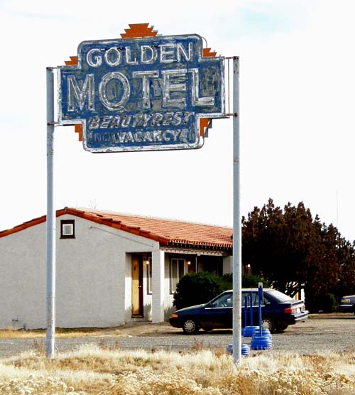
A couple of motel sign in the Winnemucca area along the Victory Highway (US40) brought back recollections of the 50’s.
It was common back when for a motel to be located off the main drag and for there to be a sign, usually quite prominent, that directed you to the site. The Shady Courts...the term “courts” was still common...... is definitely off the main traveled route in Winnemucca. Any direction you approach on the main road through town, the signs direct you to the “Courts.” BTW, the place is for sale.

The other sign is in Valmy on old US40 and the Victory Highway, about 36 miles east of Winnemucca. Beautyrest mattresses were the equivalent of today’s wifi; you had to have them to attract the business.
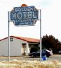
Keep the Show on the Road
You've got me pulling out the maps to find out where Valmy is. How did I miss that one? I'll catch it next time I pass througha and it will be even more weathered.
Roadhound
-
Rick,
I have been with my son (Friday – Sunday mid day) on a trip to pick up a pick-up for him in Boise. We have been without wifi, as I left the card for the laptop home by mistake. Drew headed home this afternoon and we went our separate ways about noon in Burns, Oregon. I have been traveling this afternoon along the backroads of Oregon (Burns, French Glen, Fields, Denio) where the gas and food stops are 100 miles apart.. I arrive in Winnemucca this evening and went ahead and bought a new wifi card for the laptop.
Looks like lots has been going on! I really liked your Death Valley post and was amazed at what I have missed in the past.
I may go east as far as Elko...or maybe stay here a day. I will go look at your posts from this summer, but give me your advice.
I am headed out for a bite to eat, and will check the forum when I return.
Keep the Show on the Road!
Hey Keep,
The only real recomendation that I have for Winnemucca is to go west and check out the ghost town of Unionville. If I recall it should be less than an hour west and the road is nothing to worry about. We had to pass by Unionville as the need to repair a tire was more pressing at the time. In Winnemucca I only repaired a tire and drove through the town, I'll let you report back on anything interesting in the town.
If you do head toward Elko Carlin Canyon is worth the side trip as is Palisades. Both have good roads.
I can't speak much about Elko itself as we blew by it on our way to Wells. I have driven through the main part of town in the past and recall that there were some older buildings but can't recall any specifics. In Wells of course is 6th St. and Motel Row. Northeast of Wells is the remains of Metropolis. Some of the road to Metropolis is dirt and OK as long as it is dry.
Which way are you heading back home?
Good Luck!
Roadhound
-
The journey has has been completed, camping gear cleaned and put away, with only the processing of the many photos remaining to be done.
I was able to drive in on the original westward road into Death Valley, Wildrose Canyon Road. The road is a spectacular ride up the west side of the Panamint Range that does not require high clearance or 4 wheel drive. I wouldn't drive it with anything larger than a large pickup truck as it does have a number of winding switchbacks that could be difficult to negotiate.
A highlight of the drive in was on our descent down the east side heading toward Stovepipe Wells. Perched atop a road sign was a bobcat who quickly leaped down as we approached, much to quickly for me to get the camera out. I took it as a sign that it was going to be an exciting trip.
The planned hike up Surprise Canyon didn't occur as my son wasn't able to arrange for another driver to make the trip to the trailhead. Boy Scout rules also require 2 adults on a hike.
Instead the entire group (30+ scouts and adults, 6 vehicles) drove through Titus Canyon. The road starts in Nevada just west of Beatty and goes through a narrow slot canyon back into Death Valley. Along the way it winds through some spectacular scenery, over the aptly named Red Pass, pass the ghost town of Leadfield, and through the narrow gap in Titus Canyon.
Keep? Do you have any old maps that show the road through Leadfield? The Post Office was established there in 1926 and closed in 1927.
The aptly named Red Pass

Heading into Titus Canyon

A tight squeeze between the Walls of Titus Canyon

Our last night there was extremely exciting in a scary sort of way. The weather had been beautiful for the duration of our stay until about 7:00 PM on the last night. At first it was a slight wind that quickly increased in intensity picking up sand and dust. I estimate that there were gusts close to 50 mph. We all retreated to our tents and as I was lying there I could hear the wind building in the distance, sort of like a car approaching. As the sine wave increased in amplitude and volume it was quickly upon you trying to knock your tent over. After about 30 seconds the wind would decrease and it would be quiet for a minute until it would slowly build and repeat the cycle again, all night long.
My dome tent was slightly protected behind a tree but the scouts were out in the open with their tents situatuated broadside to the wind and by morning 2 of the tents were completely blown over and the other 5 had damage of one sort or another.
Any trip to Death Valley should not be taken lightly.
Roadhound
-
Outstanding once again Keep!
In the 60's my family lived just off of Mission Blvd in Hayward which had to have been the route that is described between Hayward and Niles. The road is still there but it has changed greatly since that map was published. I can remember when there were still some of the orchards that both of those towns were noted for were still there.
There was an apricot orchard just down the street from my parents house that me and my friends would go into and climb the trees and eat the fruit. It didn't matter that the apricots weren't completely ripe yet, although we did pay the price later. The orchard is now a K Mart. I don't believe a single orchard is left in Hayward or Niles.
I am going to have to spend some time studying those maps when I get back from Death Valley. Just finished packing and gassing up the truck. All set for an early Saturday morning departure.
Roadhound

81 Years Ago - Us Road System Numbering
in U.S. Highways & Auto Trails
Posted
As did his experience while commander of the Allied Forces in Europe when he saw how effecient the German Autobahn was. As a military commander movement of men and materials is everything. Easy to see how he saw the building a strong, fast road system as vital for defense and prosperity.
Roadhound