


roadmaven
-
Posts
567 -
Joined
-
Last visited
Content Type
Profiles
Forums
Gallery
Blogs
Calendar
Posts posted by roadmaven
-
-
Anybody got a 1925 Piatt County map?

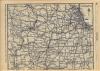
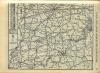
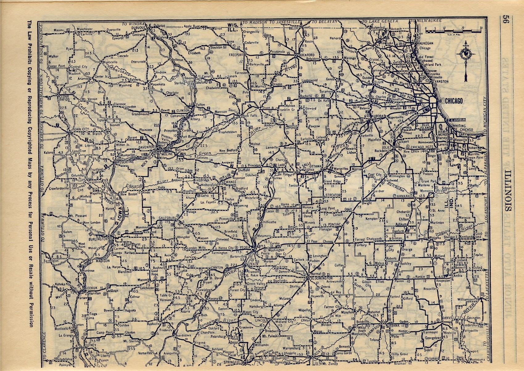
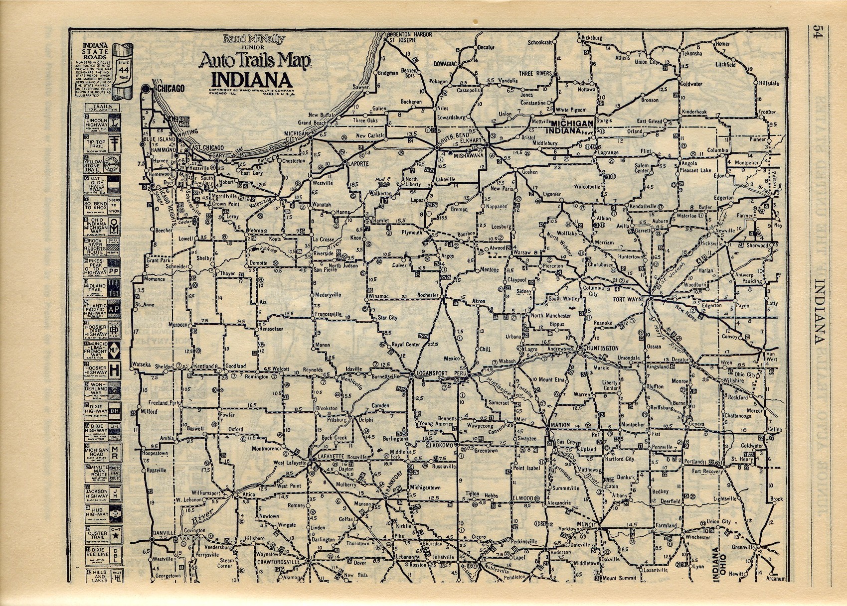
Why, yes I do! Of course, along with however many other counties are in IL! Below is the top half of IL from my 1925 RM Jr. atlas. At that point in time where the marker is, it was IL-10 (indicated by the "10" in a circle), and the PPOO was cruising the southern route along what is now US 36.
-
Wait. If it's a State ROW marker, then... didn't that road at one time have to be a state road? I think it's still evidence of a former alignment of IL 10.
I *think* as a general rule of thumb, most ROW markers didn't list a route number, but there may have been some exceptions. I would agree that only a state route back in the day would've used a ROW marker such as this. As to whether it was IL-10, I'll defer to the PPOO experts on that one, as my knowledge of the routes the PPOO traversed could be held in a thimble.

-
Agreed that there is something betwee the 'R' and the 'O' or '0' but I'm not so sure it's a '1'. We may have to sneak out there in the dark of night with shovels and lanterns
Well, I'll throw my guess out there. I'll bet someone a hot fudge sundae that if you dig further, it reads "STATE R.O.W." I'm not seeing a "1" there.
-
Here are some shots from the 66 Fest. I also took some video of the Friday night cruise, so once I can navigate You Tube, I'll have them there. Meanwhile, if you like vehiculars, here ya be: Route 66 International Festival
-
Cool! We can sort out the logistics at the bridge.
I've now been downgraded to "iffy" on making it to Broadwell. My yearly infusion of Cozy Dogs is already a year in arrears, so I might be at the CD Friday afternoon for some "medical service".

-
How was the show? Did you win the valve cover derby?
I ended up busier than I thought I would be (what else is new) on Saturday and so we couldn't make it.
jim
It went well....we had 55 Corvairs registered for the show, so it was definitely a boost for us, and should be one of our more profitable shows our club's had in a while. But that heat was getting brutal as the day wore on. I hit the swap area for an hour or so and didn't even see half of it. I just got a pineapple whip and headed back for the show field.
The valve cover race went well Friday night, as "Lady Luck" pulled out another win, even though I heard a smattering of light-hearted boos Saturday night at the banquet when they they announced me as winning. Oh well....it's not easy being king. 
-
How late does it run? Is there a cost to get in? I might bring my sons.
Since it's been years since I've actually had to pay to get in aside from my participant registration, I'm not 100% sure. However, I *think* in recent years admission was free, but you paid to park....somewhere between $5-$10. The cars start rolling in around 8am, and awards (for the non-Corvairs) are presented around 4pm. The swap meet part runs later than that...6 or 7, I believe. There's a lot to see....some junk, some treasures....and by the end of the day "your dogs will be barkin'"! I can pretty much guarantee an evening nap will follow a day out there. The Corvair folks are having our hospitality room at our headquarters at the Super 8 at I-465 & U.S. 31 South tongiht. I'll talk to one of our members who's a "mover & shaker" with the show to find out specifics on admission & post later tonight. Tonight my Valve Cover Racer attempts to improve its record to a perfect 7-0, dating back to its debut in 2004. It's kind of like pine wood derbies in cub scouts, except you have to use a Corvair valve cover and it can't weigh more than 4.5 lbs. I've retired the old "Road Maven" scheme I had on it and am debuting its new incarnation: "Lady Luck". Pictures of it later!
-
This is pretty much for those within a day's drive of Indianapolis with absolutely nothing to do Saturday. The 41st Annual Hoosier Auto Show & Swap Meet ends Saturday, September 22 at the Marion County Fairgrounds on the southeast side of Indianapolis at I-74 & I-465. There's a HUGE (understatement) auto swap meet, as well as a classic car show Saturday, including (at last count) some 49 Corvairs from all over the midwest. The weather looks good for the weekend. I'll have ole blue there Saturday. Directions to the fairgrounds can be found here.
-
I think that's the second time KtSotR has commented on the great pictures from your new camera but I was biting my tongue. I'm glad you 'fessed up before Jennifer busted you.
He's right, Dave. A good way to tell is on the Flickr site, you can see to the right of the picture what camera took the photo.....errr....."digital image". Anything that says "Nikon D-50" will be JB's. But, even though we both have a Canon PowerShot 550, I refuse to deny any images taken by that camera aren't mine.

-
Well, as much as I hate to admit it, about 82.4% of those photos come from the co-hort and her Nikon D-50. *sigh* That's why she makes the big bucks! I'll give you the caption for one of the photos (the one showing the scoreboard): "Pat reminds us why his parents put him in band instead of little league, as his "efforts" with a baseball are displayed with his "smokin'" 50mph fastball....and he still couldn't get it over the plate."

-
The other half will whip me like a bad habit for posting this too soon, but just posted are our weekend pics to the lovely & talented Cincinnati, Ohio! A combined wedding anniversary/birthday trip, we motored down U.S. 52 to Metamora, Indiana, then traced old 52 into Cincinnati, where we made our way to the Cincinnati Reds Hall of Fame Museum. As a lad growing up in the mid-70's, the Reds were "my team", and back in those days "5" was the number I worshipped, as Johnny Bench was bigger than life for me. Sunday was spent at the fine Cincnnati Zoo....highly recommended if in the Queen City. Sunday afternoon we had a late lunch/early dinner at Pompilio's in Covington, KY, where part of "Rain Man" was filmed (the restaurant where the toothpick scene occurred). Heading home, we steered towards Madison, IN for some of their famous fudge, but all were closed by the time we got there.
The pics are all here: Cincy I'll follow up when we get captions on them, but feel free to browse & wonder to yourself, "Hmmmm...I wonder what that is".

-
Thanks to Ron Warnick's Route 66 News for this link to a Springfield newspaper article on the upcoming festival:
http://www.sj-r.com/News/stories/16564.asp
The article mentions that a formal dedication of the marker at the Pig Hip site is scheduled for 2:30 Friday. I'm pondering whether to try to cruise north at a pace to include that.
It's just over a week away. Anyone else from here joining Bliss, RoadDog, Roadmaven (we think;-), and me at the bridge Friday morning?
I'm still in! Matter of fact, I need to do my online car show registration the next couple o'nights, as deadline is midnight Friday night. If we think there's enough time to get to the Pig Hip and back before the cruise, count me in! Early forecast for next Friday sez partly cloudy & high of 78 in Springfield!
-
Without wandering too far off topic (or US 6!), I've noticed cut shields elsewhere as well. Along Route 66 south of Picher, Oklahoma, I first saw some cutouts for Alternate US 69 back in the early 00's. And they're still there as of two weeks ago. I had a picture of it "somewhere", but you know how that story ends! I found one on an Oklahoma Ends site: Alt. US 69 When I first saw these, I was quite surprised. I thought perhaps they were just some "leftovers" they had and put a new reflective shield "decal" over them. Afterall, one would think it would be more expensive to cut these, as opposed to just cutting a square. And we all know how the govt is when "cutting corners".
I'm a big fan of this design, as I'm sure a lot of us are. Let's hope this is a trend. Hopefully we'll get other reports in the future of these popping up. -
Mike is an avid map and music collector who lives in Arizona. My contact with Mike has been through the Route 66 e-group at Yahoo for which he serves as MC and general organizer for the group's breakfast gatherings at national events. I believe that Mike owns one of every oil company map ever printed with duplicates of the common ones. I guess that might be a slight exaggeration but only a slight one. His collection may include auto trails era stuff but I'm not aware that it does. Mike is a member here and may occasionally browse but has not posted since the e-group->forum move.
I know Mike has at least one auto trails map, that being the '25 Jr. Rand McNally he shuttled my way on CD. I'll see what I can do about shuttling him over here.

-
The federal Highway site does show a Rand McNally PP-OO map they identify as 1927 ( http://www.fhwa.dot.gov/infrastructure/pikes02.htm ). It isn't an "offical" guide, of course, and only shows the high level city-to-city routings.
As map collecting has become a bit of a sub-topic here, I'm curious about the wheres & hows of finding auto trail period maps. I occasionally visit eBay and once in a great while do a general web search but you serious collectors must have better sources.
Where the heck is Mike Ward when you need him??
-
Enjoyed the pics - takes me back a little.
But Alex, does it take you all the way back to '53??

-
Here are some pics from our weekend at the 18th Route 66 Association of Missouri Motor Tour:
And here are some from the newly re-opened Animal Paradise: It's a zoo out there.....
-
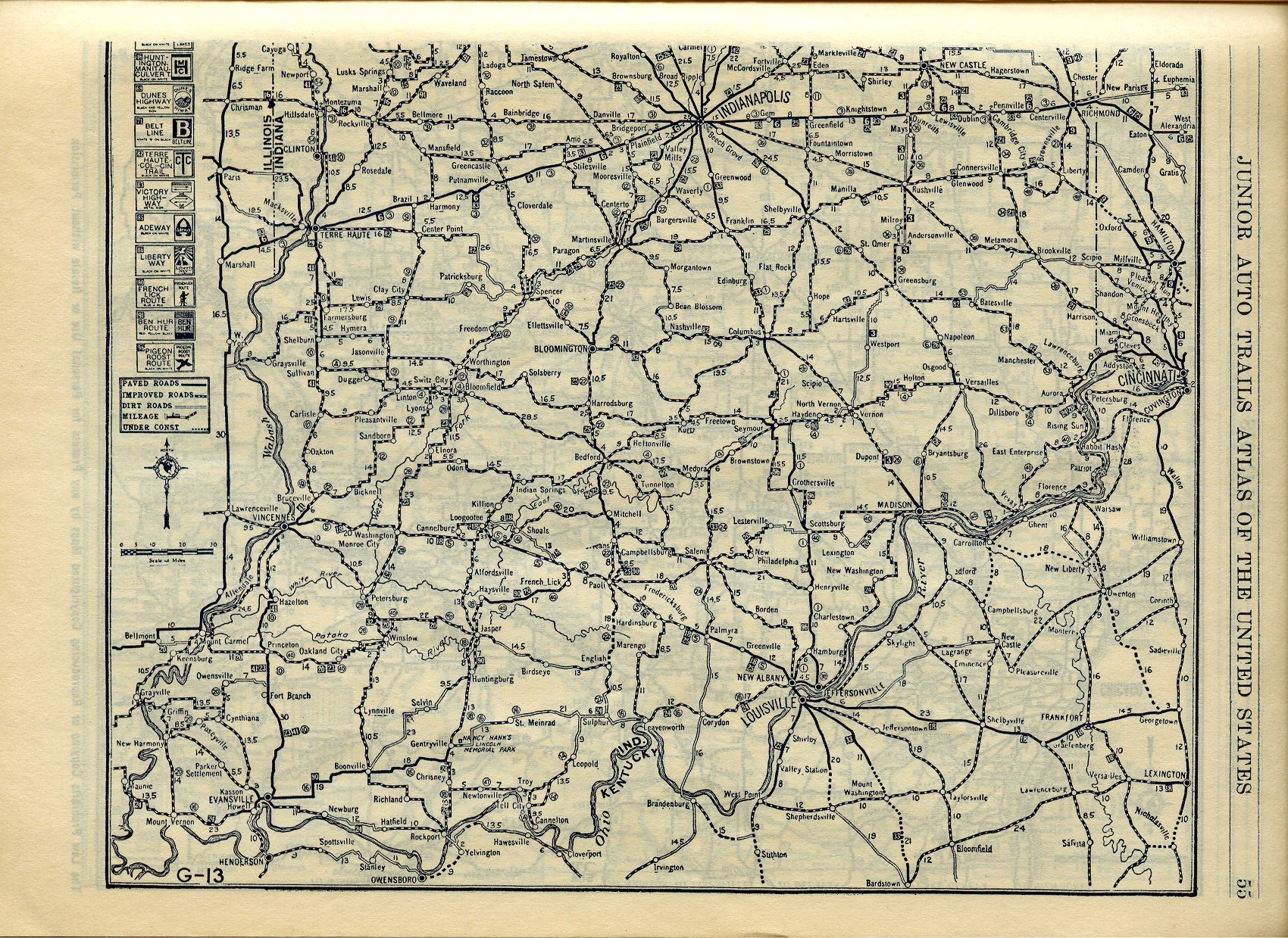
E-gads!! Will the real PPOO please stand up!? Dave's '24 map shows a straight shot across IN using present day U.S. 40 & U.S. 36. My map from one year later shows a jigsaw puzzle of current county roads that looks like something written on an Etch-a-Sketch. Denny, I think another e-mail to the P.P.O.O. guy is in order to get him on here.
-
I realize this is veering off topic but I'm wondering if the ABB you're referencing actually shows the Dixie Bee Line Highway going through Covington and Veedersburg. I know very little about the DBL other than it was principally north-south and connected, among others, Danville, IL, and Terre Haute, IN. If I read Pat's Auto Trails Map correctly (and those little bitty numbers can look pretty fuzzy at times), it appears to head SE from Danville then due south (probably on what is now IN-63) before reaching Perrysville. Apparently the PP-OO did follow a road between Covington and Veedersburg that is now called W Dixie Bee Road but is there any evidence that this was once part of the DBL Highway?
I did some tracing of the DBL at lunch and the best I can tell is that it comes into IN on IN-32, then before reaching IN-63, it cuts south on "Meridian Road", which cuts south into Eugene and into neighboring Cayuga. It was at this piont I ran out of lunch time.
 But, it looks as if it does land on 63 southest of Cayuga and heads into Newport. Google Maps shows two separate old alignments of 63, with the apparently the older one being the only road directly south out of town. This is a significant road because that road is the location of the annual "Newport Hill Climb", where flivvers of all ages race up the hill. I've not been to it, but it attracts thousands. I couldn't get the URL to open, but here it is: Newport Hill Climb But oh Lordy, last year's was the LAST WEEKEND IN SEPTEMBER! Runs Friday through Sunday. Hmmm...I think we'll be over that way, won't we???
  I'll check with my dad to see if he's going to make it over there this year.
 -
OK boys, learn me this: When was the PPOO conceived? I just got an e-mail from master road sleuth Thomas Repp, and according to his 1920 map, the PPOO doesn't exist. Nothing coming out of C-ville in any direction called the PPOO. With that in mind, I give you these. These are the two sections of Indiana from my 1925 Rand McNally Auto Trails Map. Route #16 in the black box is the PPOO. I've got the route, according to this map, about 80% routed from Crawfordsville to Rockville, but I'll finish in the coming days. Dare I post its routing and cloud this thing even more?
 I'm pretty sure a road trip shall be had this weekend if anyone's up for some ghost road hunting.
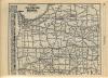
-
Good grief, this stuff is fascinating. I've spent 90 minutes figuring this out, and I didn't even realize the time passed.
No kidding! I realize now why our routes aren't jiving....there was a major routing change somewhere along the way. Mine heads SW out of Crawfordsville and ends up in Rockville, where it picks up current US 36 west to Chrisman, IL. More digging......
-
Not that I can tell. In Indiana, at least, 32 goes directly through all the towns on the PP-OO's final route. There is little evidence of roads that diverge and converge (as on the earlier US 36-based PP-OO alignment), and I don't detect any other road that hits all those towns.
I wonder if my 1924 ABB will shed some light (he says, puffing out his chest over his new acquisition). I'll try to find time to look this evening.
jim
Jim,
Out of curiosity, what do you show the route taking west out of Crawfordsville? My '25 map shows it heading out on a route that wouldn't be IN-32 today. It does some stairstepping southwest and goes through the town of Alamo, which is accessible today via county roads.
-
Not that I can tell. In Indiana, at least, 32 goes directly through all the towns on the PP-OO's final route. There is little evidence of roads that diverge and converge (as on the earlier US 36-based PP-OO alignment), and I don't detect any other road that hits all those towns.
I wonder if my 1924 ABB will shed some light (he says, puffing out his chest over his new acquisition). I'll try to find time to look this evening.
jim
We just had this conversation over the weekend about getting an ABB. I guess my hunt is now on. It's time to be a have and not a have not.
-
If you mean the final alignment of the PP-OO in IL and IN, I think it's a safe bet that it's simply IL 6/IN 32. By the time of the PP-OO's last routing, I'm betting these two roads were pretty well in place. I traced the IN portion via Google Maps and saw very little in the way of former alignments.
Is that what you're asking for?
That's it! So there's no evidence of it using any obscure county roads?
Since This Is The Month Of Halloween
in General Discussion
Posted
When it comes to things society can't readily explain, such as paranormal or UFOs, I'm typically open-minded to the possibility of either existing, but until I see evidence myself, I'll just choose to take it all with a grain of salt. The only *possible* paranormal experience I may or may not have had occurred a few years ago while we were visiting a little tourist town in southeast Indiana called Metamora. It's an old town with mainly older buildings, circa 1800's, where folks buy antiques, fudge, and the like. We were in a particular store....more of a curio shop.....when we were in the back of the shop looking through some things. Jennifer was near me, but I didn't pay a lot of attention to how close. Then, I felt a single tap on my left shoulder, so obvious that I immediately turned my head to the left to see who it was, thinking it was Jennifer. Well, there was no one on my left, and Jennifer was 5 or 6 feet away on my right! No one else was near, and I know it couldn't have been Jennifer, as she would've had to have 6 foot long arms, as my turn to see who tapped on me was instant. So, was it someone from the other side? I'll never know. I figure it was either that, or my left trapezius had a single, quick spasm! Either way, I didn't imagine it, whatever it was. Every time we're in Metamora, we always go into that shop to see if my shoulder muscle wants to twitch.......or see if our old friend wants to visit.