


mga707
-
Posts
328 -
Joined
-
Last visited
-
Days Won
4
Content Type
Profiles
Forums
Gallery
Blogs
Calendar
Everything posted by mga707
-

what is left of the old Marsh satation Road overpass on I-10
mga707 posted a gallery image in Member's Gallery
From the album: old US 80/Bankhead Highway east of Tucson
An 'on-the-fly' shot of what remain of the old overpass following it's demolition on the night of April 8/9, 2011. -
I-10 Exit Reconstruction At Old Us 80 Interchange
mga707 replied to mga707's topic in Old Spanish Trail / U.S. 80 / U.S. 90
I again drove east today on Interstate 10 to see the results of the Marsh Station Road demolition this past Friday night/Saturday morning. Sure enough, the overpass is gone...only the uprights are left standing. I also took Jeff Jensen's book with me to explore some of the other old/80/Bankhead Highway sites that he mentions on pp. 51/52, including the old bridge abutments at the Empirita Road exit that still stand on either side of the railroad tracks in the present I-10 median. Very interesting to see! Since I've nearly used up my "global upload quota" (anyone know if that quota is ever replenished?), I'll only leave one picture here, of the "fine 1933 bridge" on the Marsh Station Road old 80 segment that Jeff mentions on page 52 of his book. I have added some other shots to the member's gallery. Hope you enjoy them. -
I-10 Exit Reconstruction At Old Us 80 Interchange
mga707 replied to mga707's topic in Old Spanish Trail / U.S. 80 / U.S. 90
Dave-- Please see my above answer to Denny G's post as to where the shot was taken. Sorry, do not have coordinates, but it is about two miles from the old bridge and maybe a mile or so from where Marsh Station Road effectively becomes the I-10 frontage road, paralleling the highway for about a half-mile before one reaches Exit 281 (SR 83). The abutments date from circa 1920, so the missing portions could certainly have been reused for other purposes after the road was realigned and paved in the mid-1930s, especially if the bridge was made from wood. -
I-10 Exit Reconstruction At Old Us 80 Interchange
mga707 replied to mga707's topic in Old Spanish Trail / U.S. 80 / U.S. 90
No, the old abutments are between the 1921 Cienega Creek bridge and the AZ 83 exit (Exit 281), just to the north of Marsh Station Road, which is old 80. From Jeff's book, page 52: "Re-zeroing our odometers at the bridge, we continue our journey along the old road to the SW. The road rises and falls with the terrain, and at about two miles, watch for old bridge abutments in the washes...a sure fire sign of the old B(ankhead)H(ighway) alignment which will parallel you on the right all the way until I-10." I read the section on page 51 about the old abutments in the I-10 median area, but invisible from the highway, by Empirita Road (Exit 292). Have not yet checked it out, but will! -
I-10 Exit Reconstruction At Old Us 80 Interchange
mga707 replied to mga707's topic in Old Spanish Trail / U.S. 80 / U.S. 90
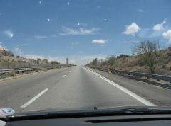
Drove out to the Marsh Station Road exit today and took some photos of the old overpass bridge before it is demolished next weekend. Had to 'bushwhack' to it as the old approaches have already been obliterated. The new interchange is a full one and one half miles east of the old--don't know why ADOT (AZ Dept. of Transpotation) decided on such a large variance between the two bridges. Attached are two pictures of the old bridge, one showing it's limited (15'2") clearance), one shot looking across the top of the overpass, and, as a bonus, a picture of a remnant of the original 1920-era Old Spanish Trail/Broadway of America/Bankhead Highway, taken from the mid-1930s alignment of US 80, about a mile or so east of the AZ 83 (Sonoita Highway)/I-10 interchange. Thanks to Jeff Jensen and his wonderful book, "Drive the Broadway of America", for cluing me in as to the existence of these old pre-80 segments along the Marsh Station Road segment of old 80. -
I-10 Exit Reconstruction At Old Us 80 Interchange
mga707 replied to mga707's topic in Old Spanish Trail / U.S. 80 / U.S. 90
OK, I will! I realize I made a bonehead 'math error': A 1956-vintage overpass bridge is 55 years old, NOT 65! -
I-10 Exit Reconstruction At Old Us 80 Interchange
mga707 replied to mga707's topic in Old Spanish Trail / U.S. 80 / U.S. 90
A quick update: The new Marsh Station Road/Interstate 10 interchange is now open. It is nearly a mile east of the old interchange, which is where pre-1956 US 80 veers off from the I-10 alignment. The old Marsh Station Road bridge over I-10 is set for demolition on the night of April 8/9, which will of course require the Interstate to be closed for some hours that night. I plan to drive over there at some point over the next week to take a last look at the 65-year-old bridge, and will naturally drive the 'old 80' loop at least in one direction. -
Idaho's Scenic Byways Make For Great Spring Road Trips
mga707 replied to tournews1's topic in General Discussion
June '09: Idaho State Route 21, from Stanley, across the Sawtooth Range, through Idaho City and on to Boise. A beautifully scenic route, but one of the most 'white-knuckle- trips of my life. Reason? I've never seen so many deer (mule deer, in this instance) on or near a highway. Probably the time of year and the time of day--late afternoon into evening--was part of the reason, but the deer were just everywhere! When we came upon a freshly-overturned Chrysler Sebring on the side of the road, horn stuck 'on', with a person laying by the car (yes, help was there), needless to say that REALLY put some fear into us. From then on we slowed to a crawl around each and every hairpin curve, straining to see any deer ahead in the fading light. Luckily, we made it into Boise that night without any wildlife incidents. After damaging one rental vehicle in an animal collision ten years before (Yellowstone, buffalo--who trotted away--1999), I sure did not want another one! -
Thanks for the info on the Reelsville alignments. Wish I had noticed the oldest alignment and had checked that out as well. Oh well...
-
That fits. From the postcard, the motel definitely has a postwar, '50s look to it. One other question, for the Indiana experts. Approximately when was US40 realigned from downtown Brazil westward to the Clay/Vigo county line? The current four lane alignment runs just south of the older two lane, which is now Indiana SR 340, in addition to being signed as "Historic National Road". I drove both alignments.
-
"You are correct, sir!" (in Ed McMahon voice)...what triggered this entire trip down memory lane was my (older) brother's recent rediscovery of such a vintage postcard among his 'stuff'. In glorious black and white, no less.
-
Sorry I didn't take any photos, but on a trip to central Indiana this past weekend I spent an enjoyable Saturday motoring along US40 between Plainfield and Brazil. Just east of Brazil at Reelsville there is a short old alignment segment that is marked at both ends ("Historic National Road") and is obviously of quite some vintage. Cracked, narrow concrete and an old narrow bridge over Big Walnut Creek. Teens or Twenties, I would say. Check it out if you're in the area. In Brazil I was looking for any evidence of an old motel called the Beacon Motel. Did not find it, or any old structure that looks like it could have been a motel at one time. There is a well-kept older motel on the west side of town called the Villa, but no Beacon. My gut instinct guessed that it could have been on the east end of town where the Wal-Mart now stands. The Beacon could very well be buried under the Wallymart parking lot! If you're wondering why I was looking, my family spent a night there in 1959 on our relocation trip west when I was but a small child. There's another old motel in Joplin MO that I would like to try to find as well!
-
Wow...your grandma was a Sun City 'pioneer'! Great picture, with those now-historic early Del Webb houses in the background. Is that you or your cousin riding shotgun, off to shop at the A. J. Bayless? (no one who has not lived in pre-1985 Arizona will get the last reference)
-
A Little Time On Old U S 80
mga707 replied to DennyG's topic in Old Spanish Trail / U.S. 80 / U.S. 90
Very nice photos! Yes, we've been in a freakishly cold spell here in So. AZ the last few days. Gila Bend's Feb. 3 low of 28 is positively balmy compared to Tucson's record low of 18 on the same morning, and record low high of 38 that afternoon! Water pipes freezing and cracking all over town, along with natural gas outages as well (meaning no heat or water for lots of folks). Finally getting back to normal now--60s and 70s with lows above freezing. -
-
Four days later, still unable to delete my duplicate posts.
-
Sorry, folks--first I got a weird error message when attempting to post, hence the dupes, and now it won't let me delete the dupes. Help!
-
I've personally driven 54 from Santa Rosa NM, where it veers SW off of I-40, all the way to it's El Paso terminus. It was an interesting drive, first through the now near-ghost town of Vaughn NM, which was once a decently thriving town with plenty of now-closed or faded mid-century era road edifices (restaurants, motels, gas stations) due to its location at the junction of three US routes (54/60/285). If one is a fan of this type of architecture, Vaqughn is like an open-air gallery, on par with anything along 66. The highway continues southward through the Billy the Kid country of Lincoln County and Carizozo, then down along the eastern side of the White Sands Missile Range (where Trinity Site is located--open twice each year to visitors and well worth the trip) to Tularosa and Alamogordo (by far the largest town along this stretch of the highway. From Alamogordo it continues on, almost in an arrow-straight line, down through the vast emptiness of the Fort Bliss back country proving grounds into Texas and El Paso. A close friend has driven the stretch of 54 from Wichita to Tucumcari NM, where it joins I-40 and runs concurrently for a short stretch between Tucumcari and Santa Rosa, just to take a slightly different route on one of her semi-regular Chicago-Tucson road journeys. She reports that the road runs mostly straight and empty through the high plains of western Kansas, the Oklahome panhandle, and across the extreme northwest corner of Texas into northeast New Mexico. She did make a slight detour in Kansas to visit Dodge City, which she describes as "like Tombstone, only bigger and less authentic-looking". So, there's my firsthand and secondhand report on the western portion of US 54 between Wichita and El Paso!
-
I-10 Exit Reconstruction At Old Us 80 Interchange
mga707 replied to mga707's topic in Old Spanish Trail / U.S. 80 / U.S. 90
Agree totally with the above. The best thing for me about the 'Cienega loop' of old 80 is that it is only about a 15-minute drive from my house on the southeast side of Tucson to the west end of the loop at the !-10/SR 83 exit. One of my favorite 'Sunday drives'! Kind of funny that we will be losing the mid-1950s Marsh Station Road interchange (at the east end of the loop) but keeping the 1930s highway alignment that is the loop itself. -
Beautiful! Don't see a 'V' emblem on the fender, so I assume it's got the 'bulletproof' (and long-running) "slant six"?
-
Not a truck chassis, just the same rear-drive GM B-body platform as the Chevy Caprise/Impala, Pontiac Bonneville, and Buick LeSabre. From your side view shot it could be anywhere from a 1980 through an '85 model. Would have to see the front and/or rear views to narrow it down, as those areas were what got 'tweaked' every model year during that time frame.
-
Hi Neil! Welcome! Either way, your trip along the "Linc" should be a good one, especially as a cycle trip. I love the wide-open unpopulated spaces of the Great Basin. Hope you have a great time!