


Chris Rowland
-
Posts
294 -
Joined
-
Last visited
-
Days Won
1
Content Type
Profiles
Forums
Gallery
Blogs
Calendar
Posts posted by Chris Rowland
-
-
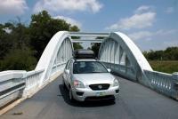
Is the two-lane involved a currently signed State highway?
-
It's, it's under a minute, and it could help Chris relive his panic one more time.
At least there weren't any shots of the temperature gauge showing your car overheating. That probably would have pushed me over the edge!
Chris
-
There's a big party for Henry's baby just up the way in Richmond, IN, and I made it there for the big parade yesterday. About 1000 copies of the Ford Model T are in town for the week to celebrate the 100 year anniversary of the first one.
I ran across a small group of them (about 7) today. They were heading westbound on US 40 between Brazil and Terre Haute.
-
Hope you see this before departure or you've decided not to scout out Footprint Rock. I was by there today on my way home from my Dad's (and Annie Oakley Days) and found it a bit farther from US-127 than I remembered. It's about four miles west of 127. Plus, all the pumps, signs, etc. have been removed from the gas station so that only a big (about 1/2 acre) concrete slab remains. The most visible marker is a pair of large metal silos on the south side of the road. N39.84153° W84.71018° if that helps.
That matches the coordinates I was able to find for it... we should be by there in the morning to see it in all of its glory! Thanks for the clarification.
Chris
-
Ohh! Ohh!! Just thought of a short & sweet stop in Columbus. It's not NR related and is about four blocks south of US-40 but it is unique - and pretty. Check out A Sunday Afternoon On The Island of La Grande Jatte in topiary if you haven't already.
That looks awesome! It's going on the itinerary now...
Chris
-
Are you thinking of US-40/NR all the way or I-70 with planned departures for specific attraction?
I think the bridges and markers should be good--short and sweet. I actually did order the Ohio NR guide a couple of months ago--it is put together well. There are a lot of items in there, which is why I asked what made the best highlights... I will definitely have the guide with me, although I will be traveling the reverse direction from how it is listed in the guide.
Regarding lunch in Columbus, after some searching, this one kind of leaped out: Tommy's Diner It looks liks a good possibility, plus it has gyros which my wife will like.
The plan is to take US-40 all of the way to Cambridge without touching I-70. We will have to return later that same night, so we'll be taking I-70 back. It'll be a day with over 600 miles by the time we get home.
I will look at Zoar Village for our second trip over there later in the week. Then we'll have a little more time to spare... For that trip, I am considering taking US-36 eastbound, spend the night, and then drive the Lincoln Highway back westbound at least as far as Delphos, Ohio before heading back into Indiana. I have practically zero Lincoln Highway experience, so that should be a good start.
Chris
-
I am planning on heading along the National Road this Sunday from Indianapolis, Indiana to Cambridge, Ohio. From there I am going to try to trace old US 21 north to Strasburg, Ohio, where we are going to drop one of our boys off for camp.
We should be passing through Columbus, Ohio around noon on Sunday--do any of you know of a good diner or restaurant in town that would be open on Sunday that we need to visit? Also, coming back home later that night, we should be stopping for dinner in Cambridge, Ohio--any recommendations there?
I may try to see the National Road museum on the way, near Zanesville, and I'm thinking of seeing the Madonna in Springfield. Any other Ohio landmarks along the road I should check out that wouldn't add heavily to our travel time? (I've traveled the Indiana section a few times before and don't need any tips along there for now).
Thanks!
Chris
-
Our purpose was to do a photo shoot for a calendar we're putting together for the local Corvair club.
The green and yellow really sets it off!

Chris
-
Before I started geotagging, there were a few times I found myself analyzing a GPS log to try to locate where I pulled over for a particular picture.
Usually an aerial photo makes it pretty easy to find, except of course when stopping at a random place and taking a photo. My solution on this trip was to bring a mini voice recorder and after parking at the side of the road or parking lot, read off the coordinates from the GPS mounted in my car. Then later I went through the whole cassette, writing down what I had recorded. This was helpful--much better than trying to write them down like I had done in other cases.
Chris
-
I'm telling you, dragging photos onto the Flickr map really sucks after about the first 20.
I installed Picasa just to do the geotagging. It integrates with Google Earth, which I usually like its navigation interface to find locations. It just gives a nice cross-hair and you move the map around behind it. After you hit the "tag" button, it moves to the next photo.
However, many of the states I went through on my trip do NOT have hi-res images on Google, so I had to load maps.live.com to find the coordinates and then paste them into Google Earth to find out where in the giant blurry image the photo was taken. For instance, their coverage of Michigan, Iowa, Minnesota, etc., is deplorable. I am used to the wonderful images of Indiana that are available, so I guess I am a little spoiled...
Chris
-
I was surfing the web tonight, and noticed an old guide on PPOO.org that mentioned the Cannon Ball Route from Chicago to Hannibal, MO. It says "marked with black cannon ball on poles." How very intriguing! Has anyone run across any other reference mat'l concerning the route or the interesting markers?
I did a quick search, but there is not a lot of material on it.
Here's an overview of where the trail went:
http://academic.marion.ohio-state.edu/schu...e/cannontr.html
The Illinois map on KTSoTR's site shows a section of it that is labeled:
http://historicalroadmaps.com/IllinoisPage...age/image1.html
Chris
-
I think we will “do the loop” soon…
I'll bet that's one beautiful route!
Chris
-
The more spectacular rocks are to the west of there on State Road 7. First time I drove north out of Madison on 7 and came upon the rock formation there, I gasped. Here are some photos somebody else took.
I featured the rocks on State Road 7 in the Madison State Road pages that I posted earlier this year. The name I ran across several times for that one was "Hanging Rock". Thanks for the link you provided... I would never have guessed that the road used to run behind the waterfall... Now I will have to go back and check it out.
Chris
-
I've now geotagged and described photos along the route all the way to downtown Indy, and have geotagged photos from there all the way north to Sycamore Row. The photo set is at http://www.flickr.com/photos/mobilene/sets...57605001968216/.
In your photo set for the toll house you state that the road was owned by gravel companies. That doesn't seem likely to me. Is that based on other research? The sign says "Operated by Augusta Gravel Road Co.", but I don't take that to be a gravel company, but a company incorporated to manage the "Augusta Gravel Road" which is probably how they referred to this section of the Michigan Road between Indianapolis and Augusta.
I think it's kind of like today when we handed management of the Indiana Toll Road over to some Australian company, they don't actually 'own' the road, but collect tolls and manage it. But I could be wrong... I'm curious what you may have come across.
Chris
-
I was just describing your trip to Sheila. As I reflected on it, your vacation represents the classic road trip. Mom and Dad take the kids on a trip that visits every curio shop and dinosaur on the road, they eat and sleep in mom and pop restaurants and motels, they visit family and friends along the way, at least one member of the family “clowns around” with the roadside “things”…..it is practically a picture book trip….an almost lost art. Wow!!
I am really enjoying “The Rowland Family’s Excellent Summer Adventure!”
Both the report and the adventure were excellent. It was, as KtSotR called it, the "the classic road trip". The kind that once just occurred naturally when a family set out on vacation but which now require considerable planning. It looked as if the boys enjoyed and appreciated the trip as it was happening and I'm betting they'll appreciate it even more as time goes by. And they've learned plenty, too. Once back at school, they'll be able to outbid everybody in the "Did you ever see the world's largest...?" competitions but, more importantly, they also know that real people live in Michigan and Canada. Nice job(s).Dave and Denny, your comments mean a lot to me! I owe a lot to my wife who helped so dutifully by writing up the trip in the motel rooms and in the car so that we could share it with our friends.
My parents always took our family on trips every year (although not quite as obsessed with roads and funny photos like we are), and that was a big influence on my love of travel. I remember that before I was 10 I would always follow along on my own map and hold the Trip-Tik most of the time... So far my kids don't have the same obsessive love for it that I do, but at least I've tried to plant the seed.
Chris
-
I would need to budget at least $900 in fuel for the same trip today if I were to drive the same vehicle. It would be closer to $1200 for my truck.
At least when I was getting that expensive gas, it was Full Service! I wasn't sure I could make it to a larger town, so I turned off of the highway into the little town of Maryfield, and fortunately they had a "Co-op" with one pump that dispensed diesel on one side and unleaded on the other.
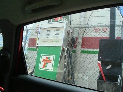
I was impressed with the large tank right behind the pump, and pretty glad that driving over the bell hose brought the attendant (looked like he was probably the owner) around to pump my gas for me.
The attendant also cleaned my windshield! It was a whole different world for me... I'm usually a 'slide the credit card and take off' kind of driver.
Chris
-
Did you happen to log your total miles on the trip? We weren't quite as loaded down on our Minnesota trip, but we got an excellent 38.2mpg in the Corolla, with one tank lasting a whopping 465 miles. Really happy about that. Unfortunately it got banged up in a wreck a week after we got home & is in the body shop awaiting 3 weeks of repairs.
Why, yes, I do have some stats:
• 3,657 miles• 126 gallons of gas costing $540.40• average 28.99 mpg• cheapest gas: $3.899/gallon in Preston, MN• most expensive gas: $5.296/gallon in Maryfield, SK (adjusted from $CAD/litre)Still much cheaper than flying a family of four... flights to Canada are pretty expensive.
Hope your Corolla is as good as new soon

Chris
-
I have now reached the border...and it looks to me like everything is bigger than life along the way! Fish, worms, bears, you name it! Did you set out to find these things, or did they just happen to be on your route?
I actually planned the trip with knowing the general route I wanted to take and then using some resources such as Roadside America (which I have been a fan of for many years). Their web site now has an interactive map that plops down the little markers of what to see, so that you can just hover over and determine which of the sights along the way look worthy. Many of the 'attractions' we visited on the trip were repeat visits--I took an Excellent Adventure my senior year of high school with my best friend and saw many of the same sights.
And maybe I missed it, but how did you folks choose accomodations? I don't see the standard franchise places, nor an AAA sign, and you mention making reservations....and it looks like you did OK. So what method did you use?For accommodations, it was a lot of Internet searching. I didn't get any personal recommendations. I tried to pick places that I could find out information on the Internet and had at least a handful of positive reviews on sites such as TripAdvisor or other generic review sites. Some of the smaller motels had sections on their own web sites with 'testimonials' and pictures of the owners, which helped, too. This was the first trip in a long time where I didn't stay at a Comfort Inn in every town--I think it was well worth it. I wish it were easier to do the research ahead of time, though. I've tried AAA, but they often leave out the smaller motels anymore.
Your resturant stops seem mixed.I picked most of the restaurants in advance, the same way as the motels. I also wanted to stay away from most of the chain restaurants--it makes the trip more memorable. I've definitely been inspired since becoming a part of the American Road community. I tried to find some restaurants that had reviews, or that I found web pages where folks had stopped and had pictures or comments about them. Then of course, I would try searches with the words "Reuben sandwich" and the name of the town, too, of course...
Chris
-
I have only done the first 8 entries but so far it looks like a great family vacation! And you folks seem to have a thing about the world's largest!! Hummmm.
Judging form what I have seen so far, Michigan has the world's largest pie pans, cherry pies, picnic tables, stc. Is this where Paul Bunyun came from?
According to Wikipedia, Paul Bunyan has been popular in the northern region of the United States, around Michigan, Wisconsin and Minnesota. Based on the number of "world's largest" things you will see on my trip, that seems to fit in. I think Minnesota has the largest collection of giant things... It's much different when traveling in other areas of the country--I think it's a cultural thing they have up there.
Chris
-
Just a quick request: When this is being done, could a sort by State or Region be included? For those of us who might not know of a route, being able to find it when planning a trip to a general area may be a big help as well. Thanks for your consideration to this marvelous project.
Even better, wouldn't it be great if article topics could be geotagged and placed on some kind of map on the Internet? Then you could easily see what might be along the route...
Chris
-
There are a couple former communities left along the way, including Wanamaker and Augusta, that were consumed to varying degrees by the city after Unigov merged city and county.
Inside the meeting room of the Franklin Township Civic League, there is a cool photo of the Pelican Diner (I think that is the name) that used to be in Wanamaker. It had an awesome neon sign.
If you need more details about Franklin Township/Wanamaker and the Michigan Road, the Franklin Township Historical Society would be a good resource. I haven't been over there myself yet, but they publish tidbits in our township paper from time to time and would have lots of photos and stories.
Chris
-
The full trip report is here.
I just finished this one, too. I enjoyed following along. Just a few observations:
• The onion rings at Rutt's Hut looked really tasty
• I drove from the Holland Tunnel across Canal Street to the Manhattan Bridge about 15 years ago in my little Tercel with a busted thermostat. It was on the verge of overheating, crawling along for blocks in the confusing traffic. I was so thankful to get off of Manhattan and over to Long Island where I could get the air flowing through my radiator again! Your descriptions helped me relive the panic I felt!
• Did you go to the Franklin museum beneath Franklin Court in Philadelphia? If so, wasn't the large room full of telephones on posts that are in various states of disrepair pretty depressing?
• Thanks for solving the mystery of 84 Lumber for me! I never would have guessed...
• I like the Wheeling suspension bridge. I need to catch that my next time through there.
Chris
-
Jennifer took some 500-plus photos those four days, and they're starting to pop up on her Flickr site here.
I just got some time to go through the photo set. Jennifer took some great shots!
I thought the "Cookies" day care building was quite amusing. I liked how the photo of Wimpy's Cafe was done in Black & White--a nice touch.
That cabin is beautiful. It looks like a wonderful place to get away for a while. Did you make it up there before mosquito season? Or is it always mosquito season in Minnesota? That was the one thing that stood out most, passing through northern Michigan, Wisconsin, Minnesota and Manitoba: the tremendous number of annoying insects in the air. I used to think Indiana was bad with mosquitos and flying pests, but now I have a better perspective...
Chris
-
Thanks Chris, I needed a dose of Saskatchewan.
My wife and I really liked it there... Regina seemed like it would be an okay place to live. I really loved the prairies and the sky. And of course everywhere you look you get two-lane roads!
Of course, I didn't visit in winter. Our friends up there talked about how cold it gets and how much snow they get (running out of places in the yard to store it), but that the roads are always passable and everyone is expected at work every day. I can't even say that about Indianapolis--about once every year or two I can't get my car out of the neighborhood...
Chris
Summer Trip Across Us 44
in U.S. Highways & Auto Trails
Posted
I enjoyed looking through the photos.
Chris