Chris Rowland
-
Posts
294 -
Joined
-
Last visited
-
Days Won
1
Content Type
Profiles
Forums
Gallery
Blogs
Calendar
Everything posted by Chris Rowland
-
A blog is much more like a news feed since you're basically just posting/publishing entries for people to read. You can present random material, and people are entertained by either following your life and adventures or what you have selected to share for the day. I see this much more like a virtual newspaper that you are publishing. On the other hand, something like historicroadmaps.com is not like a newspaper but like a library. People go there to browse and probably to look for something specific. Things are categorized and organized for ease of reference. So I see them as quite complementary. In a way, the blog could be monitored by people wanting to see what new items you are scanning and posting with a cross reference to the material actually stored and organized by state/media type/etc. on historicroadmaps.com. That's my four cents worth. Also, I was wondering what your plans are for historicroadmaps.com. Is that something that we can add scans and maps of our materials to also? Or is it meant to be an archive of only your items? Just wondering because I had a few things to possibly share. Chris
-
Trip from Indianpolis, Indiana to Key West, Florida in July 2007
-
-
From the album: Florida 2007
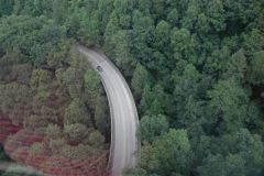
Gatlinbug Bypass viewed from the Ober Gatlinburg aerial tramway. (35.708895,-83.533344) -
From the album: Florida 2007
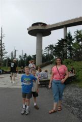
Clingman's Dome is in Smoky Mountain National Park, along the North Carolina/Tennessee border, reached by an access road from US-441. (35.5621,-83.4991) -
From the album: Florida 2007
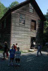
Mingus Mill, west of US-441 in Smoky Mountain National Park (35.5198,-83.3099) -
From the album: Florida 2007
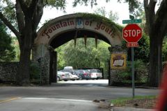
The "Fountain of Youth" tourist trap, I mean attraction, in St. Augustine, Florida. (29.9072,-81.3157) -
From the album: Florida 2007
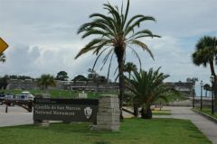
Castillo de San Marcos National Monument along Florida 1A in St. Augustine, Florida. (29.8973,-81.3113) -
From the album: Florida 2007
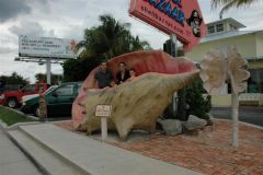
In the shell at the side of US-1 at the Shell Bazaar in Port St. Lucie, Florida. (27.2804,-80.2936) -
From the album: Florida 2007
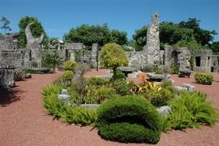
A view inside the Coral Castle, a roadside attraction along US-1 in Homestead, Florida.(25.5003,-80.4446) -
From the album: Florida 2007
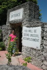
This is the entrance to the mysterious Coral Castle, long-time roadside attraction along US-1 in Homestead, Florida. (25.5003,-80.4446) -
From the album: Florida 2007
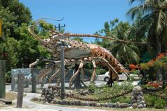
This is the giant lobster located at mile marker 86.5 on US-1 near Islamorada, Florida.(24.9583,-80.5717) -
From the album: Florida 2007
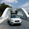
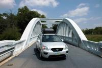
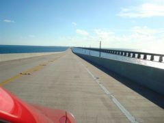
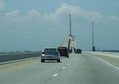
Here you can see us crossing the Seven Mile Bridge just south of Marathon, Florida. You can see our Toyota Matrix on the new bridge, and to the right you can see the old bridge that is no longer used. (24.701379,-81.165447) -
From the album: Florida 2007
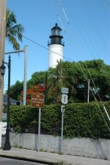
The lighthouse on Key West, along with a route turn marker for US-1. -
From the album: Florida 2007
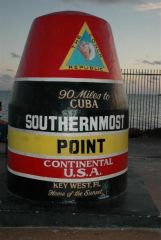
The marker for the Southernmost Point, at Key West, Florida. Just a few blocks south of US-1 at the corner of South and Whitehead. (24.5465,-81.7975) -
From the album: Florida 2007
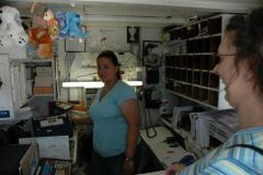
An interior shot of the smallest post office in the United States along US-41 at Ochopee, Florida (formerly an irrigation pipe shed). (25.9013,-81.2973) -
From the album: Florida 2007
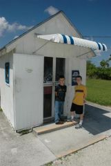
These are the boys outside the smallest post office in the United States at Ochopee, Florida, along US-41. (25.9013,-81.2973) -
From the album: Florida 2007
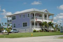
Beautiful new building along Florida 29 in Everglades City. -
From the album: Florida 2007
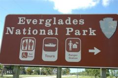
US-41 is really a great way to head across the Everglades and to see the park. -
From the album: Florida 2007
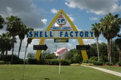
The Shell Factory in North Ft. Myers is situated between both the new and old alignments of US-41 (Tamiami Trail). It has entrances to both. This sign is from the current Cleveland Avenue alignment.(26.7060,-81.8972) -
From the album: Florida 2007
The Sunshine Skyway bridge carries US-19 southward from St. Petersburg over Tampa Bay. Being scared of heights, driving over this bridge made my legs shake. (27.6288,-82.6616) -
From the album: Florida 2007
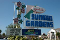
A long-time roadside attraction on US-92 in St. Petersburg, Sunken Gardens.(27.7903,-82.6377) -
From the album: Florida 2007
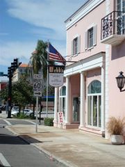
Looking northbound on US-19 Alt at the intersection with Florida 60 in Clearwater, Florida -
From the album: Florida 2007
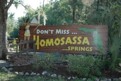
This is the entrance to Homosassa Springs (now a Wildlife State Park). I love the use of the US-19 shield on the sign. (28.7995,-82.5878). Great park--lots of manatees. -
From the album: Florida 2007
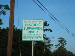
I love the Florida signs for crossing the Suwannee River. This is the one on US-19 near Fanning Springs, FL. -
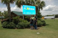
From the album: Florida 2007
Here we are in front of the Florida Welcome Center on US-231. Be sure to stop and have some free orange juice! (30.9946,-85.4091)