


Chris Rowland
-
Posts
294 -
Joined
-
Last visited
-
Days Won
1
Content Type
Profiles
Forums
Gallery
Blogs
Calendar
Everything posted by Chris Rowland
-

U S 51 - Memphis-dyersburg, Tn
Chris Rowland replied to Alex Burr - hester_nec's topic in U.S. Highways & Auto Trails
Wow. This just reinforces the fact that I need to get my hand on some Automile Blue Books... Nicely done. Chris -
I always enjoy your photos, you have a knack for capturing the important landmarks along the journey. Chris
-
If you can get a Sunday tour of the Sign Museum, I might be able to get my dad and family to come along, too, for the tour. Chris
-
Based on current availability, I could be part of the Sunday activities on either of those two weekends. Chris
-
I've always been annoyed with US-35 being signed East-West from the Indiana border to Dayton, Ohio. I guess that's one to show the Showtown guy. Surprised that one didn't come to mind, since it's close to your neck of the woods. Chris
-
I have the same problem. Maybe you made it as a "private" album? Chris
-
Old US 36/421: Abandoned Burger Chef. This is the 2nd genera
Chris Rowland commented on roadmaven's gallery image in Member's Gallery
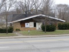 I went to look for this on Google Maps street view, and it looks like the building is gone! It is in the aerial photo, but in street view it is now an empty lot.
 -
I guess I'm a little late. I was actually planning to out-obscure you both by doing State Road 134, but here you go and raise it out of obscurity before I could. Oh well, Chris
-
Who's Up For A Sign Museum Visit?
Chris Rowland replied to DennyG's topic in Other Roadside Business / Attractions
Wish I could go, but Saturdays don't work out for me. So other than Saturday, do I understand that this place is only open by appointment? Chris -
South Dakota Vacation
Chris Rowland replied to Keep the Show on the Road!'s topic in U.S. Highways & Auto Trails
If you are in the north part of the state along US-12, I definitely recommend the Petrified Park in Lemmon, SD. If you are in the southwest area of the state along US-385, you should visit Wind Cave National Park. Wind Cave is renowned for its boxwork. At 120-some-odd miles, it is considered to be the fourth-longest cave in the world. And of course if you are near Mitchell, a visit to the Corn Palace is always in order. Chris -
Sheepherder's "woodie" Spoted
Chris Rowland replied to Keep the Show on the Road!'s topic in General Discussion
Sweet! Chris -
Brick Lh In Noble County, Indiana
Chris Rowland replied to mobilene's topic in Lincoln Highway / U.S. 30 / U.S. 50
In the aerial photo, I was somewhat surprised to see the other curve just southwest of the brick segment. I wonder if underneath all of what looks like the gravelled area just west of the current road there is still brick underneath. Maybe bring along a shovel and do some excavation? Chris -
I'm glad you had a token Reuben on your journey! The Corn Palace is also a classic--since it's different every year it's worth the stop. Chris
-
We've been through the US-25E tunnel many times. We got rear-ended just before the south end of the tunnel once, fortunately no damage. I always enjoy passing through Pineville on US-25 where the new alignment is built along the floodwall to protect the town, and there are huge gates when entering and exiting the city that they can use to keep the flood waters out (not my photo). By twisty two-lanes, I wonder if you are thinking US-421 from Frankfort, KY to Madison, IN? We took that once and 'twisty' definitely describes it, especially the portion leaving Frankfort. Chris
-
What about The Diner on US-40 between Plainfield and Indianapolis, Indiana? That thread talked about how it is in danger of new development... it actually closed but is now being operated on an interim basis by the former cook. I haven't heard any new news in the last few months, but I assume the facts are still the same. Chris
-
Making Digital Maps
Chris Rowland replied to Keep the Show on the Road!'s topic in General Discussion
This sounds very similar to the way that I make maps. I mainly use Adobe Illustrator as the vector drawing tool. I am glad to hear that the time it takes you to make one is very similar to the amount of time that it takes me to make one. I had thought that maybe I was just a little slow... It is very time-consuming. I'm still proud of a map I did of Crawfordsville, Indiana now 15 years ago. I do think we need to determine a purpose and intended outcome before we determine the best technology to produce it. Chris -
Making Digital Maps
Chris Rowland replied to Keep the Show on the Road!'s topic in General Discussion
It looks like Google Earth has some KMZ files that can store routes and points of interest, etc., to be viewed with Google Earth, which is free. I downloaded some sample KMZ files and tried them with Google Earth and they look pretty good. You can play back a route, and the view skims along the countryside, pretty interesting. Maybe we should start with the Michigan Road? Chris -
Making Digital Maps
Chris Rowland replied to Keep the Show on the Road!'s topic in General Discussion
I do not have any DeLorme software, and after doing a brief search of reviews for their 2009 edition, it doesn't sound like a great investment. I would much rather "draw" the route over the roads in Google Maps and have it accessible to everyone over the Internet, or find some other way to generate and share a route. When I am in the car, I use iNav iGuidance on my Windows Mobile PDA, which has a superb interface, but I'm not sure you can create a pre-defined route with that. Chris -
Making Digital Maps
Chris Rowland replied to Keep the Show on the Road!'s topic in General Discussion
I would love to help. I really enjoyed making the modern turn-by-turn directions of the Madison State Road. I guess we first need to pick a road or two and then figure out what we want to produce. Chris -
New Documentary Is Almost Here
Chris Rowland replied to DennyG's topic in Lincoln Highway / U.S. 30 / U.S. 50
I enjoyed the show tonight, also. I got my wife and two boys to watch with me and my wife kept repeating "can we save up and take a vacation on the Lincoln Highway next summer?" That's a good sign! The show was very well done--especially for keeping it under an hour. My wife had been wanting to take a Route 66 trip, but I think the show tipped her interest toward the Lincoln Highway... I may just have to buy that DVD. Chris -
I could probably make it down on Sunday, but unfortunately it looks like most of the places mentioned are not open on Sunday. Chris
-
A Slice Of The Original National Road Found In Pa.
Chris Rowland replied to DennyG's topic in National Road / U.S. 40
The article mentioned a "cobble roadbed", which I didn't necessarily take to mean the finished road surface. I just assumed that this was one of the deeper layers. Then when replacing the road later, they removed the top finish layer but there was no need to re-do the foundation. Chris -
I had noticed some Canadian content in the last few issues. Technically, Canada is in "America", just not in the United States of America... When the magazine was founded, was 'American' mean to imply USA? I assume so... it is difficult to think of roads in Brazil or other locations as 'American', although I guess they would be, too. Chris
-
Warning! Us 10 Swallowed By Lake!
Chris Rowland replied to Keep the Show on the Road!'s topic in U.S. Highways & Auto Trails
Jim, I spotted this old bridge on the abandoned Traders Lane alignment at Eagle Creek Park at 39.882431,-86.3063. Maybe we should figure out how to visit it someday. Would we need to get a canoe? Birds eye view I know I have walked on some of the old road a little further north from there but south of Wilson Road. There's some access from a public park along Wilson. Chris -
First Time Over Berthoud Pass
Chris Rowland replied to Chris Rowland's topic in National Road / U.S. 40
Thanks! Actually, we seem to have been a little late for the burst of colors. Very few aspens still have leaves out here. Of course, that seems to vary by altitude. Chris